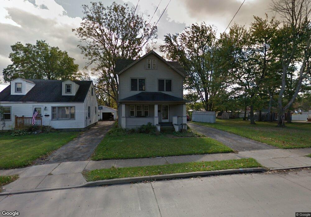
650 Elm St Struthers, OH 44471
Estimated Value: $119,000 - $159,000
3
Beds
1
Bath
1,284
Sq Ft
$107/Sq Ft
Est. Value
About This Home
This home is located at 650 Elm St, Struthers, OH 44471 and is currently estimated at $137,290, approximately $106 per square foot. 650 Elm St is a home located in Mahoning County with nearby schools including Struthers Elementary School, Struthers Middle School, and Struthers High School.
Ownership History
Date
Name
Owned For
Owner Type
Purchase Details
Closed on
Oct 5, 2022
Sold by
Powell Ronda J
Bought by
Powell Destiny Faith
Current Estimated Value
Purchase Details
Closed on
May 8, 2006
Sold by
Bradaick Joanne L
Bought by
Powell Carl E and Powell Ronda J
Home Financials for this Owner
Home Financials are based on the most recent Mortgage that was taken out on this home.
Original Mortgage
$72,978
Interest Rate
6.37%
Mortgage Type
FHA
Purchase Details
Closed on
Aug 13, 2004
Sold by
Cleland Catherine A and Bradaick Catherine A
Bought by
Bradaick Joanne L
Home Financials for this Owner
Home Financials are based on the most recent Mortgage that was taken out on this home.
Original Mortgage
$46,800
Interest Rate
5.75%
Mortgage Type
Purchase Money Mortgage
Purchase Details
Closed on
Jun 28, 1991
Bought by
Cleland Dennis and C A
Create a Home Valuation Report for This Property
The Home Valuation Report is an in-depth analysis detailing your home's value as well as a comparison with similar homes in the area
Home Values in the Area
Average Home Value in this Area
Purchase History
We collect this data history from publicly available records. To have your information removed, we recommend requesting removal directly through your county’s website.
| Date | Buyer | Sale Price | Title Company |
|---|---|---|---|
| Powell Destiny Faith | -- | -- | |
| Powell Ronda J | -- | -- | |
| Powell Carl E | $75,900 | None Available | |
| Bradaick Joanne L | $52,000 | -- | |
| Cleland Dennis | $41,000 | -- |
Source: Public Records
Mortgage History
We collect this data history from publicly available records. To have your information removed, we recommend requesting removal directly through your county’s website.
| Date | Status | Borrower | Loan Amount |
|---|---|---|---|
| Previous Owner | Powell Carl E | $72,978 | |
| Previous Owner | Bradaick Joanne L | $46,800 |
Source: Public Records
Tax History
| Year | Tax Paid | Tax Assessment Tax Assessment Total Assessment is a certain percentage of the fair market value that is determined by local assessors to be the total taxable value of land and additions on the property. | Land | Improvement |
|---|---|---|---|---|
| 2025 | $1,437 | $34,510 | $3,150 | $31,360 |
| 2024 | $1,437 | $34,510 | $3,150 | $31,360 |
| 2023 | $1,413 | $34,510 | $3,150 | $31,360 |
| 2022 | $904 | $16,700 | $3,220 | $13,480 |
| 2021 | $896 | $16,700 | $3,220 | $13,480 |
| 2020 | $900 | $16,700 | $3,220 | $13,480 |
| 2019 | $863 | $14,520 | $2,800 | $11,720 |
| 2018 | $823 | $14,520 | $2,800 | $11,720 |
| 2017 | $820 | $14,520 | $2,800 | $11,720 |
| 2016 | $870 | $15,770 | $3,500 | $12,270 |
| 2015 | $850 | $15,770 | $3,500 | $12,270 |
| 2014 | $853 | $15,770 | $3,500 | $12,270 |
| 2013 | $793 | $15,770 | $3,500 | $12,270 |
Source: Public Records
Map
Nearby Homes
- 2001 Brownlee Ave
- 1968 Wakefield Ave
- 1962 Bancroft Ave
- 1970 Weston Ave
- 541 Lincoln St
- 438 10th St
- 518 Spring St
- 414 10th St
- 2003 E Midlothian Blvd
- 0 Weston Ave
- 1934 E Midlothian Blvd
- 447 8th St
- 1661 Wakefield Ave
- 429 8th St
- 2025 Pointview Ave
- 548 W Wilson St
- 449 7th St
- 2016 Pointview Ave
- 449 Creed St
- 1913 Country Club Ave
Your Personal Tour Guide
Ask me questions while you tour the home.