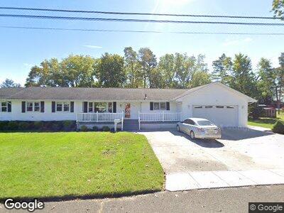
6508 Rundle Ave Mays Landing, NJ 08330
Estimated Value: $340,364 - $523,000
--
Bed
--
Bath
2,572
Sq Ft
$166/Sq Ft
Est. Value
About This Home
This home is located at 6508 Rundle Ave, Mays Landing, NJ 08330 and is currently estimated at $427,841, approximately $166 per square foot. 6508 Rundle Ave is a home located in Atlantic County with nearby schools including Joseph Shaner School, George L. Hess Educational Complex, and William Davies Middle School.
Ownership History
Date
Name
Owned For
Owner Type
Purchase Details
Closed on
May 24, 1993
Sold by
Petuskey Michael
Bought by
Petuskey Michael P
Current Estimated Value
Purchase Details
Closed on
Aug 31, 1990
Sold by
Renner Stephen A
Bought by
Petusky Michael P and Petusky Wulfson,B
Purchase Details
Closed on
Mar 31, 1989
Sold by
Spitzer Franklin H and Spitzer Davis,Robert M
Bought by
Renner Stephen A
Create a Home Valuation Report for This Property
The Home Valuation Report is an in-depth analysis detailing your home's value as well as a comparison with similar homes in the area
Home Values in the Area
Average Home Value in this Area
Purchase History
| Date | Buyer | Sale Price | Title Company |
|---|---|---|---|
| Petuskey Michael P | -- | -- | |
| Petusky Michael P | $105,300 | -- | |
| Renner Stephen A | $104,300 | -- |
Source: Public Records
Mortgage History
| Date | Status | Borrower | Loan Amount |
|---|---|---|---|
| Closed | Petuskey Michael P | $155,000 | |
| Closed | Petuskey Michael P | $27,500 | |
| Closed | Petuskey Michael P | $130,000 | |
| Closed | Petuskey Barbara S | $23,000 | |
| Closed | Petuskey Michael P | $99,750 |
Source: Public Records
Tax History Compared to Growth
Tax History
| Year | Tax Paid | Tax Assessment Tax Assessment Total Assessment is a certain percentage of the fair market value that is determined by local assessors to be the total taxable value of land and additions on the property. | Land | Improvement |
|---|---|---|---|---|
| 2024 | $7,782 | $226,800 | $60,500 | $166,300 |
| 2023 | $7,317 | $226,800 | $60,500 | $166,300 |
| 2022 | $7,317 | $226,800 | $60,500 | $166,300 |
| 2021 | $7,301 | $226,800 | $60,500 | $166,300 |
| 2020 | $7,301 | $226,800 | $60,500 | $166,300 |
| 2019 | $7,319 | $226,800 | $60,500 | $166,300 |
| 2018 | $7,063 | $226,800 | $60,500 | $166,300 |
| 2017 | $6,951 | $226,800 | $60,500 | $166,300 |
| 2016 | $6,756 | $226,800 | $60,500 | $166,300 |
| 2015 | $6,527 | $226,800 | $60,500 | $166,300 |
| 2014 | $6,173 | $235,000 | $70,500 | $164,500 |
Source: Public Records
Map
Nearby Homes
- 948 Adams Ave
- 535 Park Rd
- 526 Bainbridge Ave
- 34 Hannum Ct
- 18 Rembrandt Way
- 211 Hanthorn St
- 6056 Main St
- 0 8th St Unit 593151
- 709 Farragut Ave
- 6152 Old Harding Hwy
- 0 3rd St
- 507 14th Ave
- 0 Route 50 Hwy Unit 595564
- 5926 Main St
- 20 Ernst Ct
- 5 Camac Ave
- 23 Lewis Dr
- 22 Lewis Dr
- 706 Sugarbush Ct
- 706 Sugar Bush Ct Unit 906