Estimated Value: $281,000 - $384,563
3
Beds
2
Baths
1,600
Sq Ft
$209/Sq Ft
Est. Value
About This Home
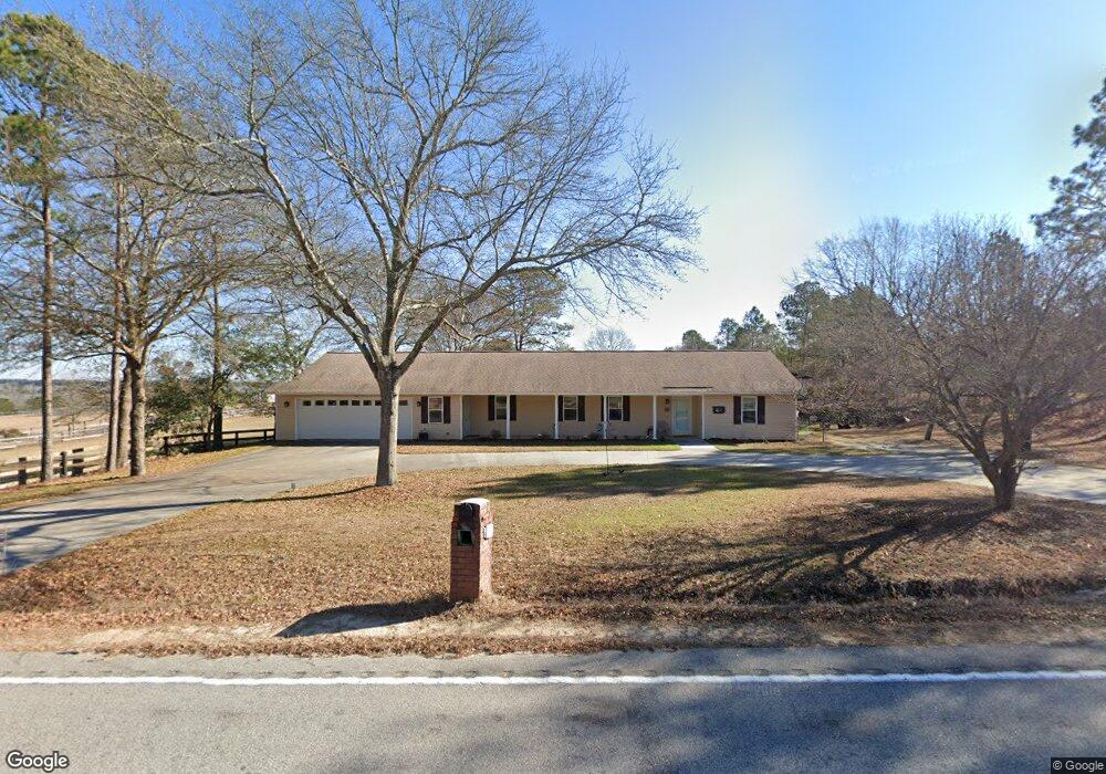
This home is located at 651 Redds Branch Rd, Aiken, SC 29801 and is currently estimated at $333,854, approximately $208 per square foot. 651 Redds Branch Rd is a home located in Aiken County with nearby schools including East Aiken School of the Arts, Aiken Intermediate School, and M.B. Kennedy Middle School.
Ownership History
Date
Name
Owned For
Owner Type
Purchase Details
Closed on
Jul 13, 2007
Sold by
Hill Betsy
Bought by
Allen Deborah
Current Estimated Value
Home Financials for this Owner
Home Financials are based on the most recent Mortgage that was taken out on this home.
Original Mortgage
$228,000
Outstanding Balance
$140,193
Interest Rate
6.37%
Mortgage Type
Purchase Money Mortgage
Estimated Equity
$193,661
Purchase Details
Closed on
Mar 22, 2006
Sold by
Simiones Damian G
Bought by
Hill Betsy
Purchase Details
Closed on
May 31, 2005
Sold by
Powell Ronnie L and Powell Jayne C
Bought by
Hill Betsy
Home Financials for this Owner
Home Financials are based on the most recent Mortgage that was taken out on this home.
Original Mortgage
$122,400
Interest Rate
5.62%
Mortgage Type
Adjustable Rate Mortgage/ARM
Create a Home Valuation Report for This Property
The Home Valuation Report is an in-depth analysis detailing your home's value as well as a comparison with similar homes in the area
Home Values in the Area
Average Home Value in this Area
Purchase History
| Date | Buyer | Sale Price | Title Company |
|---|---|---|---|
| Allen Deborah | $285,000 | Attorney | |
| Hill Betsy | $38,000 | None Available | |
| Hill Betsy | $153,000 | -- |
Source: Public Records
Mortgage History
| Date | Status | Borrower | Loan Amount |
|---|---|---|---|
| Open | Allen Deborah | $228,000 | |
| Previous Owner | Hill Betsy | $122,400 | |
| Previous Owner | Hill Betsy | $15,300 |
Source: Public Records
Tax History Compared to Growth
Tax History
| Year | Tax Paid | Tax Assessment Tax Assessment Total Assessment is a certain percentage of the fair market value that is determined by local assessors to be the total taxable value of land and additions on the property. | Land | Improvement |
|---|---|---|---|---|
| 2025 | $1,207 | $9,370 | -- | -- |
| 2023 | $1,199 | $9,370 | $1,810 | $189,010 |
| 2022 | $1,173 | $9,370 | $0 | $0 |
| 2021 | $1,175 | $9,370 | $0 | $0 |
| 2020 | $1,133 | $8,800 | $0 | $0 |
| 2019 | $1,091 | $8,800 | $0 | $0 |
| 2018 | $1,099 | $8,800 | $1,810 | $6,990 |
| 2017 | $1,055 | $0 | $0 | $0 |
| 2016 | $2,620 | $0 | $0 | $0 |
| 2015 | $2,749 | $0 | $0 | $0 |
| 2014 | $2,751 | $0 | $0 | $0 |
| 2013 | -- | $0 | $0 | $0 |
Source: Public Records
Map
Nearby Homes
- 412 New Bridge Rd
- 536 Wrights Mill Rd
- 576 Mcintosh Loop
- 431 Mcintosh Loop
- 364 Wrights Mill Rd
- 0 NW Morgan St Unit 538002
- 496 Wire Rd
- 352 Main Dr
- 1058 Wrights Mill Rd
- 00 Wrights Mill Rd
- 110 New Bridge Rd
- 000 Pine Log Rd E
- 420 Community Dr
- 1.62 Acres Lauren Cir
- 147 Northwest Dr
- 2897 Wagener Rd
- 13 Marion Young Ct
- 1116 Wrights Mill Rd
- 0 Wire Rd Unit 213447
- 121 Northwest Dr
- 641 Redds Branch Rd
- 647 Redds Branch Rd
- 637 Redds Branch Rd
- 633 Redds Branch Rd
- 632 Redds Branch Rd
- 627 Redds Branch Rd
- 672 Redds Branch Rd
- 625 Redds Branch Rd
- 625 Redds Branch Rd
- 625 Redds Branch Rd
- 681 Redds Branch Rd
- 623 Redds Branch Rd
- 621 Redds Branch Rd
- 631 Redds Branch Rd
- 610 Redds Branch Rd
- 617 Redds Branch Rd
- 626 Redds Branch Rd
- 626 Redds Branch Rd
- 611 Redds Branch Rd