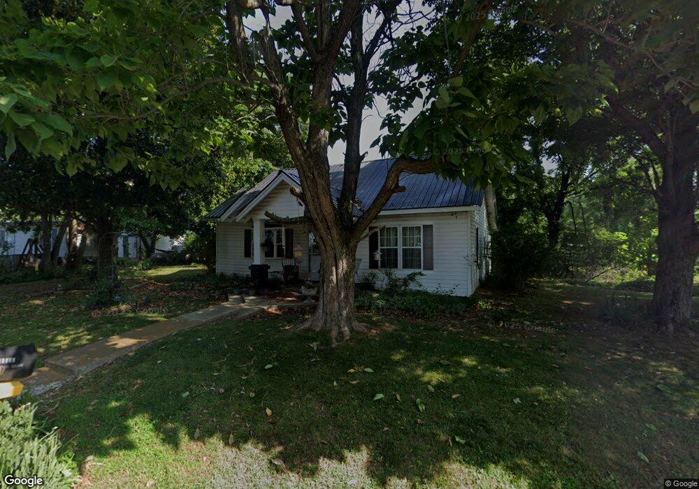
6510 Roy Pearson Rd Springfield, TN 37172
Estimated Value: $136,813 - $350,000
Studio
1
Bath
956
Sq Ft
$251/Sq Ft
Est. Value
About This Home
This home is located at 6510 Roy Pearson Rd, Springfield, TN 37172 and is currently estimated at $239,953, approximately $250 per square foot. 6510 Roy Pearson Rd is a home located in Robertson County with nearby schools including East Robertson Elementary School and East Robertson High School.
Ownership History
Date
Name
Owned For
Owner Type
Purchase Details
Closed on
Dec 20, 2020
Sold by
Creekside Corporate Trusts
Bought by
The Bodor Family Trust
Current Estimated Value
Purchase Details
Closed on
Dec 17, 2020
Sold by
Brookside Village Llc
Bought by
Creekside Corporate Trusts and Forest Haven Inc
Purchase Details
Closed on
Jun 22, 1993
Bought by
Pitt Clois and Pitt Nellie Faye
Create a Home Valuation Report for This Property
The Home Valuation Report is an in-depth analysis detailing your home's value as well as a comparison with similar homes in the area
Home Values in the Area
Average Home Value in this Area
Purchase History
| Date | Buyer | Sale Price | Title Company |
|---|---|---|---|
| The Bodor Family Trust | -- | None Available | |
| Creekside Corporate Trusts | $314,038 | None Available | |
| Pitt Clois | $30,000 | -- |
Source: Public Records
Tax History
| Year | Tax Paid | Tax Assessment Tax Assessment Total Assessment is a certain percentage of the fair market value that is determined by local assessors to be the total taxable value of land and additions on the property. | Land | Improvement |
|---|---|---|---|---|
| 2025 | $616 | $34,250 | $12,150 | $22,100 |
| 2024 | $616 | $34,250 | $12,150 | $22,100 |
| 2023 | $617 | $34,250 | $12,150 | $22,100 |
| 2022 | $509 | $19,775 | $7,075 | $12,700 |
| 2021 | $509 | $19,775 | $7,075 | $12,700 |
| 2020 | $509 | $19,775 | $7,075 | $12,700 |
| 2019 | $509 | $19,775 | $7,075 | $12,700 |
| 2018 | $509 | $19,775 | $7,075 | $12,700 |
| 2017 | $525 | $17,025 | $6,250 | $10,775 |
| 2016 | $525 | $17,025 | $6,250 | $10,775 |
| 2015 | $504 | $17,025 | $6,250 | $10,775 |
| 2014 | $504 | $17,025 | $6,250 | $10,775 |
Source: Public Records
Map
Nearby Homes
- 6348 S Lamont Rd
- 29640 Highway 49 E
- 6160 Underwood Rd
- 5867 Borthick Rd
- 7027 Cowan Rd
- 29490 Highway 49 E
- 6437 Hopewell Rd
- 5654 Borthick Rd
- 0 N Pitt Rd Unit 10
- 5288 Fred Perry Rd
- 7518 Highway 49 E
- 1115 W Church St
- 5558 Borthick Rd
- 0 Pinson Rd
- 5219 Adairville Rd
- 0 Charles Dorris Rd
- 7265 Bob Carr Rd
- 3068 Chance Ct
- 4144 Socata Ct
- 5918 Lakeview Rd
- 6510 Roy Pearson Rd
- 6517 Roy Pearson Rd
- 6440 Roy Pearson Rd
- 5823 Fulton Rd
- 6565 Roy Pearson Rd
- 6565 Roy Pearson Rd
- 5837 Fulton Rd
- 6422 Fulton Rd
- 5762 Fulton Rd
- 5835 Fulton Rd
- 5871 Fulton Rd
- 5871 Fulton Rd
- 6409 Roy Pearson Rd
- 6386 Roy Pearson Rd
- 6395 Roy Pearson Rd
- 6387 Roy Pearson Rd
- 6377 Roy Pearson Rd
- 5873 Fulton Rd
- 6363 Roy Pearson Rd
- 5925 Fulton Rd
Your Personal Tour Guide
Ask me questions while you tour the home.