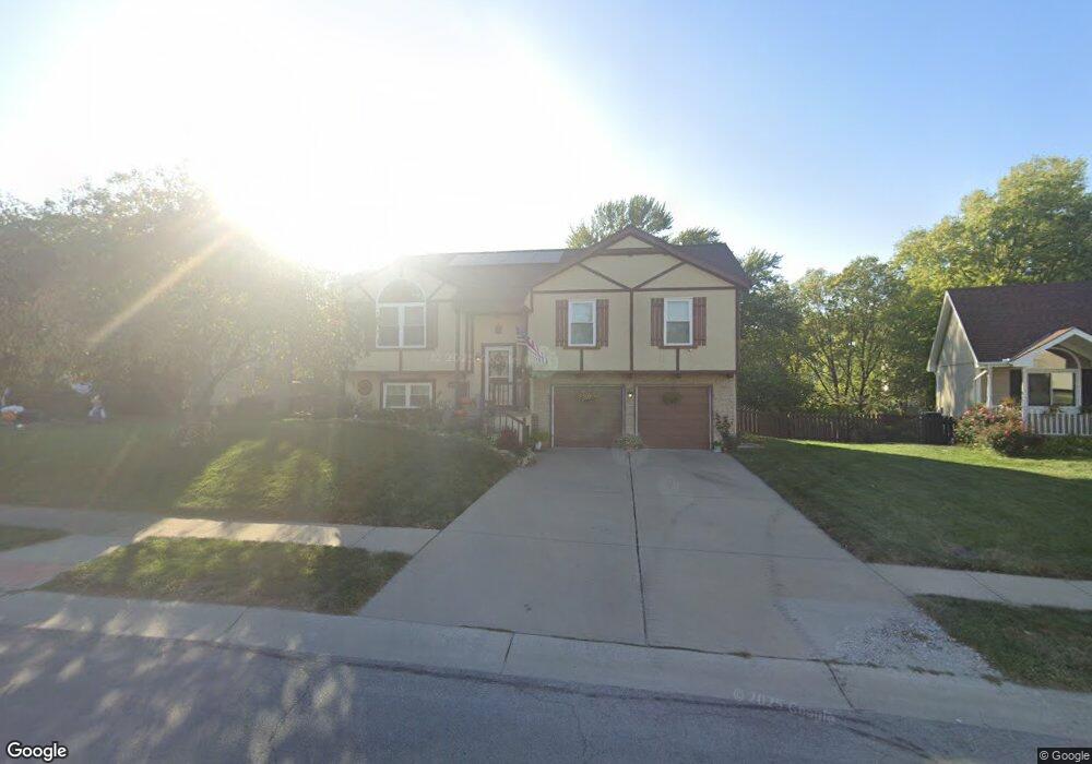
652 SE Ashton Dr Lees Summit, MO 64063
Estimated Value: $315,786 - $324,000
3
Beds
3
Baths
1,121
Sq Ft
$285/Sq Ft
Est. Value
About This Home
This home is located at 652 SE Ashton Dr, Lees Summit, MO 64063 and is currently estimated at $319,197, approximately $284 per square foot. 652 SE Ashton Dr is a home located in Jackson County with nearby schools including Pleasant Lea Middle School, Lee's Summit Senior High School, and Summit Christian Academy.
Ownership History
Date
Name
Owned For
Owner Type
Purchase Details
Closed on
Aug 2, 2024
Sold by
Daniel Francis Stramara Jr Trust and Francis-Stramara Daniel
Bought by
Stramara Family Trust
Current Estimated Value
Purchase Details
Closed on
Dec 26, 2008
Sold by
Stramara Daniel F
Bought by
Stramara Daniel Francis and Daniel Francis Stramara Jr Trust
Purchase Details
Closed on
Dec 17, 1999
Sold by
Romprey Andrew D and Romprey Marianne Gelbach
Bought by
Stramara Daniel F
Home Financials for this Owner
Home Financials are based on the most recent Mortgage that was taken out on this home.
Original Mortgage
$103,725
Interest Rate
7.86%
Mortgage Type
Purchase Money Mortgage
Create a Home Valuation Report for This Property
The Home Valuation Report is an in-depth analysis detailing your home's value as well as a comparison with similar homes in the area
Home Values in the Area
Average Home Value in this Area
Purchase History
| Date | Buyer | Sale Price | Title Company |
|---|---|---|---|
| Stramara Family Trust | -- | None Listed On Document | |
| Stramara Daniel Francis | -- | None Available | |
| Stramara Daniel F | -- | Chicago Title Co |
Source: Public Records
Mortgage History
| Date | Status | Borrower | Loan Amount |
|---|---|---|---|
| Previous Owner | Stramara Daniel F | $103,725 |
Source: Public Records
Tax History
| Year | Tax Paid | Tax Assessment Tax Assessment Total Assessment is a certain percentage of the fair market value that is determined by local assessors to be the total taxable value of land and additions on the property. | Land | Improvement |
|---|---|---|---|---|
| 2025 | $2,982 | $47,485 | $7,959 | $39,526 |
| 2024 | $2,960 | $41,293 | $4,528 | $36,765 |
| 2023 | $2,960 | $41,293 | $5,647 | $35,646 |
| 2022 | $2,945 | $36,480 | $4,912 | $31,568 |
| 2021 | $3,006 | $36,480 | $4,912 | $31,568 |
| 2020 | $2,895 | $34,789 | $4,912 | $29,877 |
| 2019 | $3,857 | $34,789 | $4,912 | $29,877 |
| 2018 | $2,623 | $30,072 | $3,731 | $26,341 |
| 2016 | $2,529 | $28,702 | $4,249 | $24,453 |
Source: Public Records
Map
Nearby Homes
- 628 SE Ashton Dr
- 505 SE Onyx Dr
- 413 SE Ashton Dr
- 1724 SE 5th Terrace
- 1604 SE 11th St
- 312 SE Battery Dr
- 1023 SE Timbercreek Ln
- 302 SE Flagstone Dr
- 1508 SE Long Place
- 1618 SE Boone Trail
- 532 SE Asheville Dr
- 2616 SE Winchester Dr
- 521 SE Asheville Dr
- 113 SE Bristol Dr
- 1321 SE Princeton Dr
- 100 NE Keystone Dr
- 1023 SE Bordner Dr
- 1308 SE 7th St
- 1225 SE 12th St
- 729 SE Claremont St
- 648 SE Ashton Dr
- 700 SE Ashton Dr
- 704 SE Ashton Dr
- 644 SE Ashton Dr
- 2100 SE 7th St
- 2101 SE 7th St
- 640 SE Ashton Dr
- 2104 SE 7th St
- 625 SE Pendleton Dr
- 2105 SE 7th St
- 621 SE Pendleton Dr
- 629 SE Pendleton Dr
- 641 SE Ashton Dr
- 636 SE Ashton Dr
- 2108 SE 7th St
- 1925 SE 7th St
- 613 SE Pendleton Dr
- 2109 SE 7th St
- 637 SE Ashton Dr
- 609 SE Pendleton Dr
Your Personal Tour Guide
Ask me questions while you tour the home.