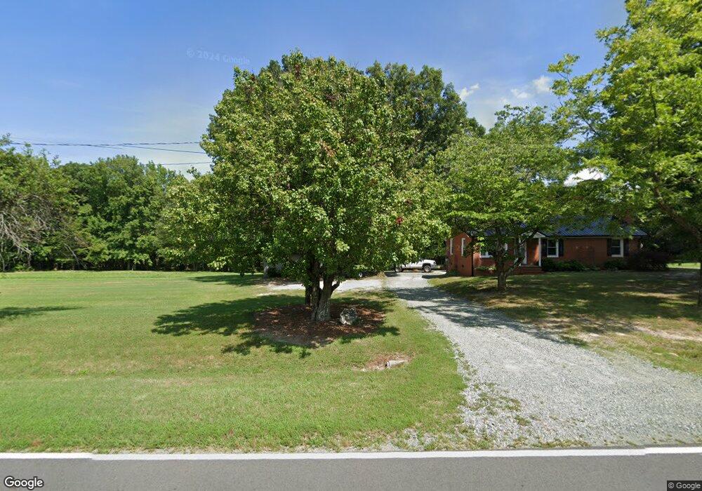
6522 Foster Rd Whitsett, NC 27377
Estimated Value: $157,000 - $207,000
2
Beds
1
Bath
1,069
Sq Ft
$169/Sq Ft
Est. Value
About This Home
This home is located at 6522 Foster Rd, Whitsett, NC 27377 and is currently estimated at $180,448, approximately $168 per square foot. 6522 Foster Rd is a home located in Guilford County with nearby schools including Nathanael Greene Elementary School, Southeast Guilford Middle School, and Southeast Guilford High School.
Ownership History
Date
Name
Owned For
Owner Type
Purchase Details
Closed on
Nov 1, 2013
Sold by
Crabtree Sarah Woodard and Crabtree Edwin B
Bought by
Boswell Timothy Lane
Current Estimated Value
Home Financials for this Owner
Home Financials are based on the most recent Mortgage that was taken out on this home.
Original Mortgage
$62,800
Interest Rate
4.13%
Mortgage Type
New Conventional
Purchase Details
Closed on
Dec 28, 2004
Bought by
Woodard Nola G
Create a Home Valuation Report for This Property
The Home Valuation Report is an in-depth analysis detailing your home's value as well as a comparison with similar homes in the area
Home Values in the Area
Average Home Value in this Area
Purchase History
| Date | Buyer | Sale Price | Title Company |
|---|---|---|---|
| Boswell Timothy Lane | $78,500 | None Available | |
| Woodard Nola G | -- | -- |
Source: Public Records
Mortgage History
| Date | Status | Borrower | Loan Amount |
|---|---|---|---|
| Closed | Boswell Timothy Lane | $62,800 |
Source: Public Records
Tax History Compared to Growth
Tax History
| Year | Tax Paid | Tax Assessment Tax Assessment Total Assessment is a certain percentage of the fair market value that is determined by local assessors to be the total taxable value of land and additions on the property. | Land | Improvement |
|---|---|---|---|---|
| 2025 | $837 | $103,300 | $50,800 | $52,500 |
| 2024 | $837 | $103,300 | $50,800 | $52,500 |
| 2023 | $837 | $103,300 | $50,800 | $52,500 |
| 2022 | $837 | $103,300 | $50,800 | $52,500 |
| 2021 | $632 | $78,000 | $33,600 | $44,400 |
| 2020 | $632 | $78,000 | $33,600 | $44,400 |
| 2019 | $632 | $78,000 | $0 | $0 |
| 2018 | $629 | $78,000 | $0 | $0 |
| 2017 | $629 | $78,000 | $0 | $0 |
| 2016 | $624 | $74,700 | $0 | $0 |
| 2015 | $627 | $74,700 | $0 | $0 |
| 2014 | $635 | $74,700 | $0 | $0 |
Source: Public Records
Map
Nearby Homes
- 6638 Holts Store Rd
- 4754 Kanora Dr
- 4560 Calm Lake Rd
- 3375 Old Julian Rd
- 1756 Nc Highway 61
- 5402 Newland Dr
- 5403 Newland Dr
- 6910 Long Meadow Ln
- 6803 McPherson Clay Rd
- 5633 Baptist Assembly Rd
- 3608 Steeplegate Ct
- 5635 Baptist Assembly Rd
- 6909 Steeplegate
- 6816 Steeplegate Dr
- 6820 Steeplegate
- 5354 Amick Rd
- 6905 Steeplegate Dr
- 5438 Wild Turkey Rd
- 3145 Nc Highway 62 E
- 7149 Nature Rd
- 6516 Foster Rd
- 6527 Foster Rd
- 6725 Holts Store Rd
- 6709 Holts Store Rd
- 6519 Foster Rd
- 6538 Foster Rd
- 6707 Holts Store Rd
- 6722 Holts Store Rd
- 6724 Holts Store Rd
- 2803 Mount Hope Church Rd
- 6728 Holts Store Rd
- 2726 Mount Hope Church Rd
- 6728 Holts Store Rd
- 6743 Holts Store Rd
- 6547 Foster Rd
- 6650 Holts Store Rd
- 2668 Mount Hope Church Rd
- 1976 Rock Creek Dairy Rd
- 2819 Mount Hope Church Rd
- 1963 Rock Creek Dairy Rd