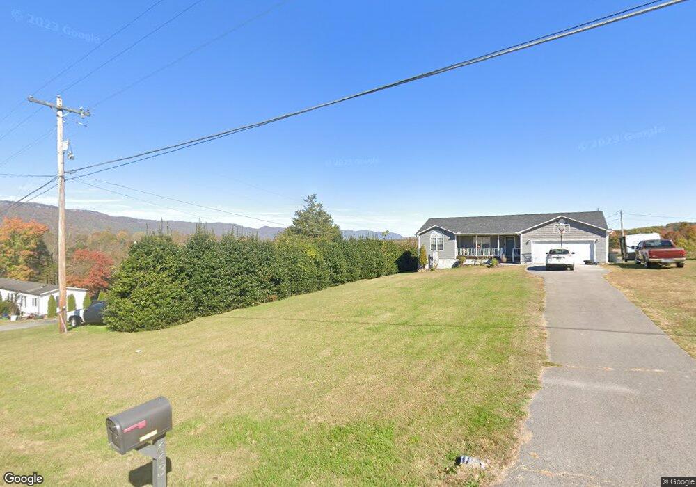
653 Carr Wynn Rd La Follette, TN 37766
Estimated Value: $275,000 - $308,000
3
Beds
2
Baths
1,120
Sq Ft
$256/Sq Ft
Est. Value
About This Home
This home is located at 653 Carr Wynn Rd, La Follette, TN 37766 and is currently estimated at $286,563, approximately $255 per square foot. 653 Carr Wynn Rd is a home located in Campbell County.
Ownership History
Date
Name
Owned For
Owner Type
Purchase Details
Closed on
Apr 28, 2011
Sold by
Morris Becky M
Bought by
Malicoat Bobby and Johnson Margie
Current Estimated Value
Home Financials for this Owner
Home Financials are based on the most recent Mortgage that was taken out on this home.
Original Mortgage
$108,468
Outstanding Balance
$74,938
Interest Rate
4.83%
Mortgage Type
Commercial
Estimated Equity
$211,625
Purchase Details
Closed on
Jun 25, 2008
Sold by
Deutsche Bank National Tru
Bought by
Morris Becky M
Purchase Details
Closed on
Feb 27, 2008
Sold by
Hunley Mark Adam and Hunley Tonya
Bought by
Deutsche Bank National Trust C
Purchase Details
Closed on
Aug 30, 2006
Sold by
Hunley Mark Adam and Hunley Tonya
Bought by
Hunley Mark A and Hunley Tonya
Purchase Details
Closed on
Apr 30, 2004
Bought by
Hunley Mark Adam and Hunley Tonya Renee
Create a Home Valuation Report for This Property
The Home Valuation Report is an in-depth analysis detailing your home's value as well as a comparison with similar homes in the area
Home Values in the Area
Average Home Value in this Area
Purchase History
| Date | Buyer | Sale Price | Title Company |
|---|---|---|---|
| Malicoat Bobby | $103,400 | -- | |
| Morris Becky M | $85,000 | -- | |
| Deutsche Bank National Trust C | $89,250 | -- | |
| Hunley Mark A | -- | -- | |
| Hunley Mark Adam | $109,800 | -- |
Source: Public Records
Mortgage History
| Date | Status | Borrower | Loan Amount |
|---|---|---|---|
| Open | Malicoat Bobby | $108,468 |
Source: Public Records
Tax History Compared to Growth
Tax History
| Year | Tax Paid | Tax Assessment Tax Assessment Total Assessment is a certain percentage of the fair market value that is determined by local assessors to be the total taxable value of land and additions on the property. | Land | Improvement |
|---|---|---|---|---|
| 2025 | $730 | $60,075 | $0 | $0 |
| 2024 | $730 | $60,075 | $13,725 | $46,350 |
| 2023 | $644 | $31,175 | $5,825 | $25,350 |
| 2022 | $644 | $31,175 | $5,825 | $25,350 |
| 2021 | $644 | $31,175 | $5,825 | $25,350 |
| 2020 | $631 | $31,175 | $5,825 | $25,350 |
| 2019 | $644 | $31,175 | $5,825 | $25,350 |
| 2018 | $676 | $30,050 | $5,875 | $24,175 |
| 2017 | $676 | $30,050 | $5,875 | $24,175 |
| 2016 | $676 | $30,050 | $5,875 | $24,175 |
| 2015 | $598 | $30,050 | $5,875 | $24,175 |
| 2014 | -- | $30,050 | $5,875 | $24,175 |
| 2013 | -- | $30,050 | $5,875 | $24,175 |
Source: Public Records
Map
Nearby Homes
- 135 Gamble Ln
- 0 Gamble Ln
- 1184 Davis Chapel Rd
- 306 Eastwood Dr
- 111 Mckinney Rd
- 0 Lilac Dr
- 328 Edgewood Dr
- 226 Hilldale Ln
- 138 Lilac Dr
- 640 Camp Ridge Rd
- 174 Old Ivey Hollow Rd
- 502 Middlesboro Rd
- 180 Donna Ln
- 180 Mccarty Rd
- 647 Coolidge Rd
- 238 Kimberly Rd
- 174 Lance Ln
- 151 Angel Ln
- 441 Morton Rd
- 232 Kimberly Rd
- 663 Carr Wynn Rd
- 673 Carr Wynn Rd
- 100 Gamble Ln
- 601 Carr Wynn Rd
- 123 Gamble Ln
- 605 Carr Wynn Rd
- 652 Carr Wynn Rd
- 695 Carr Wynn Rd
- 606 Carr Wynn Rd
- 696 Carr Wynn Rd
- 162 Stone Ridge Ln
- 0 Carrwynn Rd Unit 1206186
- 0 Carrwynn Rd Unit 1192937
- 713 Carr Wynn Rd
- 801 Carr Wynn Rd
- 112 Gamble Ln
- 161 Gamble Ln
- 710 Carr Wynn Rd
- 731 Carr Wynn Rd
- 578 Carr Wynn Rd