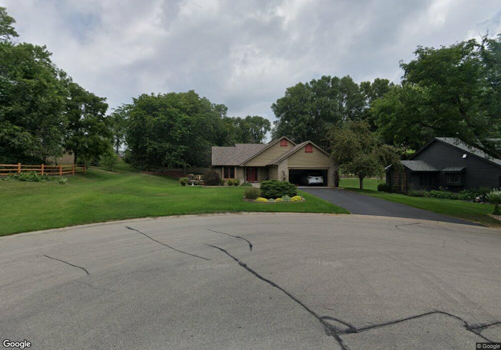
653 Witham Ln Saint Paul, MN 55123
Estimated Value: $491,184 - $556,000
3
Beds
3
Baths
1,578
Sq Ft
$329/Sq Ft
Est. Value
About This Home
This home is located at 653 Witham Ln, Saint Paul, MN 55123 and is currently estimated at $519,546, approximately $329 per square foot. 653 Witham Ln is a home located in Dakota County with nearby schools including Pinewood Elementary School, Dakota Hills Middle School, and Eagan Senior High School.
Ownership History
Date
Name
Owned For
Owner Type
Purchase Details
Closed on
Feb 27, 2018
Sold by
Bulanek Michael Ray
Bought by
Bulanek Michael Ray and Michael Ray Bulanek Living Trust
Current Estimated Value
Purchase Details
Closed on
Feb 8, 2012
Sold by
Bulanek Terrie
Bought by
Bulanek Michale
Purchase Details
Closed on
Nov 24, 1998
Sold by
Nelson Gregory P and Nelson Lisa A
Bought by
Bulanek Michael R and Bulanek Terrie L
Create a Home Valuation Report for This Property
The Home Valuation Report is an in-depth analysis detailing your home's value as well as a comparison with similar homes in the area
Home Values in the Area
Average Home Value in this Area
Purchase History
| Date | Buyer | Sale Price | Title Company |
|---|---|---|---|
| Bulanek Michael Ray | -- | None Available | |
| Bulanek Michale | -- | None Available | |
| Bulanek Michael R | $199,900 | -- |
Source: Public Records
Tax History
| Year | Tax Paid | Tax Assessment Tax Assessment Total Assessment is a certain percentage of the fair market value that is determined by local assessors to be the total taxable value of land and additions on the property. | Land | Improvement |
|---|---|---|---|---|
| 2024 | $4,846 | $460,000 | $119,500 | $340,500 |
| 2023 | $4,846 | $446,200 | $119,800 | $326,400 |
| 2022 | $4,396 | $435,700 | $119,500 | $316,200 |
| 2021 | $4,192 | $390,900 | $103,900 | $287,000 |
| 2020 | $4,156 | $363,700 | $99,000 | $264,700 |
| 2019 | $3,940 | $351,000 | $94,200 | $256,800 |
| 2018 | $3,497 | $354,400 | $89,800 | $264,600 |
| 2017 | $3,524 | $308,000 | $85,500 | $222,500 |
| 2016 | $3,508 | $296,800 | $81,400 | $215,400 |
| 2015 | $3,412 | $282,457 | $78,391 | $204,066 |
| 2014 | -- | $279,405 | $76,175 | $203,230 |
| 2013 | -- | $240,274 | $67,854 | $172,420 |
Source: Public Records
Map
Nearby Homes
- 4001 Haven Woods Ct
- 3998 Haven Woods Ct
- 4133 Countryview Dr
- 752 Summerbrooke Cir
- 4076 States Ave
- 640 Hackmore Dr
- 4190 Braddock Trail
- 3852 Big Timber Trail
- 617 Remington Ct
- 4401 Braddock Trail
- 4525 Alicia Dr
- 4370 Braddock Trail
- 10668 Alton Ct
- 9380 Aladin Trail
- 858 Sudberry Ln
- 4329 Jessica Ct
- 8560 Asiatic Ave
- 10064 Adam Ave
- 3710 Greensboro Dr
- 10612 Alison Way
- 649 Witham Ln
- 654 Witham Ln
- 645 Witham Ln
- 648 Welland Ct
- 644 Welland Ct
- xxx Witham Ln
- 650 Witham Ln
- 646 Witham Ln
- 641 Witham Ln
- 732 Bradford Place
- 642 Witham Ln
- 640 Welland Ct
- 733 Bradford Place
- 4064 Prairie Ridge Rd
- 702 Bradford Place
- 627 Wildflower Way
- 724 Bradford Place
- 4127 Lantern Ln
- 636 Welland Ct
- 623 Wildflower Way
Your Personal Tour Guide
Ask me questions while you tour the home.