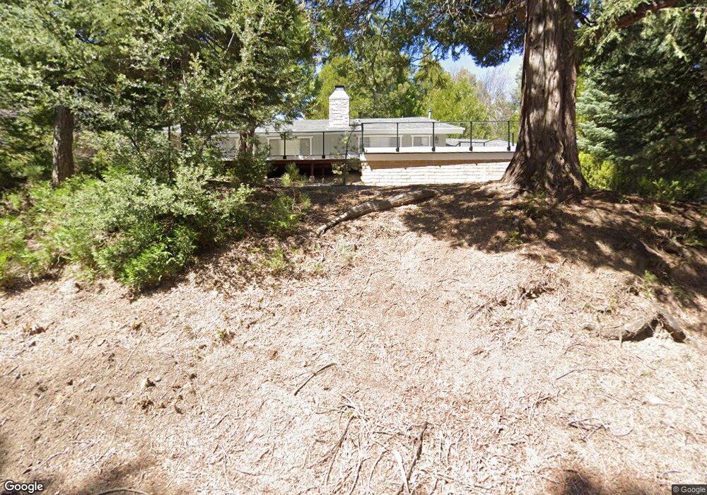
654 Maxson Dr Twin Peaks, CA 92391
Estimated Value: $402,000 - $494,000
3
Beds
3
Baths
1,980
Sq Ft
$223/Sq Ft
Est. Value
About This Home
This home is located at 654 Maxson Dr, Twin Peaks, CA 92391 and is currently estimated at $442,511, approximately $223 per square foot. 654 Maxson Dr is a home with nearby schools including Lake Arrowhead Elementary School, Mary P. Henck Intermediate School, and Rim Of The World Senior High School.
Ownership History
Date
Name
Owned For
Owner Type
Purchase Details
Closed on
Jun 25, 2012
Sold by
Wilfong Michelle
Bought by
Wilfong Michelle
Current Estimated Value
Purchase Details
Closed on
Aug 23, 2008
Sold by
Wilfong Leslie
Bought by
Wilfong Leslie Paul and Wilfong Michelle
Purchase Details
Closed on
Oct 28, 2002
Sold by
Wilfong Leslie
Bought by
Wilfong Leslie
Create a Home Valuation Report for This Property
The Home Valuation Report is an in-depth analysis detailing your home's value as well as a comparison with similar homes in the area
Home Values in the Area
Average Home Value in this Area
Purchase History
| Date | Buyer | Sale Price | Title Company |
|---|---|---|---|
| Wilfong Michelle | -- | None Available | |
| Wilfong Leslie Paul | -- | None Available | |
| Wilfong Leslie | -- | -- |
Source: Public Records
Tax History
| Year | Tax Paid | Tax Assessment Tax Assessment Total Assessment is a certain percentage of the fair market value that is determined by local assessors to be the total taxable value of land and additions on the property. | Land | Improvement |
|---|---|---|---|---|
| 2025 | $3,456 | $192,768 | $8,451 | $184,317 |
| 2024 | $3,339 | $188,988 | $8,285 | $180,703 |
| 2023 | $3,282 | $185,283 | $8,123 | $177,160 |
| 2022 | $3,203 | $181,650 | $7,964 | $173,686 |
| 2021 | $3,168 | $178,088 | $7,808 | $170,280 |
| 2020 | $3,174 | $176,262 | $7,728 | $168,534 |
| 2019 | $3,095 | $172,805 | $7,576 | $165,229 |
| 2018 | $2,808 | $169,416 | $7,427 | $161,989 |
| 2017 | $2,749 | $166,094 | $7,281 | $158,813 |
| 2016 | $2,638 | $162,837 | $7,138 | $155,699 |
| 2015 | $2,643 | $160,391 | $7,031 | $153,360 |
| 2014 | $2,593 | $157,249 | $6,893 | $150,356 |
Source: Public Records
Map
Nearby Homes
- 683 Maxson Dr
- 26582 Lake Forest Dr
- 0 Forest Ln Unit PW25157119
- 26638 Lake Forest Dr
- 26370 Alpine Ln
- 26645 Lake Forest Dr
- 26331 Alpine Ln
- 620 Cedar Ln
- 26325 Lake Forest Dr
- 26669 State Highway 189
- 644 Cedar Ln
- 26287 Lake Forest Dr
- 784 Sierra Vista
- 784 Sierra Vista Dr
- 804 Sierra Vista Dr
- 0 California 189
- 889 Strawberry Peak Rd
- 0 Club House Dr
- 26314 Jacqueline Rd
- 859 Strawberry Peak Rd
- 664 Maxson Dr
- 26481 Alpine Ln
- 26477 Alpine Ln
- 26485 Alpine Ln
- 638 Maxson Dr
- 665 Alpine (Spur) Ln
- 653 Maxson Dr
- 671 Alpine Ln
- 26489 Alpine Ln
- 672 Maxson Dr
- 637 Maxson Dr
- 663 Maxson Dr
- 677 Alpine Spur Ln
- 26547 Lake Forest Dr
- 620 Maxson Dr
- 26493 Alpine Ln
- 688 Robin Dr
- 26466 Alpine Ln
- 26473 Alpine Ln
- 687 Alpine Spur Ln
Your Personal Tour Guide
Ask me questions while you tour the home.