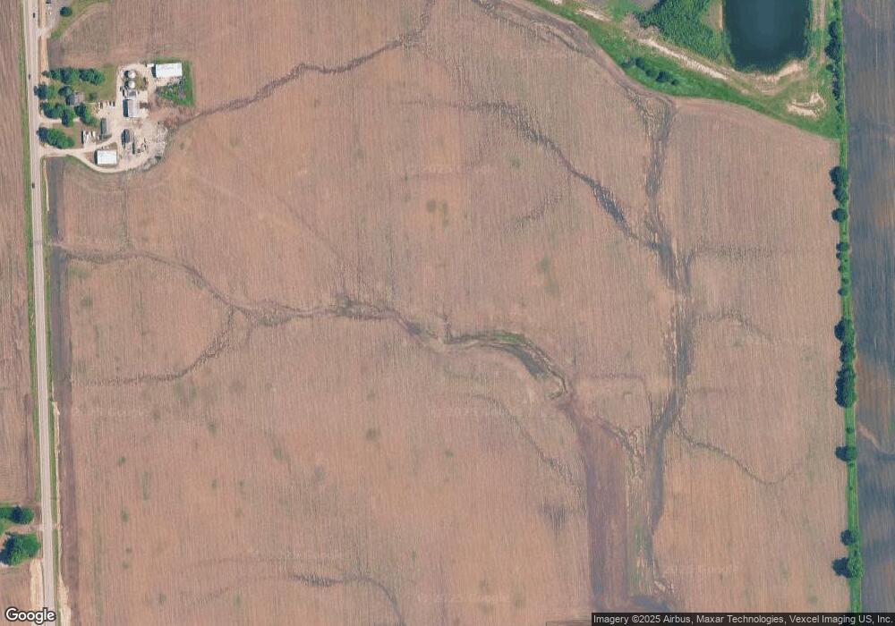
6550 Ridge Rd Oswego, IL 60543
South Oswego NeighborhoodEstimated Value: $675,000 - $4,332,000
Studio
1
Bath
2,304
Sq Ft
$849/Sq Ft
Est. Value
About This Home
This home is located at 6550 Ridge Rd, Oswego, IL 60543 and is currently estimated at $1,955,293, approximately $848 per square foot. 6550 Ridge Rd is a home with nearby schools including Hunt Club Elementary School, Murphy Junior High School, and Oswego East High School.
Ownership History
Date
Name
Owned For
Owner Type
Purchase Details
Closed on
Mar 30, 2011
Sold by
First Midwest Bank
Bought by
S & E Investments Llc Series 5
Current Estimated Value
Purchase Details
Closed on
Jan 18, 2007
Sold by
First Midwest Bank
Bought by
Wayne Hummer Trust Co Na and Trust #Hbt-2256
Purchase Details
Closed on
May 14, 2004
Sold by
First Midwest Bank
Bought by
The Macom Corp
Create a Home Valuation Report for This Property
The Home Valuation Report is an in-depth analysis detailing your home's value as well as a comparison with similar homes in the area
Home Values in the Area
Average Home Value in this Area
Purchase History
| Date | Buyer | Sale Price | Title Company |
|---|---|---|---|
| S & E Investments Llc Series 5 | $2,350,000 | Chicago Title Insurance Co | |
| Wayne Hummer Trust Co Na | $3,711,000 | Chicago Title Insurance Co | |
| The Macom Corp | $13,136,000 | Chicago Title Insurance Co |
Source: Public Records
Tax History
| Year | Tax Paid | Tax Assessment Tax Assessment Total Assessment is a certain percentage of the fair market value that is determined by local assessors to be the total taxable value of land and additions on the property. | Land | Improvement |
|---|---|---|---|---|
| 2024 | $16,311 | $201,721 | $92,044 | $109,677 |
| 2023 | $15,826 | $186,959 | $85,836 | $101,123 |
| 2022 | $15,826 | $173,089 | $79,440 | $93,649 |
| 2021 | $15,416 | $163,520 | $74,890 | $88,630 |
| 2020 | $14,811 | $154,919 | $70,013 | $84,906 |
| 2019 | $14,363 | $147,988 | $65,634 | $82,354 |
| 2018 | $14,311 | $141,750 | $62,274 | $79,476 |
| 2017 | $13,974 | $135,387 | $59,174 | $76,213 |
| 2016 | $6,704 | $128,192 | $56,222 | $71,970 |
| 2015 | $6,871 | $125,622 | $53,652 | $71,970 |
| 2014 | -- | $113,004 | $51,862 | $61,142 |
| 2013 | -- | $109,304 | $48,162 | $61,142 |
Source: Public Records
Map
Nearby Homes
- 26603 W Captiva Ln
- 13732 S Palmetto Dr
- 13740 S Palmetto Dr
- 13744 S Palmetto Dr
- 13720 Palmetto Dr
- 13704 S Palmetto Dr
- 13652 S Palmetto Dr
- 13648 S Palmetto Dr
- 13546 S Coronado Cir
- 13546 Coronado Cir
- 13521 Arborview Cir
- 13530 S Coronado Cir
- 13530 Coronado Cir
- 13526 Coronado Cir
- 13522 Coronado Cir
- 13522 S Coronado Cir
- 13526 S Coronado Cir
- 13516 S Coronado Cir
- 13510 S Coronado Cir
- 13504 S Coronado Cir
- 6544 E Plainfield Rd
- 6398 Ridge Rd
- 6398 Stewart Rd
- 26809 Ashgate Crossing
- 26813 Ashgate Crossing
- 26807 Ashgate Crossing
- 26815 Ashgate Crossing
- 26819 Ashgate Crossing
- 26808 Ashgate Crossing
- 26823 Ashgate Crossing
- 26812 Ashgate Crossing
- 26816 Ashgate Crossing
- 26820 Ashgate Crossing
- 26623 W Captiva Ln
- 26619 W Captiva Ln
- 26829 Ashgate Crossing
- 26901 Ashgate Crossing
- 26828 Ashgate Crossing
- 26607 W Captiva Ln
- 26905 Ashgate Crossing
