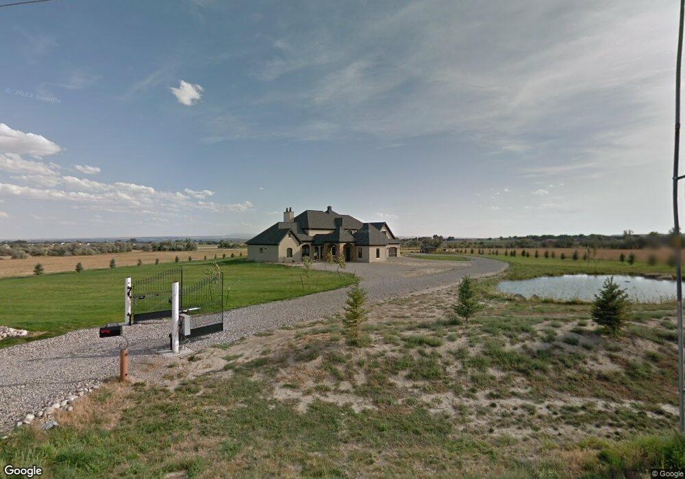
6550 Rimrock Rd Billings, MT 59106
West Shiloh NeighborhoodEstimated Value: $785,000 - $1,960,153
4
Beds
5
Baths
5,759
Sq Ft
$238/Sq Ft
Est. Value
About This Home
This home is located at 6550 Rimrock Rd, Billings, MT 59106 and is currently estimated at $1,372,577, approximately $238 per square foot. 6550 Rimrock Rd is a home located in Yellowstone County with nearby schools including Meadowlark School, Ben Steele Middle School, and Billings West High School.
Ownership History
Date
Name
Owned For
Owner Type
Purchase Details
Closed on
Jul 30, 2019
Sold by
First Interstate Bank
Bought by
Lix G David and Lix Amy J
Current Estimated Value
Home Financials for this Owner
Home Financials are based on the most recent Mortgage that was taken out on this home.
Original Mortgage
$400,000
Outstanding Balance
$350,326
Interest Rate
3.7%
Mortgage Type
New Conventional
Estimated Equity
$1,022,251
Create a Home Valuation Report for This Property
The Home Valuation Report is an in-depth analysis detailing your home's value as well as a comparison with similar homes in the area
Home Values in the Area
Average Home Value in this Area
Purchase History
| Date | Buyer | Sale Price | Title Company |
|---|---|---|---|
| Lix G David | -- | First Montana Title Co |
Source: Public Records
Mortgage History
| Date | Status | Borrower | Loan Amount |
|---|---|---|---|
| Open | Lix G David | $400,000 |
Source: Public Records
Tax History Compared to Growth
Tax History
| Year | Tax Paid | Tax Assessment Tax Assessment Total Assessment is a certain percentage of the fair market value that is determined by local assessors to be the total taxable value of land and additions on the property. | Land | Improvement |
|---|---|---|---|---|
| 2025 | $13,857 | $2,349,700 | $328,762 | $2,020,938 |
| 2024 | $13,857 | $1,836,600 | $265,149 | $1,571,451 |
| 2023 | $13,761 | $1,863,600 | $265,149 | $1,598,451 |
| 2022 | $11,898 | $1,381,900 | $225,570 | $1,156,330 |
| 2021 | $11,840 | $1,381,900 | $0 | $0 |
| 2020 | $11,373 | $1,330,300 | $0 | $0 |
| 2019 | $13,264 | $1,598,300 | $0 | $0 |
| 2018 | $12,462 | $1,469,300 | $0 | $0 |
| 2017 | $12,305 | $1,504,200 | $0 | $0 |
| 2016 | $11,938 | $1,476,700 | $0 | $0 |
| 2015 | $11,638 | $1,476,700 | $0 | $0 |
| 2014 | $11,705 | $798,498 | $0 | $0 |
Source: Public Records
Map
Nearby Homes
- 3005 Golden Acres Dr
- 2924 Golden Acres Dr
- 6424 Southern Bluffs Ln
- 637 Willow Branch Rd
- 635 Willow Branch Rd
- 6312 Absaloka Ln
- 6325 Beckville Ln
- 6310 Absaloka Ln
- 6421 Southern Bluffs Ln Unit 2
- 6421 Southern Bluffs Ln Unit 1
- 6307 Absaloka Ln
- 6389 Signal Peak Ave
- 6312 Decker Ln
- 6387 Signal Peak Ave
- 6386 Signal Peak Ave
- 6309 Decker Ln
- 6730 Cove Creek Dr
- 6838 Copper Ridge Loop
- 3111 Amelia Cir
- 3127 Falcon Cir
- 6442 Signal Peak Ave
- 6440 Signal Peak Ave
- 6438 Signal Peak Ave
- 6436 Signal Peak Ave
- 6430 Signal Peak Ave
- 6428 Signal Peak Ave
- 6426 Signal Peak Ave
- LOT 2 66th Stree W
- 6429 Signal Peak Ave
- 6424 Signal Peak Ave
- 6431 Signal Peak Ave
- 6422 Signal Peak Ave
- 6427 Signal Peak Ave
- 6340 Absaloka Ln
- 6419 Signal Peak Ave
- 2907 Golden Acres Dr
- 6338 Absaloka Ln
- 6425 Signal Peak Ave
- 6336 Absaloka Ln
- 6423 Signal Peak Ave