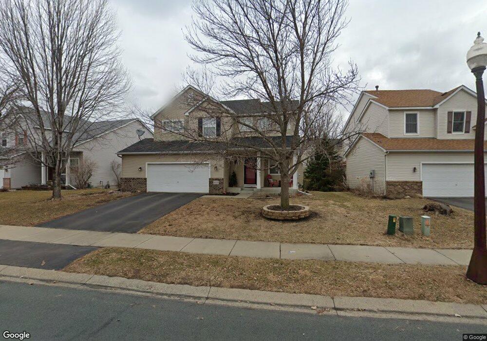
6551 Carlisle Curve Shakopee, MN 55379
Estimated Value: $426,000 - $464,000
3
Beds
3
Baths
2,260
Sq Ft
$200/Sq Ft
Est. Value
About This Home
This home is located at 6551 Carlisle Curve, Shakopee, MN 55379 and is currently estimated at $452,549, approximately $200 per square foot. 6551 Carlisle Curve is a home located in Scott County with nearby schools including Red Oak Elementary School, Shakopee West Middle School, and Shakopee Senior High School.
Ownership History
Date
Name
Owned For
Owner Type
Purchase Details
Closed on
Nov 9, 2021
Sold by
Flanders Kevin D
Bought by
Gustafson Paula Jean
Current Estimated Value
Purchase Details
Closed on
Jan 24, 2020
Sold by
Lebens Christopher J
Bought by
Flanders Paula J
Home Financials for this Owner
Home Financials are based on the most recent Mortgage that was taken out on this home.
Original Mortgage
$296,910
Interest Rate
3.7%
Mortgage Type
New Conventional
Purchase Details
Closed on
Jul 16, 2014
Sold by
Winter Kristin M and Lebens Kristin M
Bought by
Lebens Christopher J
Purchase Details
Closed on
Jul 7, 2000
Sold by
Centex Homes Minnesota Division
Bought by
Lebens Christopher J and Lebens Kristin M
Create a Home Valuation Report for This Property
The Home Valuation Report is an in-depth analysis detailing your home's value as well as a comparison with similar homes in the area
Home Values in the Area
Average Home Value in this Area
Purchase History
| Date | Buyer | Sale Price | Title Company |
|---|---|---|---|
| Gustafson Paula Jean | -- | None Available | |
| Flanders Paula J | $329,900 | Burnet Title | |
| Lebens Christopher J | -- | None Available | |
| Lebens Christopher J | $203,350 | -- |
Source: Public Records
Mortgage History
| Date | Status | Borrower | Loan Amount |
|---|---|---|---|
| Previous Owner | Flanders Paula J | $296,910 |
Source: Public Records
Tax History Compared to Growth
Tax History
| Year | Tax Paid | Tax Assessment Tax Assessment Total Assessment is a certain percentage of the fair market value that is determined by local assessors to be the total taxable value of land and additions on the property. | Land | Improvement |
|---|---|---|---|---|
| 2025 | $4,388 | $430,400 | $154,400 | $276,000 |
| 2024 | $4,414 | $423,700 | $151,400 | $272,300 |
| 2023 | $4,422 | $413,000 | $147,000 | $266,000 |
| 2022 | $4,228 | $407,300 | $141,300 | $266,000 |
| 2021 | $3,586 | $338,500 | $118,800 | $219,700 |
| 2020 | $3,694 | $316,300 | $99,000 | $217,300 |
| 2019 | $3,738 | $289,200 | $91,800 | $197,400 |
| 2018 | $4,146 | $0 | $0 | $0 |
| 2016 | $4,208 | $0 | $0 | $0 |
| 2014 | -- | $0 | $0 | $0 |
Source: Public Records
Map
Nearby Homes
- 6869 Falmouth Curve
- 7499 Derby Ln
- 1339 Yorkshire Ln
- 7450 Ridge Creek Trail
- 8042 Stratford Cir S
- 1782 Switchgrass Cir
- 7427 Water St
- 7422 Waverly Ave
- 4474 Bulrush Blvd
- 1551 Coneflower Ln
- 7206 22nd Ave E
- 7142 22nd Ave S
- 7660 Waverly Ave
- 7696 Waverly Ave
- 7687 22nd Ave S
- 7638 22nd Ave S
- 7698 22nd Ave E
- 7499 22nd Ave S
- 7675 22nd Ave S
- 13200 Henning Cir NE
- 6571 Carlisle Curve
- 6541 Carlisle Curve
- 6618 Danbury Curve
- 6581 Carlisle Curve
- 6531 Carlisle Curve
- 6628 Danbury Curve
- 6608 Danbury Curve
- 6558 Carlisle Curve
- 6521 Carlisle Curve
- 6591 Carlisle Curve
- 6568 Carlisle Curve
- 6548 Carlisle Curve
- 6638 Danbury Curve
- 6578 Carlisle Curve
- 6538 Carlisle Curve
- 6598 Danbury Curve
- 6588 Carlisle Curve
- 6611 Carlisle Curve
- 6528 Carlisle Curve
- 6511 Carlisle Curve