Estimated Value: $339,000 - $366,000
3
Beds
2
Baths
1,858
Sq Ft
$187/Sq Ft
Est. Value
About This Home
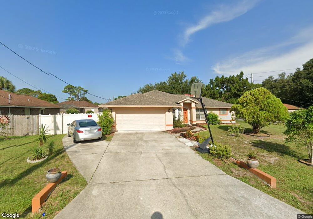
This home is located at 6555 Fuller Ave, Cocoa, FL 32927 and is currently estimated at $347,553, approximately $187 per square foot. 6555 Fuller Ave is a home located in Brevard County with nearby schools including Enterprise Elementary School, Space Coast Junior/Senior High School, and East Atlantic Prep of Brevard County.
Ownership History
Date
Name
Owned For
Owner Type
Purchase Details
Closed on
May 29, 2025
Sold by
Pierce Louis A and Pierce Deborah L
Bought by
Pierce Louis A and Pierce Deborah L
Current Estimated Value
Purchase Details
Closed on
Nov 8, 1993
Sold by
Jason Corp
Bought by
Pierce Louis A and Pierce Deborah L
Home Financials for this Owner
Home Financials are based on the most recent Mortgage that was taken out on this home.
Original Mortgage
$95,880
Interest Rate
6.97%
Purchase Details
Closed on
Aug 26, 1993
Sold by
Atlantic Gulf Com Corp
Bought by
Jason Corp
Create a Home Valuation Report for This Property
The Home Valuation Report is an in-depth analysis detailing your home's value as well as a comparison with similar homes in the area
Home Values in the Area
Average Home Value in this Area
Purchase History
| Date | Buyer | Sale Price | Title Company |
|---|---|---|---|
| Pierce Louis A | $100 | None Listed On Document | |
| Pierce Louis A | $94,000 | -- | |
| Jason Corp | $10,500 | -- |
Source: Public Records
Mortgage History
| Date | Status | Borrower | Loan Amount |
|---|---|---|---|
| Previous Owner | Pierce Louis A | $95,880 |
Source: Public Records
Tax History
| Year | Tax Paid | Tax Assessment Tax Assessment Total Assessment is a certain percentage of the fair market value that is determined by local assessors to be the total taxable value of land and additions on the property. | Land | Improvement |
|---|---|---|---|---|
| 2025 | $1,444 | $99,710 | -- | -- |
| 2024 | $1,405 | $96,900 | -- | -- |
| 2023 | $1,405 | $94,080 | -- | -- |
| 2022 | $1,311 | $91,340 | $0 | $0 |
| 2021 | $1,303 | $88,680 | $0 | $0 |
| 2020 | $1,225 | $87,460 | $0 | $0 |
| 2019 | $1,159 | $85,500 | $0 | $0 |
| 2018 | $1,149 | $83,910 | $0 | $0 |
| 2017 | $1,137 | $82,190 | $0 | $0 |
| 2016 | $1,135 | $80,500 | $18,000 | $62,500 |
| 2015 | $1,144 | $79,950 | $15,000 | $64,950 |
| 2014 | $1,144 | $79,320 | $11,000 | $68,320 |
Source: Public Records
Map
Nearby Homes
- 5715 Fairbridge St
- 6581 Bancroft Ave
- 6481 La Brea Ave
- 5680 Banos Ave
- 6615 Dock Ave
- 6438 Hudson Rd
- 6574 Bamboo Ave
- 0 Aruin St Unit 1222557
- 6470 Bamboo Ave
- 5601 Banos Ave
- 6545 Addie Ave
- 6460 Homestead Ave
- 6665 Addie Ave
- 23-35-21-JX-B-2 Aruin St
- 5680 Brandon St
- 6450 Ember Ave
- 5555 Brandon St
- 6760 Cairo Rd
- 6105 Banyan St
- 5720 Flint Rd
- 6565 Fuller Ave
- 6552 Emil Ave
- 6562 Emil Ave
- 5645 Curtis Blvd
- 6575 Fuller Ave
- 6550 Fuller Ave
- 5625 Curtis Blvd
- 6560 Fuller Ave
- 6572 Emil Ave
- 5615 Curtis Blvd
- 5661 Curtis Blvd
- 6570 Fuller Ave
- 6585 Fuller Ave
- 6582 Emil Ave
- 5585 Curtis Blvd
- 5680 Curtis Blvd
- 6580 Fuller Ave
- 6553 Emil Ave
- 5665 Curtis Blvd
- 6563 Emil Ave
Your Personal Tour Guide
Ask me questions while you tour the home.