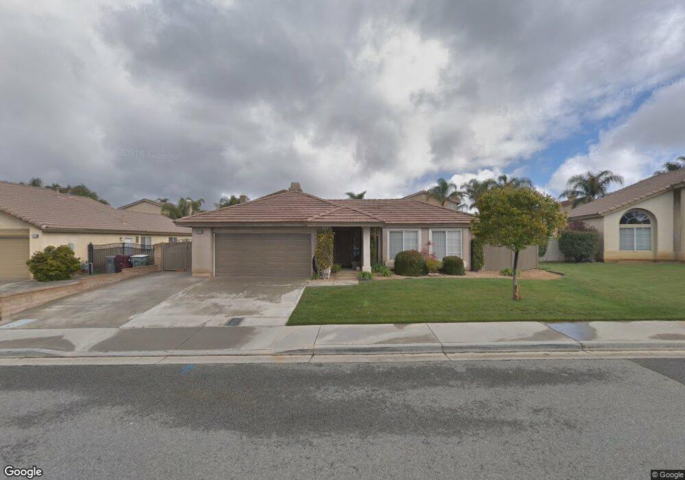
656 Brookside Ln Beaumont, CA 92223
Estimated Value: $443,000 - $465,000
4
Beds
2
Baths
1,400
Sq Ft
$328/Sq Ft
Est. Value
About This Home
This home is located at 656 Brookside Ln, Beaumont, CA 92223 and is currently estimated at $458,839, approximately $327 per square foot. 656 Brookside Ln is a home located in Riverside County with nearby schools including Three Rings Ranch Elementary School, Mountain View Middle School, and Beaumont Senior High School.
Ownership History
Date
Name
Owned For
Owner Type
Purchase Details
Closed on
Feb 13, 2017
Sold by
Curtis Lyndell M and Mcgregor Lyndell M
Bought by
Curtis Michael L and Curtis Lyndell M
Current Estimated Value
Home Financials for this Owner
Home Financials are based on the most recent Mortgage that was taken out on this home.
Original Mortgage
$231,063
Outstanding Balance
$190,881
Interest Rate
4.12%
Mortgage Type
VA
Estimated Equity
$267,958
Purchase Details
Closed on
Apr 29, 2002
Sold by
Osborne Development Corp
Bought by
Mcgregor Lyndell M
Home Financials for this Owner
Home Financials are based on the most recent Mortgage that was taken out on this home.
Original Mortgage
$157,699
Interest Rate
6.86%
Mortgage Type
FHA
Create a Home Valuation Report for This Property
The Home Valuation Report is an in-depth analysis detailing your home's value as well as a comparison with similar homes in the area
Home Values in the Area
Average Home Value in this Area
Purchase History
| Date | Buyer | Sale Price | Title Company |
|---|---|---|---|
| Curtis Michael L | -- | American Coast Title Company | |
| Mcgregor Lyndell M | $160,000 | Fidelity National Title Co |
Source: Public Records
Mortgage History
| Date | Status | Borrower | Loan Amount |
|---|---|---|---|
| Open | Curtis Michael L | $231,063 | |
| Previous Owner | Mcgregor Lyndell M | $157,699 |
Source: Public Records
Tax History
| Year | Tax Paid | Tax Assessment Tax Assessment Total Assessment is a certain percentage of the fair market value that is determined by local assessors to be the total taxable value of land and additions on the property. | Land | Improvement |
|---|---|---|---|---|
| 2025 | $3,927 | $241,151 | $73,852 | $167,299 |
| 2023 | $3,927 | $231,788 | $70,985 | $160,803 |
| 2022 | $3,836 | $227,244 | $69,594 | $157,650 |
| 2021 | $3,778 | $222,789 | $68,230 | $154,559 |
| 2020 | $3,738 | $220,506 | $67,531 | $152,975 |
| 2019 | $3,669 | $216,183 | $66,207 | $149,976 |
| 2018 | $3,792 | $211,945 | $64,910 | $147,035 |
| 2017 | $3,861 | $207,790 | $63,638 | $144,152 |
| 2016 | $3,826 | $203,717 | $62,391 | $141,326 |
| 2015 | $3,762 | $200,658 | $61,454 | $139,204 |
| 2014 | $3,351 | $163,000 | $50,000 | $113,000 |
Source: Public Records
Map
Nearby Homes
- 1153 Woodburn Cir
- 1193 Woodburn Cir
- 926 Hardwick Ave
- 410 Windfields Way
- 1211 Olive Ave
- 370 W 12th St
- 38800 Florence St
- 0 Veile Ave
- 0 Union Vineland Unit EV24050578
- 0 Oak Glen Rd Unit CV25224046
- 1243 N California Ave
- 150 E 12th St
- 737 Edgar Ave
- 1049 Beaumont Ave
- 1032 Western Knolls Ave
- 559 Edgar Ave Unit A2-282
- 925 Magnolia Ave
- 0 W 4th St Unit OC25273758
- 838 Classic Ave
- 207 E 5th St
- 660 Brookside Ln
- 652 Brookside Ln
- 601 Ashford Ct
- 585 Ashford Ct
- 644 Brookside Ln
- 619 Ashford Ct
- 573 Ashford Ct
- 664 Brookside Ln
- 1080 Darby Dan Way
- 1087 Wilmont Way
- 1087 Willmont Way
- 561 Ashford Ct
- 631 Ashford Ct
- 636 Brookside Ln
- 661 Brookside Ln
- 1076 Darby Dan Way
- 1075 Wilmont Way
- 559 Ashford Ct
- 675 Ashford Ct
- 598 Ashford Ct
Your Personal Tour Guide
Ask me questions while you tour the home.