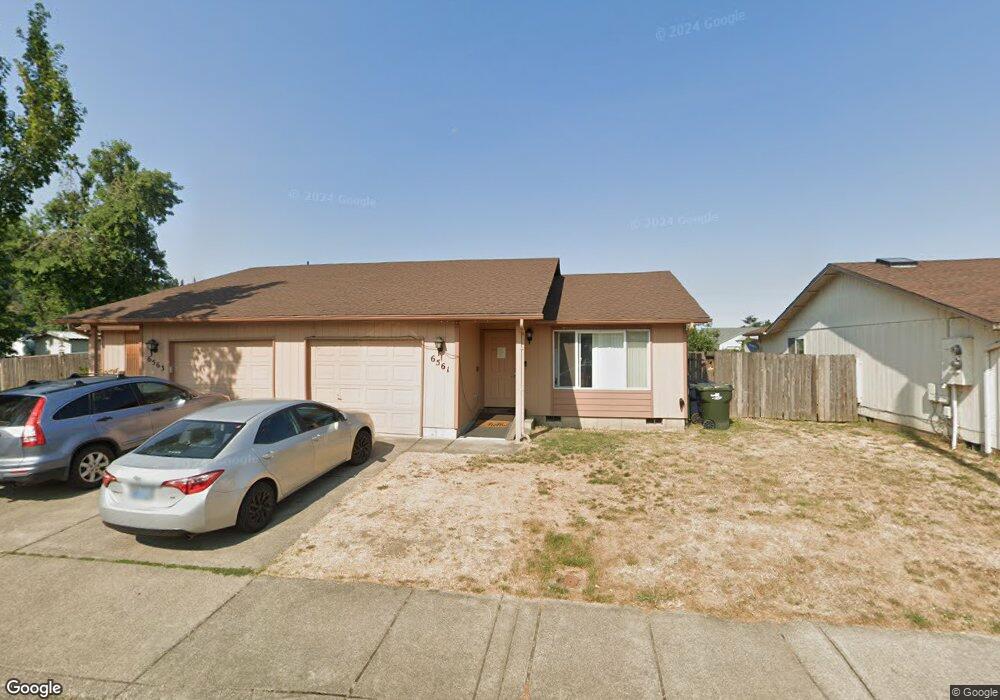
6561 A St Springfield, OR 97478
Thurston NeighborhoodEstimated Value: $429,000 - $481,855
4
Beds
4
Baths
1,820
Sq Ft
$256/Sq Ft
Est. Value
About This Home
This home is located at 6561 A St, Springfield, OR 97478 and is currently estimated at $465,214, approximately $255 per square foot. 6561 A St is a home located in Lane County with nearby schools including Ridgeview Elementary School, Thurston Middle School, and Thurston High School.
Create a Home Valuation Report for This Property
The Home Valuation Report is an in-depth analysis detailing your home's value as well as a comparison with similar homes in the area
Home Values in the Area
Average Home Value in this Area
Tax History
| Year | Tax Paid | Tax Assessment Tax Assessment Total Assessment is a certain percentage of the fair market value that is determined by local assessors to be the total taxable value of land and additions on the property. | Land | Improvement |
|---|---|---|---|---|
| 2025 | $4,592 | $250,425 | -- | -- |
| 2024 | $4,518 | $243,132 | -- | -- |
| 2023 | $4,518 | $236,051 | $0 | $0 |
| 2022 | $4,184 | $229,176 | $0 | $0 |
| 2021 | $4,109 | $222,501 | $0 | $0 |
| 2020 | $3,989 | $216,021 | $0 | $0 |
| 2019 | $3,869 | $209,730 | $0 | $0 |
| 2018 | $3,647 | $197,691 | $0 | $0 |
| 2017 | $3,459 | $197,691 | $0 | $0 |
| 2016 | $3,367 | $191,933 | $0 | $0 |
| 2015 | $3,205 | $186,343 | $0 | $0 |
| 2014 | $3,169 | $181,620 | $0 | $0 |
Source: Public Records
Map
Nearby Homes
- 6540 B St
- 6445 B St
- 6451 Dogwood St
- 320 Mountaingate Dr
- 250 68th St
- 6884 Forest Ridge Dr
- 0 Forest Ridge Unit 520732026
- 193 62nd Place
- 555 66th St
- 0 Forest Ridge Dr Unit 637211360
- 6875 B St
- 6225 Forest Ridge Dr
- 6964 Bluebelle Way
- 246 S 70th St
- 5995 Main St
- 0 S 69th Place
- 994 S 67th St
- 353 71st St
- 962 S 66th Place
- 0 71st St
Your Personal Tour Guide
Ask me questions while you tour the home.