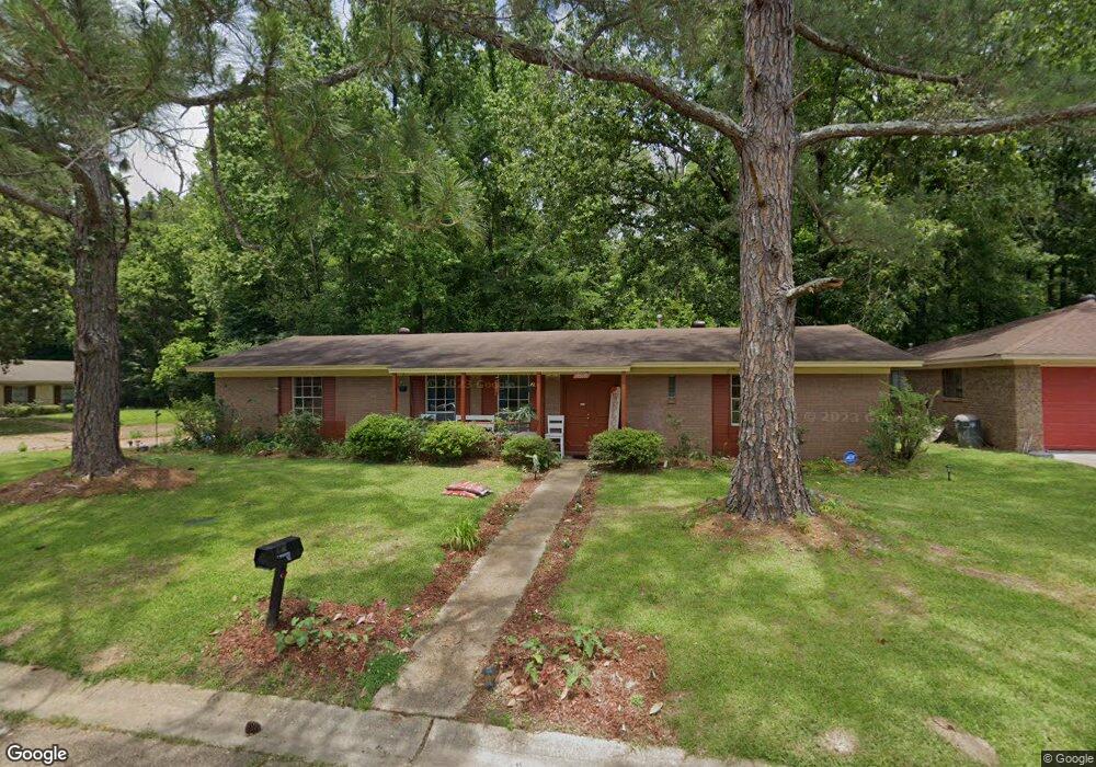
6569 Franklin D Roosevelt Dr Jackson, MS 39213
North Jackson NeighborhoodEstimated Value: $96,815 - $116,000
--
Bed
--
Bath
1,769
Sq Ft
$62/Sq Ft
Est. Value
About This Home
This home is located at 6569 Franklin D Roosevelt Dr, Jackson, MS 39213 and is currently estimated at $108,954, approximately $61 per square foot. 6569 Franklin D Roosevelt Dr is a home located in Hinds County with nearby schools including John Hopkins Elementary School, Powell Middle School, and Provine High School.
Ownership History
Date
Name
Owned For
Owner Type
Purchase Details
Closed on
Oct 17, 2007
Sold by
Bell Printes
Bought by
Scott Alma
Current Estimated Value
Home Financials for this Owner
Home Financials are based on the most recent Mortgage that was taken out on this home.
Original Mortgage
$74,086
Outstanding Balance
$46,370
Interest Rate
6.26%
Mortgage Type
FHA
Estimated Equity
$62,584
Create a Home Valuation Report for This Property
The Home Valuation Report is an in-depth analysis detailing your home's value as well as a comparison with similar homes in the area
Home Values in the Area
Average Home Value in this Area
Purchase History
| Date | Buyer | Sale Price | Title Company |
|---|---|---|---|
| Scott Alma | -- | -- |
Source: Public Records
Mortgage History
| Date | Status | Borrower | Loan Amount |
|---|---|---|---|
| Open | Scott Alma | $74,086 |
Source: Public Records
Tax History Compared to Growth
Tax History
| Year | Tax Paid | Tax Assessment Tax Assessment Total Assessment is a certain percentage of the fair market value that is determined by local assessors to be the total taxable value of land and additions on the property. | Land | Improvement |
|---|---|---|---|---|
| 2025 | $1,573 | $8,139 | $2,250 | $5,889 |
| 2024 | $1,573 | $8,139 | $2,250 | $5,889 |
| 2023 | $1,573 | $8,139 | $2,250 | $5,889 |
| 2022 | $1,566 | $8,139 | $2,250 | $5,889 |
| 2021 | $1,544 | $8,025 | $2,250 | $5,775 |
| 2020 | $1,528 | $7,985 | $2,250 | $5,735 |
| 2019 | $1,529 | $7,985 | $2,250 | $5,735 |
| 2018 | $1,512 | $7,985 | $2,250 | $5,735 |
| 2017 | $1,473 | $7,985 | $2,250 | $5,735 |
| 2016 | $1,473 | $7,985 | $2,250 | $5,735 |
| 2015 | $1,400 | $7,818 | $2,250 | $5,568 |
| 2014 | $1,398 | $7,818 | $2,250 | $5,568 |
Source: Public Records
Map
Nearby Homes
- 6607 Franklin D Roosevelt Dr
- 0 Trace Dr Dr
- 138 William McKinley Cir
- 6548 George Washington Dr
- 381 James Garfield Cir
- 6634 Lyndon b Johnson Dr
- 3731 John F. Kennedy Blvd
- 0003 Southern Trace Blvd
- 3704 John F. Kennedy Blvd Unit J
- 804 N Flag Chapel Rd
- 0 U S 49 Unit 4094302
- 0 Cottonwood Dr
- 685 Queen Cir
- 0 Red Oak St
- 667 Queen Cir
- 0 Castlewood Dr
- 220 Pin Oak Dr
- 000 Magnolia Rd
- 525 Magnolia Rd
- 506 Lowder Dr
- 6569 Franklin Delano Roosevelt Dr
- 6571 Franklin D Roosevelt Dr
- 6571 Franklin Delano Roosevelt Dr
- 6565 Franklin D Roosevelt Dr
- 6568 Franklin D Roosevelt Dr
- 6566 Franklin D Roosevelt Dr
- 6570 Franklin D Roosevelt Dr
- 6563 Franklin D Roosevelt Dr
- 6564 Franklin D Roosevelt Dr
- 6572 Franklin D Roosevelt Dr
- 6562 Franklin D Roosevelt Dr
- 6574 Franklin D Roosevelt Dr
- 6559 Franklin D Roosevelt Dr
- 6560 Franklin D Roosevelt Dr
- 6576 Franklin D Roosevelt Dr
- 6579 Franklin D Roosevelt Dr
- 6558 Franklin D Roosevelt Dr
- 6578 Franklin D Roosevelt Dr
- 6555 Franklin D Roosevelt Dr
- 6556 Franklin D Roosevelt Dr