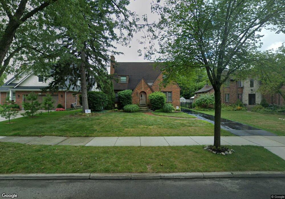
657 Barrington Rd Grosse Pointe Park, MI 48230
Estimated Value: $420,519 - $680,000
--
Bed
2
Baths
2,160
Sq Ft
$245/Sq Ft
Est. Value
About This Home
This home is located at 657 Barrington Rd, Grosse Pointe Park, MI 48230 and is currently estimated at $528,380, approximately $244 per square foot. 657 Barrington Rd is a home located in Wayne County with nearby schools including Carstens Academy of Aquatic Science, Edward 'Duke' Ellington Conservatory of Music and Art, and Charles L. Spain Elementary-Middle School.
Ownership History
Date
Name
Owned For
Owner Type
Purchase Details
Closed on
Oct 19, 2024
Sold by
Taylor Andrew W and Taylor Janel R
Bought by
Andrew And Janel Taylor Trust and Taylor
Current Estimated Value
Purchase Details
Closed on
Jun 15, 2000
Sold by
Levan Michael J
Bought by
Mary C Tocci
Purchase Details
Closed on
Mar 6, 1997
Sold by
Bacon Louise and Bacon Louise M
Bought by
Michael J Le Van and Michael Sara Reichert
Create a Home Valuation Report for This Property
The Home Valuation Report is an in-depth analysis detailing your home's value as well as a comparison with similar homes in the area
Home Values in the Area
Average Home Value in this Area
Purchase History
| Date | Buyer | Sale Price | Title Company |
|---|---|---|---|
| Andrew And Janel Taylor Trust | -- | None Listed On Document | |
| Andrew And Janel Taylor Trust | -- | None Listed On Document | |
| Mary C Tocci | $294,000 | -- | |
| Michael J Le Van | $154,250 | -- |
Source: Public Records
Tax History Compared to Growth
Tax History
| Year | Tax Paid | Tax Assessment Tax Assessment Total Assessment is a certain percentage of the fair market value that is determined by local assessors to be the total taxable value of land and additions on the property. | Land | Improvement |
|---|---|---|---|---|
| 2025 | $2,765 | $202,000 | $0 | $0 |
| 2024 | $2,765 | $188,100 | $0 | $0 |
| 2023 | $2,640 | $165,500 | $0 | $0 |
| 2022 | $2,508 | $152,500 | $0 | $0 |
| 2021 | $4,945 | $149,600 | $0 | $0 |
| 2019 | $5,089 | $132,200 | $0 | $0 |
| 2018 | $2,391 | $117,700 | $0 | $0 |
| 2017 | $5,678 | $91,400 | $0 | $0 |
| 2016 | $5,160 | $107,000 | $0 | $0 |
| 2015 | $8,950 | $102,600 | $0 | $0 |
| 2013 | $8,670 | $88,400 | $0 | $0 |
| 2012 | $2,484 | $93,500 | $25,800 | $67,700 |
Source: Public Records
Map
Nearby Homes
- 614 Pemberton Rd
- 709 Lakepointe St
- 429 Manistique St
- 784 Barrington Rd
- 289 Manistique St
- 504 Alter Rd
- 709 Middlesex Rd
- 225 Ashland St
- 487 Philip St
- 458 Marlborough St
- 388 Chalmers St
- 402 Chalmers St
- 383 Chalmers St
- 847 Barrington Rd
- 15215 Windmill Pointe Dr
- 15345 Windmill Pointe Dr
- 14511 Harbor Island St
- 709 Ashland St
- 221 Chalmers St
- 15230 Windmill Pointe Dr
- 651 Barrington Rd
- 663 Barrington Rd
- 643 Barrington Rd
- 658 Barrington Rd
- 386 Alter Rd
- 378 Alter Rd
- 390 Alter Rd
- 392 Alter Rd
- 368 Alter Rd
- 637 Barrington Rd
- 705 Barrington Rd
- 370 Alter Rd
- 652 Barrington Rd
- 402 Alter Rd
- 644 Barrington Rd
- 354 Alter Rd
- 404 Alter Rd
- 631 Barrington Rd
- 711 Barrington Rd
- 638 Barrington Rd