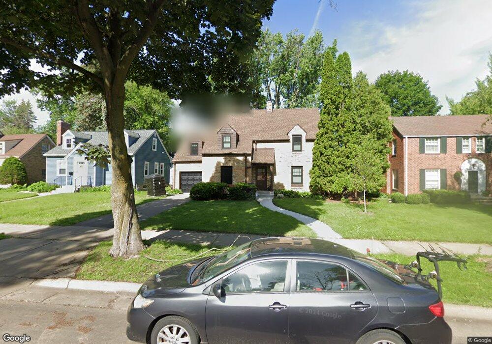
657 Sumner St Saint Paul, MN 55116
Highland Park NeighborhoodEstimated Value: $614,000 - $657,000
3
Beds
2
Baths
2,110
Sq Ft
$302/Sq Ft
Est. Value
About This Home
This home is located at 657 Sumner St, Saint Paul, MN 55116 and is currently estimated at $637,930, approximately $302 per square foot. 657 Sumner St is a home located in Ramsey County with nearby schools including Horace Mann School, Highland Park Middle School, and Highland Park Senior High.
Ownership History
Date
Name
Owned For
Owner Type
Purchase Details
Closed on
Feb 11, 2022
Sold by
Weber Richard P
Bought by
Brandt Leslie W and Brandt Jonathan R
Current Estimated Value
Purchase Details
Closed on
Sep 14, 2021
Sold by
Miller Ronald I and Trust Agreement Of Ronald I Mi
Bought by
Petersen Kirsten Mary and Gunsolus Ian Lyle
Home Financials for this Owner
Home Financials are based on the most recent Mortgage that was taken out on this home.
Original Mortgage
$420,000
Interest Rate
2.7%
Mortgage Type
New Conventional
Purchase Details
Closed on
May 27, 2021
Sold by
Miller Ronald I
Bought by
Miller Ronald I and Trust Agreement Of Ronald I Mi
Create a Home Valuation Report for This Property
The Home Valuation Report is an in-depth analysis detailing your home's value as well as a comparison with similar homes in the area
Home Values in the Area
Average Home Value in this Area
Purchase History
| Date | Buyer | Sale Price | Title Company |
|---|---|---|---|
| Brandt Leslie W | $192,000 | None Listed On Document | |
| Petersen Kirsten Mary | $525,000 | Edina Realty Title Inc | |
| Miller Ronald I | -- | None Available | |
| Petersen Kirsten Kirsten | $525,000 | -- |
Source: Public Records
Mortgage History
| Date | Status | Borrower | Loan Amount |
|---|---|---|---|
| Previous Owner | Petersen Kirsten Mary | $420,000 | |
| Closed | Petersen Kirsten Kirsten | $420,000 |
Source: Public Records
Tax History Compared to Growth
Tax History
| Year | Tax Paid | Tax Assessment Tax Assessment Total Assessment is a certain percentage of the fair market value that is determined by local assessors to be the total taxable value of land and additions on the property. | Land | Improvement |
|---|---|---|---|---|
| 2025 | $7,850 | $589,500 | $238,900 | $350,600 |
| 2023 | $7,850 | $508,500 | $238,900 | $269,600 |
| 2022 | $7,300 | $542,200 | $238,900 | $303,300 |
| 2021 | $7,618 | $451,500 | $238,900 | $212,600 |
| 2020 | $8,492 | $480,200 | $238,900 | $241,300 |
| 2019 | $8,134 | $497,900 | $310,500 | $187,400 |
| 2018 | $7,976 | $470,100 | $310,500 | $159,600 |
| 2017 | $8,024 | $465,200 | $310,500 | $154,700 |
| 2016 | $8,450 | $0 | $0 | $0 |
| 2015 | $8,506 | $479,900 | $266,200 | $213,700 |
| 2014 | $8,166 | $0 | $0 | $0 |
Source: Public Records
Map
Nearby Homes
- 677 Wilder St S
- 1885 W Eleanor Ave
- 1941 Ford Pkwy Unit 102
- 1856 Highland Pkwy
- 590 Fairview Ave S
- 1857 Ford Pkwy
- 2114 Randolph Ave
- 1736 Scheffer Ave
- 1778 Ford Pkwy
- 1776 Ford Pkwy
- 898 Wilder St S
- 1797 James Ave
- 1712 Highland Pkwy
- 1818 Juliet Ave
- 475 Mount Curve Blvd
- 1705 Ford Pkwy
- 1846 Saunders Ave
- 1886 Rome Ave
- 1688 James Ave
- 700 Mississippi River Blvd S
- 663 Sumner St
- 651 Sumner St
- 669 Sumner St
- 650 Kenneth St
- 654 Kenneth St
- 658 Kenneth St
- 671 Sumner St
- 1988 Bayard Ave
- 1958 Bayard Ave
- 662 Kenneth St
- 662 Sumner St
- 668 Kenneth St
- 668 Sumner St
- 1975 Bayard Ave
- 1965 Bayard Ave
- 1979 Bayard Ave
- 670 Kenneth St
- 675 Sumner St
- 1961 Bayard Ave
- 1950 1950 Bayard Ave