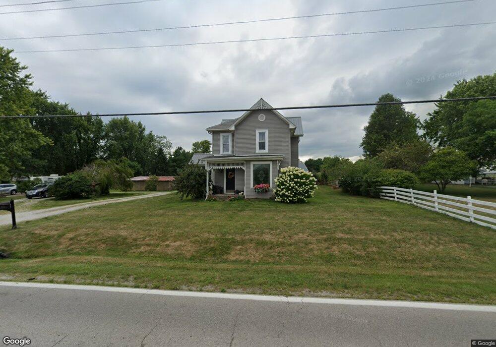
6571 State Route 762 Orient, OH 43146
Estimated Value: $362,000 - $628,000
3
Beds
1
Bath
2,789
Sq Ft
$161/Sq Ft
Est. Value
About This Home
This home is located at 6571 State Route 762, Orient, OH 43146 and is currently estimated at $448,364, approximately $160 per square foot. 6571 State Route 762 is a home located in Pickaway County.
Ownership History
Date
Name
Owned For
Owner Type
Purchase Details
Closed on
Jan 9, 2012
Sold by
Wheaterhead Thomas L and Wheaterhead Cassandra J
Bought by
Weatehrhead Thomas L and Wheaterhead Casandra J
Current Estimated Value
Home Financials for this Owner
Home Financials are based on the most recent Mortgage that was taken out on this home.
Original Mortgage
$180,000
Outstanding Balance
$21,179
Interest Rate
4.37%
Mortgage Type
New Conventional
Estimated Equity
$427,185
Purchase Details
Closed on
Mar 1, 1995
Sold by
Hill Keavin R
Bought by
Weatherhead Thomas L
Home Financials for this Owner
Home Financials are based on the most recent Mortgage that was taken out on this home.
Original Mortgage
$77,000
Interest Rate
9.12%
Mortgage Type
New Conventional
Create a Home Valuation Report for This Property
The Home Valuation Report is an in-depth analysis detailing your home's value as well as a comparison with similar homes in the area
Home Values in the Area
Average Home Value in this Area
Purchase History
| Date | Buyer | Sale Price | Title Company |
|---|---|---|---|
| Weatehrhead Thomas L | -- | None Available | |
| Weatherhead Thomas L | $85,000 | -- |
Source: Public Records
Mortgage History
| Date | Status | Borrower | Loan Amount |
|---|---|---|---|
| Open | Weatehrhead Thomas L | $180,000 | |
| Closed | Weatherhead Thomas L | $77,000 |
Source: Public Records
Tax History Compared to Growth
Tax History
| Year | Tax Paid | Tax Assessment Tax Assessment Total Assessment is a certain percentage of the fair market value that is determined by local assessors to be the total taxable value of land and additions on the property. | Land | Improvement |
|---|---|---|---|---|
| 2024 | -- | $98,090 | $22,830 | $75,260 |
| 2023 | $3,694 | $98,090 | $22,830 | $75,260 |
| 2022 | $2,858 | $69,700 | $15,220 | $54,480 |
| 2021 | $2,866 | $69,700 | $15,220 | $54,480 |
| 2020 | $2,867 | $69,700 | $15,220 | $54,480 |
| 2019 | $2,286 | $57,910 | $14,490 | $43,420 |
| 2018 | $2,261 | $57,910 | $14,490 | $43,420 |
| 2017 | $3,043 | $57,910 | $14,490 | $43,420 |
| 2016 | $2,117 | $52,750 | $12,660 | $40,090 |
| 2015 | $2,119 | $52,750 | $12,660 | $40,090 |
| 2014 | $2,121 | $52,750 | $12,660 | $40,090 |
| 2013 | $2,282 | $53,130 | $12,660 | $40,470 |
Source: Public Records
Map
Nearby Homes
- 56 Chambers Bay Rd
- 294 Shady Hollow Dr
- 47 Front St
- 49 Front St
- 55 Genoa Cir
- 62 Genoa Cir
- 66 Genoa Cir
- 45 Genoa Cir
- 310 Genoa Rd
- 317 Adrien Ct
- 486 Creekside Dr
- The Siebert Plan at Genoa Crossing
- The Hollandia B Plan at Genoa Crossing
- The Rainier Plan at Genoa Crossing
- The Petoskey Plan at Genoa Crossing
- 428 Lockbay Rd
- 10901 Borror Rd Unit 19
- 500 Walker Pointe Dr
- 201 Victorian Dr
- 502 Conley Dr
- 6587 State Route 762
- 0 Genoa Rd Unit 2614120
- 0 Genoa Rd Unit 2614128
- 0 Genoa Rd Unit 2614122
- 0 Genoa Rd Unit Lot 91 219041322
- 0 Genoa Rd Unit Lot 59
- 117 Main St
- 46 Parkview Cir
- 323 Parkview Rd
- 56 Parkview Cir
- 22 Carmel Ct
- 47 Main St
- 0 Carmel Ct
- 7071 State Route 762
- 0 State Route 762
- 6568 State Route 762
- 43 Main St
- 6630 State Route 762
- 15 Carmel Ct
- 44 Main St