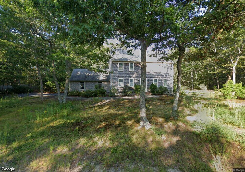
66 Beechtree Dr Brewster, MA 02631
Estimated Value: $802,000 - $840,000
3
Beds
3
Baths
1,872
Sq Ft
$438/Sq Ft
Est. Value
About This Home
This home is located at 66 Beechtree Dr, Brewster, MA 02631 and is currently estimated at $819,885, approximately $437 per square foot. 66 Beechtree Dr is a home located in Barnstable County with nearby schools including Stony Brook Elementary School, Eddy Elementary School, and Nauset Regional Middle School.
Ownership History
Date
Name
Owned For
Owner Type
Purchase Details
Closed on
Sep 13, 2018
Sold by
Macinnes Richard and Macinnes Carol J
Bought by
Macinnes Ft
Current Estimated Value
Purchase Details
Closed on
Dec 29, 2010
Sold by
Hebert Raymond W and Hebert Therese M
Bought by
Hebert Therese M
Purchase Details
Closed on
Sep 9, 1991
Sold by
Brennan Pamela P
Bought by
Macinna Richard and Macinnes Carol J
Home Financials for this Owner
Home Financials are based on the most recent Mortgage that was taken out on this home.
Original Mortgage
$120,000
Interest Rate
9.43%
Mortgage Type
Purchase Money Mortgage
Create a Home Valuation Report for This Property
The Home Valuation Report is an in-depth analysis detailing your home's value as well as a comparison with similar homes in the area
Home Values in the Area
Average Home Value in this Area
Purchase History
| Date | Buyer | Sale Price | Title Company |
|---|---|---|---|
| Macinnes Ft | -- | -- | |
| Hebert Therese M | -- | -- | |
| Hebert Therese M | -- | -- | |
| Macinna Richard | $150,000 | -- |
Source: Public Records
Mortgage History
| Date | Status | Borrower | Loan Amount |
|---|---|---|---|
| Previous Owner | Macinna Richard | $120,000 | |
| Previous Owner | Macinna Richard | $93,000 |
Source: Public Records
Tax History
| Year | Tax Paid | Tax Assessment Tax Assessment Total Assessment is a certain percentage of the fair market value that is determined by local assessors to be the total taxable value of land and additions on the property. | Land | Improvement |
|---|---|---|---|---|
| 2025 | $4,908 | $713,300 | $286,400 | $426,900 |
| 2024 | $4,586 | $673,400 | $270,200 | $403,200 |
| 2023 | $4,242 | $606,900 | $241,200 | $365,700 |
| 2022 | $3,981 | $507,100 | $201,000 | $306,100 |
| 2021 | $3,822 | $445,500 | $174,700 | $270,800 |
| 2020 | $3,732 | $432,900 | $174,700 | $258,200 |
| 2019 | $3,605 | $420,200 | $168,000 | $252,200 |
| 2018 | $3,394 | $410,900 | $168,000 | $242,900 |
| 2017 | $3,291 | $392,300 | $168,000 | $224,300 |
| 2016 | $3,478 | $412,600 | $193,400 | $219,200 |
| 2015 | $3,357 | $406,400 | $189,600 | $216,800 |
Source: Public Records
Map
Nearby Homes
- 58 Aunt Molls Ridge Rd
- 61 Sheffield Rd
- 337 Jonathans Way
- 184 Barons Way
- 737 Thousand Oaks Dr
- 13 Mill Pond Rd
- 274 Commons Way
- 958 Long Pond Rd
- 3 Stephen Hopkins Rd
- 235 Old Chatham Rd
- 19 Walkerwoods Dr
- 204 Eaton Ln Unit 204
- 26 Walkerwoods Dr
- 52 Eaton Ln Unit (52)
- 127 Eaton Ln Unit 127
- 16 Commons Way
- 0 Commons Way Unit 22504099
- 0 Old Chatham Rd
- 16 Partridge Ln
- 63 Trevor Ln Unit 63
- 54 Beechtree Dr
- 65 Beechtree Dr
- 84 Beechtree Dr
- 91 Scarborough Rd
- 99 Scarborough Rd
- 83 Beechtree Dr
- 48 Beechtree Dr
- 81 Scarborough Rd
- 119 Beechtree Dr
- 92 Beechtree Dr
- 32 Beechtree Dr
- 104 Beechtree Dr
- 108 Greenland Pond Rd
- 23 Beechtree Dr
- 116 Greenland Pond Rd
- 179 Beechtree Dr
- 190 Beechtree Dr
- 131 Beechtree Dr
- 86 Scarborough Rd
- 120 Beechtree Dr
Your Personal Tour Guide
Ask me questions while you tour the home.