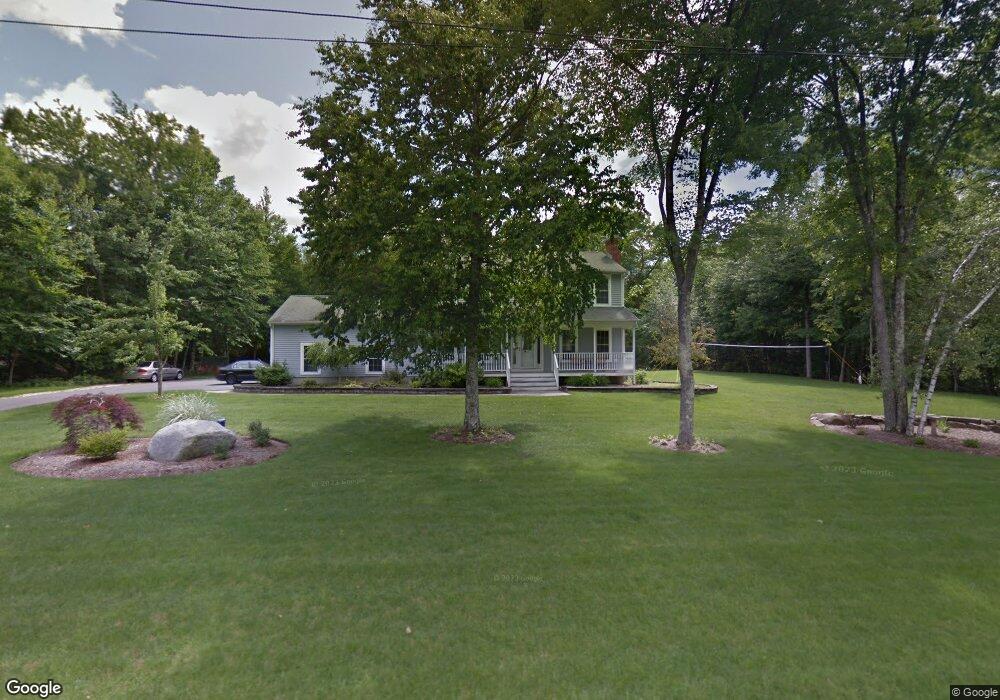
66 Mt Laurel Dr Tolland, CT 06084
Estimated Value: $543,000 - $637,000
3
Beds
3
Baths
1,893
Sq Ft
$301/Sq Ft
Est. Value
About This Home
This home is located at 66 Mt Laurel Dr, Tolland, CT 06084 and is currently estimated at $570,699, approximately $301 per square foot. 66 Mt Laurel Dr is a home located in Tolland County with nearby schools including Birch Grove Primary School, Tolland Intermediate School, and Tolland Middle School.
Ownership History
Date
Name
Owned For
Owner Type
Purchase Details
Closed on
Jul 28, 2009
Sold by
Chassanoff David and Chassanoff Wendy
Bought by
Conrad James and Conrad Margaret
Current Estimated Value
Purchase Details
Closed on
Sep 27, 2004
Sold by
Mchugh James and Mchugh Libiea
Bought by
Chassanoff David and Chassanoff Wendy
Purchase Details
Closed on
Feb 12, 2001
Sold by
Clh Const Llc
Bought by
Mchugh James and Mchugh Libien
Create a Home Valuation Report for This Property
The Home Valuation Report is an in-depth analysis detailing your home's value as well as a comparison with similar homes in the area
Home Values in the Area
Average Home Value in this Area
Purchase History
| Date | Buyer | Sale Price | Title Company |
|---|---|---|---|
| Conrad James | $345,000 | -- | |
| Conrad James | $345,000 | -- | |
| Chassanoff David | $334,000 | -- | |
| Chassanoff David | $334,000 | -- | |
| Mchugh James | $234,000 | -- | |
| Clh Const | $59,000 | -- |
Source: Public Records
Mortgage History
| Date | Status | Borrower | Loan Amount |
|---|---|---|---|
| Open | Clh Const | $175,751 | |
| Closed | Clh Const | $187,022 |
Source: Public Records
Tax History Compared to Growth
Tax History
| Year | Tax Paid | Tax Assessment Tax Assessment Total Assessment is a certain percentage of the fair market value that is determined by local assessors to be the total taxable value of land and additions on the property. | Land | Improvement |
|---|---|---|---|---|
| 2025 | $8,364 | $307,600 | $77,600 | $230,000 |
| 2024 | $7,924 | $209,800 | $73,900 | $135,900 |
| 2023 | $7,832 | $209,800 | $73,900 | $135,900 |
| 2022 | $7,674 | $209,800 | $73,900 | $135,900 |
| 2021 | $7,786 | $209,800 | $73,900 | $135,900 |
| 2020 | $7,563 | $209,800 | $73,900 | $135,900 |
| 2019 | $7,895 | $219,000 | $76,200 | $142,800 |
| 2018 | $7,665 | $219,000 | $76,200 | $142,800 |
| 2017 | $7,488 | $219,000 | $76,200 | $142,800 |
| 2016 | $7,488 | $219,000 | $76,200 | $142,800 |
| 2015 | $7,306 | $219,000 | $76,200 | $142,800 |
| 2014 | $7,117 | $229,200 | $84,700 | $144,500 |
Source: Public Records
Map
Nearby Homes
- 487 Buff Cap Rd
- 644 Buff Cap Rd
- 745 Old Stafford Rd
- 8 Neff Hill Rd
- 0 Tolland Turnpike
- 15 Usher Ridge
- 68 Usher Ridge
- 36 Usher Ridge
- 110 Neff Hill Rd
- 130 Neff Hill Rd
- 105 Neff Hill Rd
- 137 Neff Hill Rd
- 100 Neff Hill Rd
- 77 Neff Hill Rd
- 84 Neff Hill Rd
- 71 Neff Hill Rd
- 42 Ladd Rd
- 5 Melissa Way
- 68 Cook Rd
- 476 Old Stafford Rd
- 66 Mt Laurel Dr
- 58 Mountain Laurel Dr
- 73 Mt Laurel Dr
- 65 Mt Laurel Dr
- 74 Mt Laurel Dr
- 91 Deerwood Rd
- 53 Mt Laurel Dr
- 58 Mt Laurel Dr
- 50 Mt Laurel Dr
- 81 Mountain Laurel Dr
- 81 Mt Laurel Dr
- 85 Deerwood Rd
- 90 Deerwood Rd
- 45 Mt Laurel Dr
- 45 Mountain Laurel Dr
- 99 Deerwood Rd
- 96 Deerwood Rd
- 119 Deerwood Rd
- 111 Deerwood Rd
- 73 Deerwood Rd