
Seller's Agent in 2026
Joanne Cecchini
Berkshire Hathaway HomeServices Starck Real Estate
(224) 629-1010
4 in this area
50 Total Sales
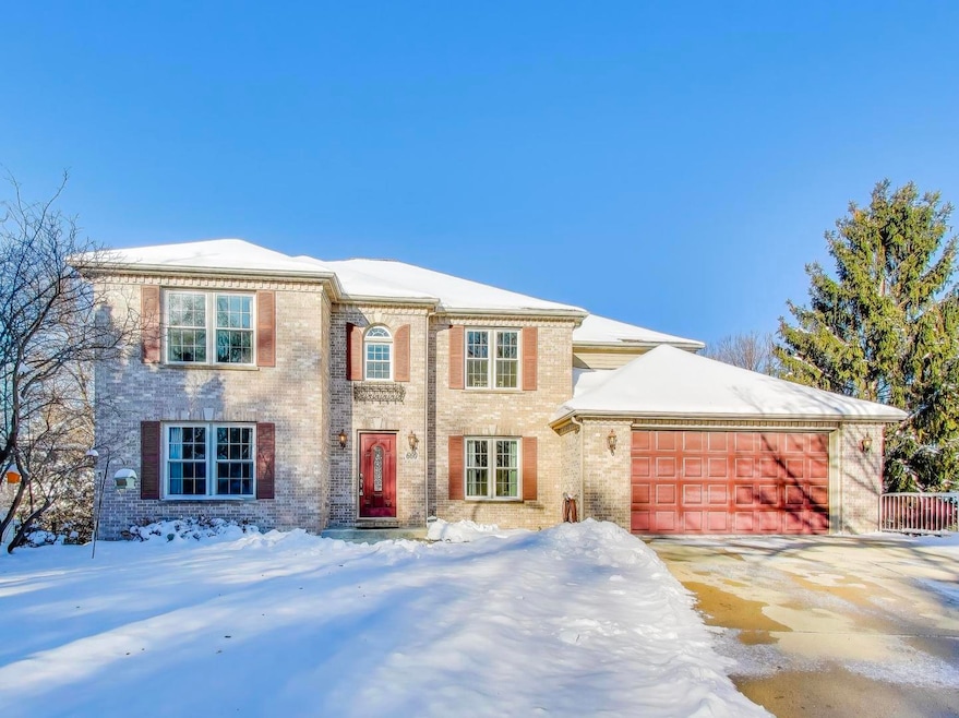
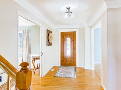
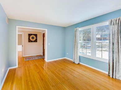

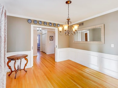
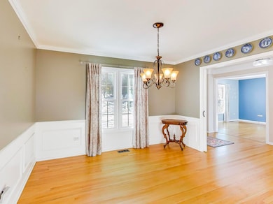

THREE FULL FLOORS OF LIVING SPACE! FOUR/FIVE BEDROOM 3.5 BATH CUSTOM-BUILT HOME TUCKED IN A QUIET CUL-DE-SAC ON A FENCED THIRD OF AN ACRE. REMODELED STAINLESS EAT-IN KITCHEN WITH GORGEOUS QUARTZ COUNTERS AND NEW HARDWOOD OPEN TO AN INVITING FAMILY ROOM GRACED WITH A GAS-STARTING FIREPLACE, FORMAL DINING ROOM WITH POCKET DOORS, A LARGE OFFICE, AND HALF BATH, ALONG WITH A SPACIOUS LAUNDRY ROOM COMPLETE THE FIRST LEVEL. THE DECK PROVIDES BREATH-TAKING VIEWS. THE SECOND STORY HAS NEW WARM HARDWOOD THROUGHOUT. THE DOUBLE DOOR PRIMARY BEDROOM BOASTS VAULTED CEILINGS, LUXURY EN SUITE AND AN EXPANSIVE WALK-IN CLOSET. TWO ADDITIONAL GOOD-SIZED BEDROOMS AND UPDATED HALL BATH COMPRISE THE SECOND LEVEL. THE FINISHED WALK-OUT BASEMENT RECREATION ROOM SPORTS NEW LUXURY VINYL FLOORING, ADDITIONAL BEDROOM/FLEX SPACE AND FULL BATH. THE PERFECT SPOT FOR FAMILY MEMBERS DESIRING PRIVACY. THE AMAZING WORKROOM/STORAGE AREA, LOCATED UNDER THE GARAGE, CAN BE ACCESSED FROM IN OR OUTSIDE. THIS SPACE IS IDEAL FOR STORING GARAGE "TOYS" AND TOOLS TO FREE UP GARAGE SPACE. SO MUCH NEW HERE SINCE PURCHASE: ROOF 2019, FURNACE AND A/C 2018, HOT WATER HEATER 2021, REFRIGERATOR/WASHER/DRYER 2024, KITCHEN, NEW WINDOWS/DOORS 2019, FENCE, BEAUTIFUL HARDWOOD AND LUXURY VINYL FLOORING, CARPET, AND A FRENCH DRAINAGE SYSTEM. TRULY A HOME TO MEET ANY FAMILY'S NEEDS! COME SEE THE ATTENTION TO DETAIL INSIDE AND OUTSIDE OF THIS CUSTOM HOME. A GREAT VALUE AND LOCATION!
Last Agent to Sell the Property
Berkshire Hathaway HomeServices Starck Real Estate Brokerage Email: clientcare@starckre.com License #475120551 Listed on: 12/09/2025
| Date | Type | Sale Price | Title Company |
|---|---|---|---|
| Warranty Deed | $279,000 | Great Metropolitan Title Llc | |
| Warranty Deed | $55,000 | Chicago Title Insurance Co |
| Date | Status | Loan Amount | Loan Type |
|---|---|---|---|
| Open | $264,955 | New Conventional |
| Date | Event | Price | List to Sale | Price per Sq Ft |
|---|---|---|---|---|
| 03/17/2026 03/17/26 | Sold | $530,000 | -1.8% | $147 / Sq Ft |
| 02/08/2026 02/08/26 | Pending | -- | -- | -- |
| 12/09/2025 12/09/25 | For Sale | $539,900 | -- | $150 / Sq Ft |
| Year | Tax Paid | Tax Assessment Tax Assessment Total Assessment is a certain percentage of the fair market value that is determined by local assessors to be the total taxable value of land and additions on the property. | Land | Improvement |
|---|---|---|---|---|
| 2024 | $12,064 | $158,742 | $37,559 | $121,183 |
| 2023 | $11,543 | $143,412 | $33,932 | $109,480 |
| 2022 | $10,819 | $130,767 | $30,940 | $99,827 |
| 2021 | $10,372 | $122,258 | $28,927 | $93,331 |
| 2020 | $10,098 | $116,714 | $27,615 | $89,099 |
| 2019 | $9,823 | $111,177 | $26,305 | $84,872 |
| 2018 | $9,762 | $104,736 | $24,781 | $79,955 |
| 2017 | $9,567 | $99,013 | $23,427 | $75,586 |
| 2016 | $9,157 | $91,857 | $21,734 | $70,123 |
| 2015 | -- | $84,195 | $19,921 | $64,274 |
| 2014 | -- | $83,155 | $19,675 | $63,480 |
| 2013 | -- | $85,348 | $20,194 | $65,154 |
Seller's Agent in 2026
Joanne Cecchini
Berkshire Hathaway HomeServices Starck Real Estate
(224) 629-1010
4 in this area
50 Total Sales
Buyer's Agent in 2026
Pervaiz Mian
Amis Real Estate,, Inc.
(847) 414-9108
1 in this area
16 Total Sales
Source: Midwest Real Estate Data (MRED)
MLS Number: 12514953
APN: 06-09-308-018
Disclaimer: Certain information contained herein is derived from information provided by parties other than Homes.com. All information provided is deemed reliable, but is not guaranteed to be accurate and should be independently verified.
![]() Based on information submitted to the MLS GRID. All data is obtained from various sources and may not have been verified by broker or MLS GRID. Supplied Open House Information is subject to change without notice. All information should be independently reviewed and verified for accuracy. Properties may or may not be listed by the office/agent presenting the information. Some IDX listings have been excluded from this website.
Based on information submitted to the MLS GRID. All data is obtained from various sources and may not have been verified by broker or MLS GRID. Supplied Open House Information is subject to change without notice. All information should be independently reviewed and verified for accuracy. Properties may or may not be listed by the office/agent presenting the information. Some IDX listings have been excluded from this website.
Based on information submitted to the MLS GRID
Ask me questions while you tour the home.