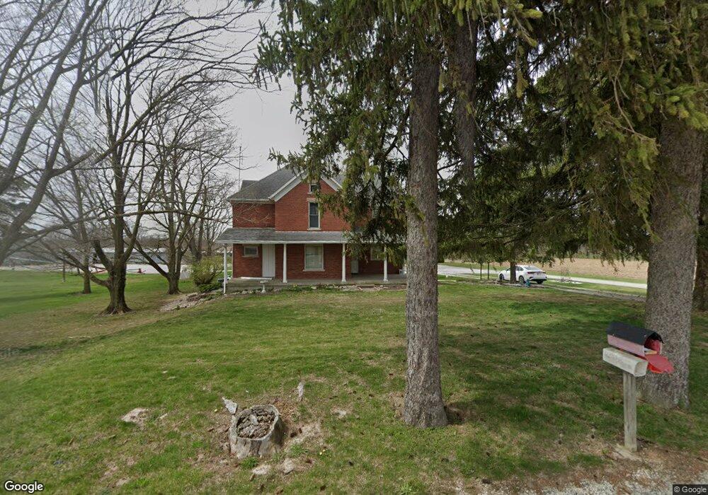
6610 S 400 W Warren, IN 46792
Estimated Value: $385,000 - $538,703
3
Beds
2
Baths
2,844
Sq Ft
$163/Sq Ft
Est. Value
About This Home
This home is located at 6610 S 400 W, Warren, IN 46792 and is currently estimated at $464,568, approximately $163 per square foot. 6610 S 400 W is a home located in Huntington County with nearby schools including Lancaster Elementary School and Huntington North High School.
Ownership History
Date
Name
Owned For
Owner Type
Purchase Details
Closed on
Jan 26, 2024
Sold by
Donald D Davenriner Testementary Trust
Bought by
Gressley Barbara and Jarrett Cheryl
Current Estimated Value
Purchase Details
Closed on
Aug 29, 2018
Sold by
Davenriner Jarice J
Bought by
Donald D Davenriner T
Purchase Details
Closed on
Dec 16, 2014
Sold by
Davenriner Donald D and Davenriner Jarice J
Bought by
Davenriner Farm Llc
Purchase Details
Closed on
Jan 18, 2013
Sold by
Davenriner Donald D and Davenriner Jarice J
Bought by
Davenriner Doanld D and Davenriner Jarice J
Create a Home Valuation Report for This Property
The Home Valuation Report is an in-depth analysis detailing your home's value as well as a comparison with similar homes in the area
Home Values in the Area
Average Home Value in this Area
Purchase History
| Date | Buyer | Sale Price | Title Company |
|---|---|---|---|
| Gressley Barbara | -- | None Listed On Document | |
| Donald D Davenriner T | -- | -- | |
| Davenriner Jarice J | -- | -- | |
| Davenriner Farm Llc | -- | Attorney | |
| Davenriner Doanld D | -- | None Available |
Source: Public Records
Tax History Compared to Growth
Tax History
| Year | Tax Paid | Tax Assessment Tax Assessment Total Assessment is a certain percentage of the fair market value that is determined by local assessors to be the total taxable value of land and additions on the property. | Land | Improvement |
|---|---|---|---|---|
| 2024 | $5,384 | $377,100 | $170,400 | $206,700 |
| 2023 | $3,787 | $351,900 | $145,100 | $206,800 |
| 2022 | $3,212 | $308,900 | $118,400 | $190,500 |
| 2021 | $3,093 | $276,200 | $104,400 | $171,800 |
| 2020 | $3,229 | $277,900 | $103,800 | $174,100 |
| 2019 | $3,206 | $0 | $0 | $0 |
| 2018 | $3,331 | $289,500 | $125,800 | $163,700 |
| 2017 | $3,279 | $303,900 | $141,800 | $162,100 |
| 2016 | $3,236 | $310,100 | $149,100 | $161,000 |
| 2014 | $3,313 | $316,000 | $155,100 | $160,900 |
| 2013 | $3,313 | $295,500 | $135,800 | $159,700 |
Source: Public Records
Map
Nearby Homes