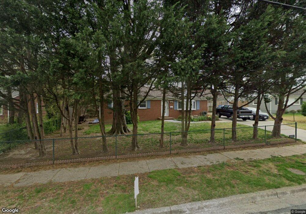
6611 Buckskin St Springfield, VA 22150
Springtown NeighborhoodEstimated Value: $576,000 - $612,000
3
Beds
2
Baths
1,300
Sq Ft
$458/Sq Ft
Est. Value
About This Home
This home is located at 6611 Buckskin St, Springfield, VA 22150 and is currently estimated at $595,134, approximately $457 per square foot. 6611 Buckskin St is a home located in Fairfax County with nearby schools including Springfield Estates Elementary School, Key Middle, and Lewis High School.
Ownership History
Date
Name
Owned For
Owner Type
Purchase Details
Closed on
Oct 2, 1995
Sold by
Payne William T
Bought by
Miller James F
Current Estimated Value
Home Financials for this Owner
Home Financials are based on the most recent Mortgage that was taken out on this home.
Original Mortgage
$117,600
Outstanding Balance
$848
Interest Rate
7.89%
Estimated Equity
$594,286
Create a Home Valuation Report for This Property
The Home Valuation Report is an in-depth analysis detailing your home's value as well as a comparison with similar homes in the area
Home Values in the Area
Average Home Value in this Area
Purchase History
| Date | Buyer | Sale Price | Title Company |
|---|---|---|---|
| Miller James F | $147,000 | -- |
Source: Public Records
Mortgage History
| Date | Status | Borrower | Loan Amount |
|---|---|---|---|
| Open | Miller James F | $117,600 |
Source: Public Records
Tax History Compared to Growth
Tax History
| Year | Tax Paid | Tax Assessment Tax Assessment Total Assessment is a certain percentage of the fair market value that is determined by local assessors to be the total taxable value of land and additions on the property. | Land | Improvement |
|---|---|---|---|---|
| 2025 | $6,202 | $556,440 | $275,000 | $281,440 |
| 2024 | $6,202 | $535,380 | $265,000 | $270,380 |
| 2023 | $5,780 | $512,200 | $251,000 | $261,200 |
| 2022 | $5,347 | $467,580 | $227,000 | $240,580 |
| 2021 | $4,903 | $417,770 | $190,000 | $227,770 |
| 2020 | $4,783 | $404,140 | $183,000 | $221,140 |
| 2019 | $4,452 | $376,190 | $173,000 | $203,190 |
| 2018 | $4,224 | $367,270 | $170,000 | $197,270 |
| 2017 | $4,058 | $349,550 | $161,000 | $188,550 |
| 2016 | $4,050 | $349,550 | $161,000 | $188,550 |
| 2015 | $3,801 | $340,570 | $161,000 | $179,570 |
| 2014 | $3,450 | $309,820 | $142,000 | $167,820 |
Source: Public Records
Map
Nearby Homes
- 6024 Frontier Dr
- 6400 Inwood Dr
- 6610 Stagecoach St
- 6108 Dorchester St
- 6821 Floyd Ave
- 6347 Simmer Cir
- 6400 Kroy Dr
- 6413 Lureta Ann Ln
- 6433 Rives Ct
- 6434 Rives Ct
- 7039 Calamo St
- 6013 Hibbling Ave
- 6253 Sibel Place
- 7119 Barry Rd
- 6221 Hibbling Ave
- 6481 Sharon Kay Ct
- 6609 Elk Park Ct
- 6008 Dinwiddie St
- 6447 Gildar St
- 6342 Franconia Commons Dr
- 6613 Buckskin St
- 6609 Buckskin St
- 6612 Franconia Rd
- 6610 Franconia Rd
- 6608 Franconia Rd
- 6615 Buckskin St
- 6612 Buckskin St
- 6607 Buckskin St
- 6614 Franconia Rd
- 6608 Buckskin St
- 6606 Franconia Rd
- 6617 Buckskin St
- 6605 Buckskin St
- 6319 Abilene St
- 6616 Franconia Rd
- 6616 Buckskin St
- 6318 Alamo St
- 6604 Franconia Rd
- 6604 Buckskin St
- 6603 Buckskin St