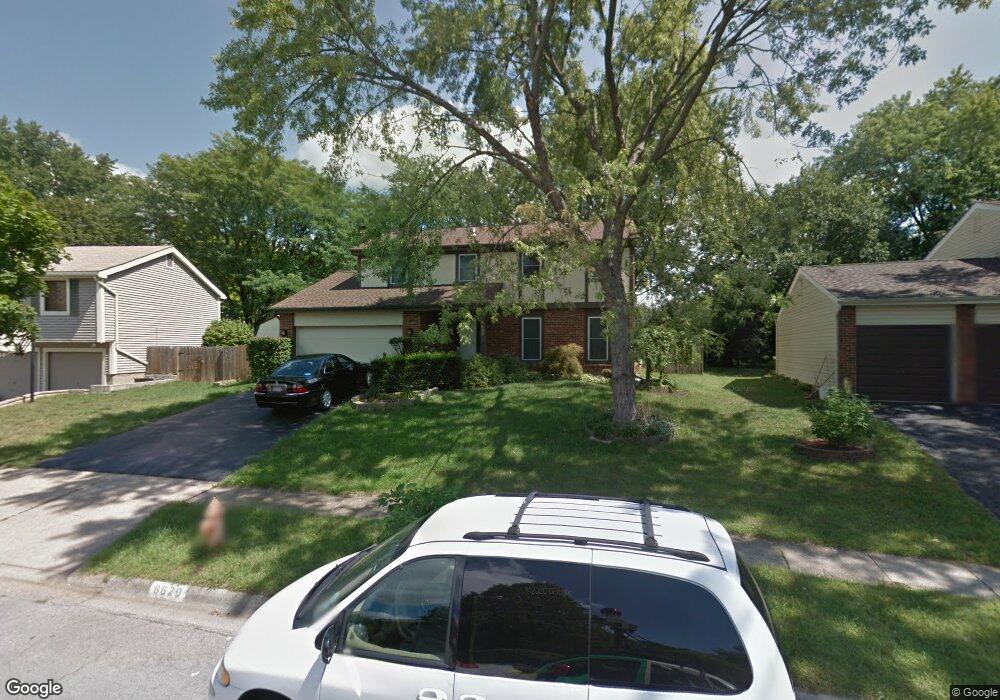
6620 Brock St Dublin, OH 43017
Riverside NeighborhoodEstimated Value: $376,000 - $413,150
4
Beds
3
Baths
1,920
Sq Ft
$208/Sq Ft
Est. Value
About This Home
This home is located at 6620 Brock St, Dublin, OH 43017 and is currently estimated at $399,538, approximately $208 per square foot. 6620 Brock St is a home located in Franklin County with nearby schools including Riverside Elementary School, Ann Simpson Davis Middle School, and Dublin Scioto High School.
Ownership History
Date
Name
Owned For
Owner Type
Purchase Details
Closed on
Aug 13, 1999
Sold by
Renc Mark A and Renc Elizabeth A
Bought by
Miniato Ahmad M and Miniato Samia A
Current Estimated Value
Home Financials for this Owner
Home Financials are based on the most recent Mortgage that was taken out on this home.
Original Mortgage
$115,900
Outstanding Balance
$30,965
Interest Rate
7.7%
Estimated Equity
$368,573
Purchase Details
Closed on
Jul 2, 1998
Sold by
Workman Paul R and Workman Vicki Lynn
Bought by
Renc Mark A and Ball Elizabeth E
Purchase Details
Closed on
Aug 1, 1986
Purchase Details
Closed on
Oct 1, 1977
Create a Home Valuation Report for This Property
The Home Valuation Report is an in-depth analysis detailing your home's value as well as a comparison with similar homes in the area
Home Values in the Area
Average Home Value in this Area
Purchase History
| Date | Buyer | Sale Price | Title Company |
|---|---|---|---|
| Miniato Ahmad M | $144,900 | -- | |
| Renc Mark A | $136,000 | Chicago Title | |
| -- | $82,900 | -- | |
| -- | $61,200 | -- |
Source: Public Records
Mortgage History
| Date | Status | Borrower | Loan Amount |
|---|---|---|---|
| Open | Miniato Ahmad M | $115,900 |
Source: Public Records
Tax History
| Year | Tax Paid | Tax Assessment Tax Assessment Total Assessment is a certain percentage of the fair market value that is determined by local assessors to be the total taxable value of land and additions on the property. | Land | Improvement |
|---|---|---|---|---|
| 2025 | $7,695 | $127,230 | $36,230 | $91,000 |
| 2024 | $7,695 | $127,230 | $36,230 | $91,000 |
| 2023 | $7,587 | $127,225 | $36,225 | $91,000 |
| 2022 | $6,295 | $98,110 | $30,770 | $67,340 |
| 2021 | $6,397 | $98,110 | $30,770 | $67,340 |
| 2020 | $6,359 | $98,110 | $30,770 | $67,340 |
| 2019 | $5,746 | $78,480 | $24,610 | $53,870 |
| 2018 | $5,339 | $78,480 | $24,610 | $53,870 |
| 2017 | $5,305 | $78,480 | $24,610 | $53,870 |
| 2016 | $4,879 | $67,800 | $17,680 | $50,120 |
| 2015 | $4,909 | $67,800 | $17,680 | $50,120 |
| 2014 | $4,914 | $67,800 | $17,680 | $50,120 |
| 2013 | $2,376 | $64,575 | $16,835 | $47,740 |
Source: Public Records
Map
Nearby Homes
- 6628 Brock St
- 3223 Banting St
- 6841 Riverside Glen Ct
- 2960 Sawdust Ln Unit 2960
- 2946 Sawdust Ln
- 3107 Hamden Ct
- 3002 Glenloch Cir Unit 3002
- 3185 Middleboro Way
- 2947 Talbrock Cir
- 6220 Emberwood Rd
- 3263 Scioto Ridge Rd
- 5622 Riverside Dr
- 6546 Reflections Dr Unit D
- 6486 Reflections Dr Unit A
- 6478 Reflections Dr Unit C
- 6171 Water Bank St
- 5935 Abbey Church Rd
- 6640 Mooney St Unit 404
- 4231 Troutbrook Dr
- 6745 Longshore St Unit 506
- 6621 Strathcona Ave
- 6611 Strathcona Ave
- 6604 Brock St
- 6636 Brock St
- 6629 Strathcona Ave
- 6603 Strathcona Ave
- 6597 Strathcona Ave
- 6633 Brock St
- 6637 Strathcona Ave
- 6598 Brock St
- 6627 Brock St
- 6639 Brock St
- 3155 Lorne Scots Ave
- 6591 Strathcona Ave
- 6623 Brock St
- 6585 Strathcona Ave
- 6645 Brock St
- 3141 Lorne Scots Ave
- 6579 Strathcona Ave
- 6592 Brock St
Your Personal Tour Guide
Ask me questions while you tour the home.