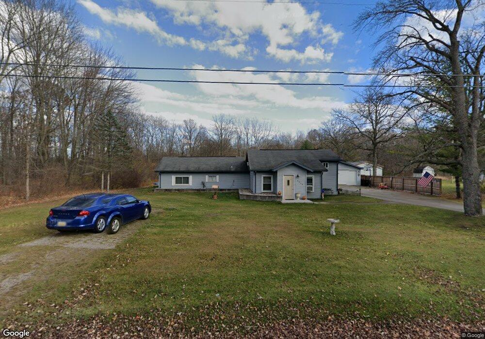
6622 Perrine Rd Midland, MI 48642
Estimated Value: $230,000 - $364,000
5
Beds
2
Baths
2,022
Sq Ft
$138/Sq Ft
Est. Value
About This Home
This home is located at 6622 Perrine Rd, Midland, MI 48642 and is currently estimated at $279,768, approximately $138 per square foot. 6622 Perrine Rd is a home located in Midland County with nearby schools including Woodcrest Elementary School, Jefferson Middle School, and H.H. Dow High School.
Ownership History
Date
Name
Owned For
Owner Type
Purchase Details
Closed on
May 17, 2022
Sold by
Richard Hendrick
Bought by
Hendrick Kelli J
Current Estimated Value
Home Financials for this Owner
Home Financials are based on the most recent Mortgage that was taken out on this home.
Original Mortgage
$125,000
Outstanding Balance
$118,800
Interest Rate
5.3%
Mortgage Type
New Conventional
Estimated Equity
$160,968
Purchase Details
Closed on
Sep 19, 2014
Sold by
Cook Kelly
Bought by
Hendrick Richard
Purchase Details
Closed on
Jan 18, 2012
Sold by
Beerbower Bruce W and Beerbower Lisa A
Bought by
Cook Kelly
Create a Home Valuation Report for This Property
The Home Valuation Report is an in-depth analysis detailing your home's value as well as a comparison with similar homes in the area
Home Values in the Area
Average Home Value in this Area
Purchase History
| Date | Buyer | Sale Price | Title Company |
|---|---|---|---|
| Hendrick Kelli J | -- | None Listed On Document | |
| Hendrick Richard | $125,000 | -- | |
| Cook Kelly | $110,000 | -- |
Source: Public Records
Mortgage History
| Date | Status | Borrower | Loan Amount |
|---|---|---|---|
| Open | Hendrick Kelli J | $125,000 |
Source: Public Records
Tax History Compared to Growth
Tax History
| Year | Tax Paid | Tax Assessment Tax Assessment Total Assessment is a certain percentage of the fair market value that is determined by local assessors to be the total taxable value of land and additions on the property. | Land | Improvement |
|---|---|---|---|---|
| 2025 | $2,321 | $91,300 | $0 | $0 |
| 2024 | $1,805 | $90,100 | $0 | $0 |
| 2023 | $1,720 | $76,300 | $0 | $0 |
| 2022 | $2,111 | $75,200 | $0 | $0 |
| 2021 | $2,035 | $55,800 | $0 | $0 |
| 2020 | $2,057 | $49,400 | $0 | $0 |
| 2019 | $2,026 | $48,900 | $13,200 | $35,700 |
| 2018 | $2,013 | $70,700 | $13,200 | $57,500 |
| 2017 | $0 | $49,100 | $13,200 | $35,900 |
| 2016 | $1,933 | $47,900 | $12,500 | $35,400 |
| 2012 | -- | $44,600 | $12,500 | $32,100 |
Source: Public Records
Map
Nearby Homes
- 6923 Perrine Rd Unit 4216 Airport Rd
- 5514 & 5608 W Wackerly St
- 5915 Leeway Dr
- 6105 Oak Meadows Ct
- 4206 Pebble Creek Dr
- 3217 W Wackerly St
- 5007 Bristlecone Dr
- 5712 Woodbridge Ln
- 3706 Bobcat Ct
- 3710 Moorland Dr
- VL parcel B Sturgeon Ave
- 2720 W Wackerly St
- 5723 Londonberrie Ct
- V/L N Sturgeon Rd
- 5523 Oakridge Dr
- 5209 Hallisy Ct
- 2611 Walden Woods Ct
- 3819 Haskin Dr
- 4104 Stonegate Dr
- 5708 Powder Horn Trail
- 6622 Perrine Rd
- 6616 Perrine Rd
- 6610 Perrine Rd
- 6610 Perrine Rd
- 6625 Perrine Rd
- 6619 Perrine Rd
- 6705 Perrine Rd
- 6604 Perrine Rd
- 6705 Perrine Rd
- 6713 Perrine Rd
- 6515 Perrine Rd
- 6515 Perrine Rd
- 6506 Perrine Rd
- 6509 Perrine Rd
- 6805 Perrine Rd
- 4020 Airport Rd
- 4108 Airport Rd
- 6721 Perrine Rd
- 4120 Airport Rd
- 6811 Perrine Rd