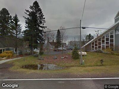
Estimated Value: $122,000 - $447,000
1
Bed
1
Bath
480
Sq Ft
$589/Sq Ft
Est. Value
About This Home
This home is located at 6626 W Highway 61 Unit A01, Tofte, MN 55615 and is currently estimated at $282,702, approximately $588 per square foot. 6626 W Highway 61 Unit A01 is a home located in Cook County with nearby schools including Sawtooth Mountain Elementary School, Cook County Middle School, and Cook County Senior High School.
Ownership History
Date
Name
Owned For
Owner Type
Purchase Details
Closed on
Mar 29, 2019
Sold by
Hilton Bj
Bought by
Knoke Ryan and Scheff Monte
Current Estimated Value
Home Financials for this Owner
Home Financials are based on the most recent Mortgage that was taken out on this home.
Original Mortgage
$52,800
Outstanding Balance
$47,260
Interest Rate
4.3%
Mortgage Type
Construction
Estimated Equity
$151,465
Purchase Details
Closed on
Feb 28, 2017
Sold by
Papenfuss Mary Mary
Bought by
Hilton Bj Bj
Purchase Details
Closed on
Jun 15, 2015
Sold by
Hilton Betty Betty
Bought by
Papenfuss Mary
Create a Home Valuation Report for This Property
The Home Valuation Report is an in-depth analysis detailing your home's value as well as a comparison with similar homes in the area
Home Values in the Area
Average Home Value in this Area
Purchase History
| Date | Buyer | Sale Price | Title Company |
|---|---|---|---|
| Knoke Ryan | $66,000 | North Shore Title | |
| Hilton Bj Bj | $75,000 | -- | |
| Papenfuss Mary | $75,000 | -- |
Source: Public Records
Mortgage History
| Date | Status | Borrower | Loan Amount |
|---|---|---|---|
| Open | Knoke Ryan | $52,800 |
Source: Public Records
Tax History Compared to Growth
Tax History
| Year | Tax Paid | Tax Assessment Tax Assessment Total Assessment is a certain percentage of the fair market value that is determined by local assessors to be the total taxable value of land and additions on the property. | Land | Improvement |
|---|---|---|---|---|
| 2023 | $15 | $177,600 | $83,500 | $94,100 |
| 2022 | $902 | $100,500 | $46,500 | $54,000 |
| 2021 | $674 | $75,000 | $22,300 | $52,700 |
| 2020 | $822 | $68,400 | $19,000 | $49,400 |
| 2019 | $612 | $68,600 | $18,500 | $50,100 |
| 2018 | $596 | $62,200 | $16,500 | $45,700 |
| 2017 | $568 | $62,800 | $16,600 | $46,200 |
| 2016 | $520 | $63,700 | $16,900 | $46,800 |
| 2015 | $400 | $64,200 | $16,900 | $47,300 |
| 2014 | $394 | $54,100 | $11,700 | $42,400 |
| 2012 | -- | $56,400 | $14,000 | $42,400 |
Source: Public Records
Map
Nearby Homes
- 33 Overlook Trail
- 41 Overlook Trail
- 6546 Aspenwood Dr
- 6502 Aspenwood Dr
- 6292 Sea Villa Loop
- 63 Rollins Ridge
- XX-2 Hoaglund Dr
- 670-679 Upper Cliff House Rd
- 555 Poplar River Rd
- 521 Moose Mountain Dr
- 504 Moose Mountain Dr
- 135 Bridge Run Ln Unit B
- 144C Bridge Run Ln
- 115 Bridge Run Ln Unit A
- 124 Bridge Run Ln Unit B
- 124 Bridge Run Ln
- XX Temperance Landing
- xxx Skou Rd
- 122 Skou Rd
- 11 Wildflower Ln
