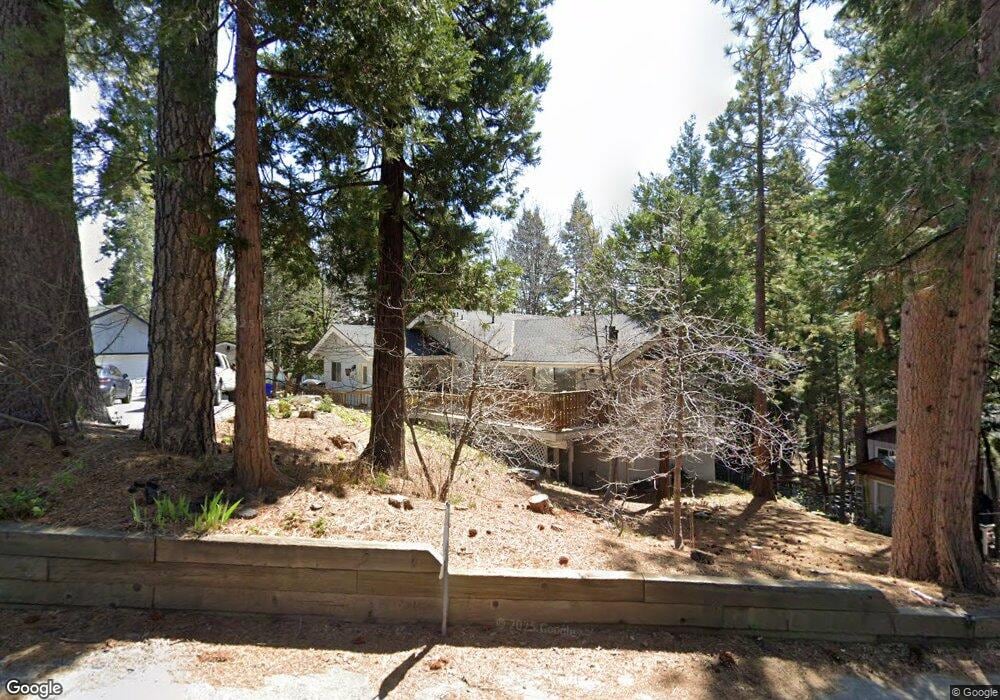
663 Maxson Dr Twin Peaks, CA 92391
Estimated Value: $470,273 - $629,000
4
Beds
3
Baths
1,727
Sq Ft
$301/Sq Ft
Est. Value
About This Home
This home is located at 663 Maxson Dr, Twin Peaks, CA 92391 and is currently estimated at $519,818, approximately $300 per square foot. 663 Maxson Dr is a home with nearby schools including Lake Arrowhead Elementary School, Mary P. Henck Intermediate School, and Rim Of The World Senior High School.
Ownership History
Date
Name
Owned For
Owner Type
Purchase Details
Closed on
Aug 18, 2021
Sold by
Lingenfelter Frances E
Bought by
Lingenfelter Frances E and Chaotic Acres Trust
Current Estimated Value
Home Financials for this Owner
Home Financials are based on the most recent Mortgage that was taken out on this home.
Original Mortgage
$252,500
Interest Rate
2.8%
Mortgage Type
New Conventional
Purchase Details
Closed on
Apr 13, 2016
Sold by
Lingenfelter Frances E
Bought by
Lingenfelter Frances E
Purchase Details
Closed on
Dec 19, 2003
Sold by
Lingenfelter James C and Lingenfelter Frances E
Bought by
Lingenfelter Frances E
Purchase Details
Closed on
May 21, 1998
Sold by
Lingenfelter James C and Lingenfelter Frances Frances
Bought by
Lingenfelter James C and Lingenfelter Frances E
Create a Home Valuation Report for This Property
The Home Valuation Report is an in-depth analysis detailing your home's value as well as a comparison with similar homes in the area
Home Values in the Area
Average Home Value in this Area
Purchase History
| Date | Buyer | Sale Price | Title Company |
|---|---|---|---|
| Lingenfelter Frances E | -- | Amrock Llc | |
| Lingenfelter Frances E | -- | Amrock Llc | |
| Lingenfelter Frances E | -- | None Available | |
| Lingenfelter Frances E | -- | -- | |
| Lingenfelter James C | -- | -- |
Source: Public Records
Mortgage History
| Date | Status | Borrower | Loan Amount |
|---|---|---|---|
| Closed | Lingenfelter Frances E | $252,500 |
Source: Public Records
Tax History
| Year | Tax Paid | Tax Assessment Tax Assessment Total Assessment is a certain percentage of the fair market value that is determined by local assessors to be the total taxable value of land and additions on the property. | Land | Improvement |
|---|---|---|---|---|
| 2025 | $3,382 | $193,586 | $15,501 | $178,085 |
| 2024 | $3,267 | $189,790 | $15,197 | $174,593 |
| 2023 | $3,209 | $186,069 | $14,899 | $171,170 |
| 2022 | $3,129 | $182,421 | $14,607 | $167,814 |
| 2021 | $3,094 | $178,845 | $14,321 | $164,524 |
| 2020 | $3,099 | $177,011 | $14,174 | $162,837 |
| 2019 | $3,020 | $173,540 | $13,896 | $159,644 |
| 2018 | $2,737 | $170,138 | $13,624 | $156,514 |
| 2017 | $2,677 | $166,802 | $13,357 | $153,445 |
| 2016 | $2,567 | $163,531 | $13,095 | $150,436 |
| 2015 | $2,571 | $161,074 | $12,898 | $148,176 |
| 2014 | $2,521 | $157,918 | $12,645 | $145,273 |
Source: Public Records
Map
Nearby Homes
- 683 Maxson Dr
- 26582 Lake Forest Dr
- 0 Forest Ln Unit PW25157119
- 26638 Lake Forest Dr
- 26370 Alpine Ln
- 26645 Lake Forest Dr
- 26331 Alpine Ln
- 620 Cedar Ln
- 26325 Lake Forest Dr
- 26669 State Highway 189
- 644 Cedar Ln
- 26287 Lake Forest Dr
- 784 Sierra Vista
- 784 Sierra Vista Dr
- 804 Sierra Vista Dr
- 0 California 189
- 889 Strawberry Peak Rd
- 0 Club House Dr
- 26314 Jacqueline Rd
- 859 Strawberry Peak Rd
- 688 Robin Dr
- 653 Maxson Dr
- 26547 Lake Forest Dr
- 674 Robin Dr
- 664 Maxson Dr
- 672 Maxson Dr
- 654 Maxson Dr
- 662 Robin Dr
- 26558 Lake Forest Dr
- 683 Robin Dr
- 637 Maxson Dr
- 671 Alpine Ln
- 26477 Alpine Ln
- 665 Alpine (Spur) Ln
- 677 Alpine Spur Ln
- 687 Alpine Spur Ln
- 26481 Alpine Ln
- 638 Maxson Dr
- 679 Robin Dr
- 673 Robin Dr
Your Personal Tour Guide
Ask me questions while you tour the home.