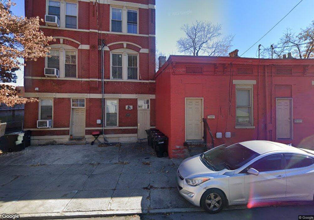
664 State Ave Cincinnati, OH 45204
East Price Hill NeighborhoodEstimated Value: $51,000 - $154,000
1
Bed
1
Bath
630
Sq Ft
$129/Sq Ft
Est. Value
About This Home
This home is located at 664 State Ave, Cincinnati, OH 45204 and is currently estimated at $80,985, approximately $128 per square foot. 664 State Ave is a home located in Hamilton County with nearby schools including Oyler School, Robert A. Taft Information Technology High School, and Gilbert A. Dater High School.
Ownership History
Date
Name
Owned For
Owner Type
Purchase Details
Closed on
Dec 1, 2016
Sold by
579 Blair Llc
Bought by
Meigs Investments Ltd
Current Estimated Value
Purchase Details
Closed on
Jul 14, 2016
Sold by
Hamilton County Auditor
Bought by
579 Blair Llc
Purchase Details
Closed on
Oct 28, 2004
Sold by
Mattingly Earl and Mattingly Patricia
Bought by
Rainey Bob J and Rainey Kathrine I
Purchase Details
Closed on
Sep 10, 1997
Sold by
Ray Tanya
Bought by
Mattingly Earl
Purchase Details
Closed on
Aug 16, 1995
Sold by
Hatton James D
Bought by
Ray Tanya M
Purchase Details
Closed on
Jun 30, 1995
Sold by
Hatton James D
Bought by
Ray Tanya
Create a Home Valuation Report for This Property
The Home Valuation Report is an in-depth analysis detailing your home's value as well as a comparison with similar homes in the area
Home Values in the Area
Average Home Value in this Area
Purchase History
| Date | Buyer | Sale Price | Title Company |
|---|---|---|---|
| Meigs Investments Ltd | $1,300 | -- | |
| 579 Blair Llc | $1,600 | -- | |
| Rainey Bob J | -- | -- | |
| Mattingly Earl | -- | -- | |
| Ray Tanya M | $6,800 | -- | |
| Ray Tanya | $6,800 | -- |
Source: Public Records
Tax History
| Year | Tax Paid | Tax Assessment Tax Assessment Total Assessment is a certain percentage of the fair market value that is determined by local assessors to be the total taxable value of land and additions on the property. | Land | Improvement |
|---|---|---|---|---|
| 2025 | $584 | $9,146 | $599 | $8,547 |
| 2024 | $583 | $9,146 | $599 | $8,547 |
| 2023 | $584 | $9,146 | $599 | $8,547 |
| 2022 | $295 | $4,134 | $522 | $3,612 |
| 2021 | $289 | $4,134 | $522 | $3,612 |
| 2020 | $290 | $4,134 | $522 | $3,612 |
| 2019 | $289 | $3,756 | $473 | $3,283 |
| 2018 | $289 | $3,756 | $473 | $3,283 |
| 2017 | $279 | $3,756 | $473 | $3,283 |
| 2016 | $256 | $3,361 | $487 | $2,874 |
| 2015 | $218 | $3,361 | $487 | $2,874 |
| 2014 | $220 | $3,361 | $487 | $2,874 |
| 2013 | $285 | $4,305 | $623 | $3,682 |
Source: Public Records
Map
Nearby Homes
- 2152 Staebler St
- 2430 Maryland Ave
- 2358 Glenway Ave
- 309 Mount Hope Ave
- 2414 River Rd
- 2360 Wilder Ave
- 2485 Warsaw Ave
- 2403 Elberon Ave
- 2425 Glenway Ave
- 720 Grand Ave
- 2462 River Rd
- 540 Grand Ave
- 538 Grand Ave
- 2519 Warsaw Ave
- 552 Grand Ave
- 658 Hawthorne Ave
- 454 Grand Ave
- 452 Grand Ave
- 578 Considine Ave
- 817 Hawthorne Ave
Your Personal Tour Guide
Ask me questions while you tour the home.