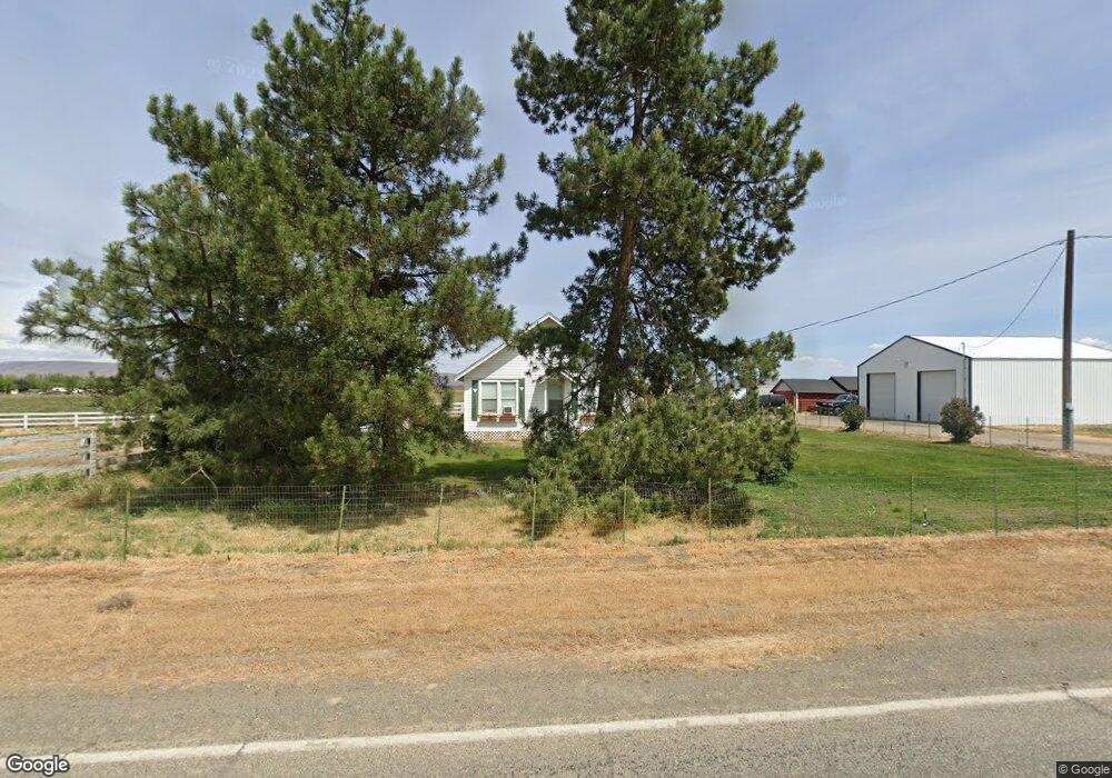
6651 Progressive Rd Wapato, WA 98951
Estimated Value: $256,258 - $266,000
2
Beds
1
Bath
876
Sq Ft
$298/Sq Ft
Est. Value
About This Home
This home is located at 6651 Progressive Rd, Wapato, WA 98951 and is currently estimated at $261,065, approximately $298 per square foot. 6651 Progressive Rd is a home located in Yakima County with nearby schools including Harrah Elementary School, Mount Adams Middle School, and White Swan High School.
Ownership History
Date
Name
Owned For
Owner Type
Purchase Details
Closed on
May 15, 2008
Sold by
Bulch Michael M
Bought by
Bulch Michael M and Bulch Jennifer H
Current Estimated Value
Purchase Details
Closed on
Mar 28, 2005
Sold by
Balch Jennifer
Bought by
Balch Mike M
Home Financials for this Owner
Home Financials are based on the most recent Mortgage that was taken out on this home.
Original Mortgage
$81,600
Outstanding Balance
$41,616
Interest Rate
5.6%
Mortgage Type
Stand Alone Refi Refinance Of Original Loan
Estimated Equity
$219,449
Purchase Details
Closed on
Mar 7, 2005
Sold by
Schilperoort Gerrit J and Schilperoort Dora Ellen
Bought by
Balch Mike M
Home Financials for this Owner
Home Financials are based on the most recent Mortgage that was taken out on this home.
Original Mortgage
$81,600
Outstanding Balance
$41,616
Interest Rate
5.6%
Mortgage Type
Stand Alone Refi Refinance Of Original Loan
Estimated Equity
$219,449
Create a Home Valuation Report for This Property
The Home Valuation Report is an in-depth analysis detailing your home's value as well as a comparison with similar homes in the area
Purchase History
| Date | Buyer | Sale Price | Title Company |
|---|---|---|---|
| Bulch Michael M | -- | None Available | |
| Balch Mike M | -- | Pacific Alliance Title Co | |
| Balch Mike M | $95,673 | Pacific Alliance Title Co |
Source: Public Records
Mortgage History
| Date | Status | Borrower | Loan Amount |
|---|---|---|---|
| Open | Balch Mike M | $81,600 | |
| Closed | Balch Mike M | $77,400 |
Source: Public Records
Tax History
| Year | Tax Paid | Tax Assessment Tax Assessment Total Assessment is a certain percentage of the fair market value that is determined by local assessors to be the total taxable value of land and additions on the property. | Land | Improvement |
|---|---|---|---|---|
| 2025 | $2,018 | $264,900 | $85,100 | $179,800 |
| 2023 | $1,442 | $158,000 | $51,100 | $106,900 |
| 2022 | $1,061 | $119,400 | $49,400 | $70,000 |
| 2021 | $992 | $110,400 | $47,900 | $62,500 |
| 2019 | $813 | $85,400 | $42,600 | $42,800 |
| 2018 | $805 | $82,100 | $38,400 | $43,700 |
| 2017 | $728 | $81,200 | $38,400 | $42,800 |
| 2016 | $773 | $81,400 | $38,400 | $43,000 |
| 2015 | $773 | $80,300 | $38,400 | $41,900 |
| 2014 | $773 | $81,100 | $38,400 | $42,700 |
| 2013 | $773 | $81,100 | $38,400 | $42,700 |
Source: Public Records
Map
Nearby Homes
- NKA Shields Rd
- 3630 Progressive Rd
- NKA Fort Rd
- NKA Jones Riggs Rd
- NNA Fort Rd Unit Fort Rd/Lateral B Rd
- 4840 Lateral A Rd
- NKA Lateral A Progressive Rd
- NKA McDonald Rd
- 754 Kings Ln
- 8291 Fort Rd
- 281 Lateral C Rd
- 6263 Ashue Rd
- 381 Lateral C Rd
- nka W Wapato Ashue Rd
- 141 Carolinda Ln Unit I
- 2693 Kays Rd
- NKA Ashue Rd
- 801 S Satus Ave
- 709 S Satus Ave
- 1081 Tecumseh Rd
- 6771 Progressive Rd
- 6831 Progressive Rd
- 6791 Progressive Rd
- 6891 Progressive Rd
- 6793 Progressive Rd
- 6931 Progressive Rd
- 6961 Progressive Rd
- 2921 Harrah Rd
- 2931 Harrah Rd
- 2873 Harrah Rd
- 6971 Progressive Rd
- 2801 Harrah Rd
- 3070 Harrah Rd
- 2761 Harrah Rd
- 2723 Harrah Rd
- 2721 Harrah Rd
- 3210 Harrah Rd
- 3280 Harrah Rd
- 3270 Harrah Rd
- 2661 Harrah Rd
Your Personal Tour Guide
Ask me questions while you tour the home.