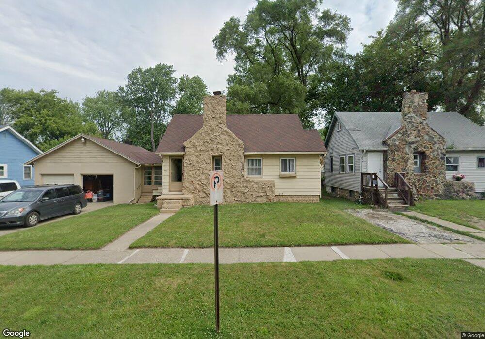
667 E Mansfield Ave Pontiac, MI 48340
Estimated Value: $91,000 - $124,000
3
Beds
1
Bath
812
Sq Ft
$139/Sq Ft
Est. Value
About This Home
This home is located at 667 E Mansfield Ave, Pontiac, MI 48340 and is currently estimated at $113,243, approximately $139 per square foot. 667 E Mansfield Ave is a home located in Oakland County with nearby schools including Owen Elementary School, Pontiac Middle School, and Pontiac High School.
Ownership History
Date
Name
Owned For
Owner Type
Purchase Details
Closed on
Nov 22, 2021
Sold by
Revocable Trust
Bought by
Wilder Dawnell J
Current Estimated Value
Home Financials for this Owner
Home Financials are based on the most recent Mortgage that was taken out on this home.
Original Mortgage
$63,000
Interest Rate
2.43%
Mortgage Type
New Conventional
Purchase Details
Closed on
Feb 21, 2017
Sold by
Griggs Robert Carol and The Revocable Trust Agreement
Bought by
Griggs Robert C
Purchase Details
Closed on
Aug 30, 2013
Sold by
Griggs Robert C
Bought by
Griggs Robert Carrol and The Revocable Trust Agreement Of Robert
Purchase Details
Closed on
Nov 13, 2006
Sold by
Griggs Robert C
Bought by
Griggs Robert C and Deaver David L
Create a Home Valuation Report for This Property
The Home Valuation Report is an in-depth analysis detailing your home's value as well as a comparison with similar homes in the area
Home Values in the Area
Average Home Value in this Area
Purchase History
| Date | Buyer | Sale Price | Title Company |
|---|---|---|---|
| Wilder Dawnell J | $70,000 | None Listed On Document | |
| Griggs Robert C | -- | None Available | |
| Griggs Robert Carrol | -- | None Available | |
| Griggs Robert C | -- | None Available | |
| Griggs Robert C | -- | None Available |
Source: Public Records
Mortgage History
| Date | Status | Borrower | Loan Amount |
|---|---|---|---|
| Previous Owner | Wilder Dawnell J | $63,000 |
Source: Public Records
Tax History Compared to Growth
Tax History
| Year | Tax Paid | Tax Assessment Tax Assessment Total Assessment is a certain percentage of the fair market value that is determined by local assessors to be the total taxable value of land and additions on the property. | Land | Improvement |
|---|---|---|---|---|
| 2024 | $557 | $40,110 | $0 | $0 |
| 2023 | $531 | $35,980 | $0 | $0 |
| 2022 | $578 | $31,080 | $0 | $0 |
| 2021 | $563 | $26,580 | $0 | $0 |
| 2020 | $483 | $24,170 | $0 | $0 |
| 2019 | $538 | $20,890 | $0 | $0 |
| 2018 | $509 | $18,820 | $0 | $0 |
| 2017 | $486 | $17,830 | $0 | $0 |
| 2016 | $514 | $15,640 | $0 | $0 |
| 2015 | -- | $13,710 | $0 | $0 |
| 2014 | -- | $12,060 | $0 | $0 |
| 2011 | -- | $19,150 | $0 | $0 |
Source: Public Records
Map
Nearby Homes
- 630 E Madison Ave
- 614 E Tennyson Ave
- 627 Wesbrook St
- 663 Lenox Ave
- 620 Wesbrook St
- 675 E Beverly Ave
- 583 Wesbrook St
- 731 1st Ave
- 667 Raskob St
- 790 Parkwood Ave
- 821 Robinwood St
- 686 4th Ave
- 778 4th Ave
- 720 E Columbia Ave
- 683 Clara Ave
- 794 Clara Ave
- 785 Kenilworth Ave
- 686 Peacock Ave
- 802 Cameron Ave
- 715 Kenilworth Ave
- 659 E Mansfield Ave
- 671 E Mansfield Ave
- 675 E Mansfield Ave
- 655 E Mansfield Ave
- 658 E Tennyson Ave
- 662 E Tennyson Ave
- 666 E Tennyson Ave
- 0 Joslyn Unit 31296524
- 0 Kingsway Rd Unit 4970025
- 0 Kingsway Rd Unit 4974124
- 0 Bald Mountain Unit 5499604
- VL Lake Nepessing Rd
- 1234 Arlene
- 4015 Ashton Dr
- 0 Vacant Unit 4914769
- 0 Vacant Unit 4906806
- 0 Vacant Unit 214086917
- 0 Vacant Unit 215064658
- N Lake Angelus Rd
- 0 Bald Mountain Unit G31182646