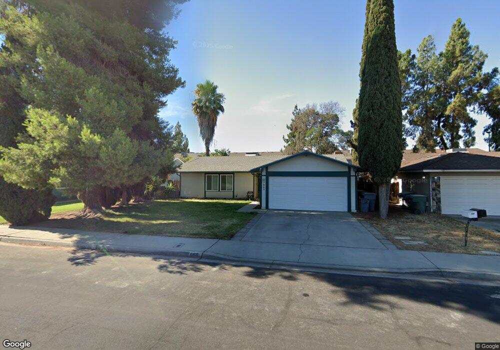
668 W Antonio Dr Clovis, CA 93612
Estimated Value: $340,916 - $371,000
3
Beds
2
Baths
1,248
Sq Ft
$287/Sq Ft
Est. Value
About This Home
This home is located at 668 W Antonio Dr, Clovis, CA 93612 and is currently estimated at $357,639, approximately $286 per square foot. 668 W Antonio Dr is a home located in Fresno County with nearby schools including Viking Elementary School, Ahwahnee Middle School, and Herbert Hoover High School.
Ownership History
Date
Name
Owned For
Owner Type
Purchase Details
Closed on
Apr 19, 2023
Sold by
Nelson Jason Patrick
Bought by
Jason Patrick Nelson And Rose Ann Nelson Revo
Current Estimated Value
Purchase Details
Closed on
Oct 3, 2016
Sold by
Nelson Jason Patrick
Bought by
Nelson Jason Patrick
Purchase Details
Closed on
Apr 6, 2009
Sold by
Nelson Sharon D
Bought by
Sharon Dawn Nelson Revocable Trust
Purchase Details
Closed on
Dec 4, 2008
Sold by
Deutsche Bank National Trust Company
Bought by
Nelson Sharon D
Home Financials for this Owner
Home Financials are based on the most recent Mortgage that was taken out on this home.
Original Mortgage
$99,000
Interest Rate
6.03%
Mortgage Type
Purchase Money Mortgage
Purchase Details
Closed on
Oct 16, 2008
Sold by
Rodriguez Brenda and Lozano Andres
Bought by
Deutsche Bank National Trust Co
Home Financials for this Owner
Home Financials are based on the most recent Mortgage that was taken out on this home.
Original Mortgage
$99,000
Interest Rate
6.03%
Mortgage Type
Purchase Money Mortgage
Purchase Details
Closed on
Jan 13, 2006
Sold by
Jolley Gregory F
Bought by
Rodriguez Brenda and Lozano Andres
Home Financials for this Owner
Home Financials are based on the most recent Mortgage that was taken out on this home.
Original Mortgage
$216,000
Interest Rate
8.35%
Mortgage Type
Purchase Money Mortgage
Purchase Details
Closed on
Aug 3, 2004
Sold by
Jolley Margaret A
Bought by
Jolley Gregory F
Purchase Details
Closed on
Mar 8, 2002
Sold by
Rosenfeld Betty K
Bought by
Jolley Gregory F and Jolley Margaret A
Home Financials for this Owner
Home Financials are based on the most recent Mortgage that was taken out on this home.
Original Mortgage
$25,000
Interest Rate
6.78%
Purchase Details
Closed on
Dec 8, 1997
Sold by
Rosenfeld David D and Rosenfeld Betty K
Bought by
Rosenfeld David D and Rosenfeld Betty K
Create a Home Valuation Report for This Property
The Home Valuation Report is an in-depth analysis detailing your home's value as well as a comparison with similar homes in the area
Home Values in the Area
Average Home Value in this Area
Purchase History
| Date | Buyer | Sale Price | Title Company |
|---|---|---|---|
| Jason Patrick Nelson And Rose Ann Nelson Revo | -- | None Listed On Document | |
| Nelson Jason Patrick | -- | None Available | |
| Sharon Dawn Nelson Revocable Trust | -- | None Available | |
| Nelson Sharon D | $124,000 | First American Title Company | |
| Deutsche Bank National Trust Co | $132,300 | Accommodation | |
| Rodriguez Brenda | $270,000 | First American Title Company | |
| Jolley Gregory F | -- | -- | |
| Jolley Gregory F | $100,000 | Fidelity National Title Co | |
| Rosenfeld David D | -- | -- |
Source: Public Records
Mortgage History
| Date | Status | Borrower | Loan Amount |
|---|---|---|---|
| Previous Owner | Nelson Sharon D | $99,000 | |
| Previous Owner | Rodriguez Brenda | $54,000 | |
| Previous Owner | Rodriguez Brenda | $216,000 | |
| Previous Owner | Jolley Gregory F | $25,000 |
Source: Public Records
Tax History
| Year | Tax Paid | Tax Assessment Tax Assessment Total Assessment is a certain percentage of the fair market value that is determined by local assessors to be the total taxable value of land and additions on the property. | Land | Improvement |
|---|---|---|---|---|
| 2025 | $2,030 | $159,667 | $64,380 | $95,287 |
| 2023 | $1,915 | $153,469 | $61,881 | $91,588 |
| 2022 | $1,890 | $150,461 | $60,668 | $89,793 |
| 2021 | $1,838 | $147,512 | $59,479 | $88,033 |
| 2020 | $1,830 | $146,001 | $58,870 | $87,131 |
| 2019 | $1,759 | $143,139 | $57,716 | $85,423 |
| 2018 | $1,721 | $140,334 | $56,585 | $83,749 |
| 2017 | $1,692 | $137,583 | $55,476 | $82,107 |
| 2016 | $1,636 | $134,887 | $54,389 | $80,498 |
| 2015 | $1,611 | $132,862 | $53,573 | $79,289 |
| 2014 | $1,581 | $130,260 | $52,524 | $77,736 |
Source: Public Records
Map
Nearby Homes
- 3025 Timmy Ave
- 703 W Holland Ave
- 741 W Holland Ave
- 5098 E Ashlan Ave Unit 117
- 873 W Euclid Ave
- 546 W Swift Ave
- 882 W National Ave
- 5118 E Ashlan Ave Unit 102
- 541 W Ashlan Ave
- 531 W Ashlan Ave
- 521 W Ashlan Ave
- 5138 E Ashlan Ave Unit 101
- 5138 E Ashlan Ave Unit 106
- 555 W Ashcroft Ave
- 916 W Holland Ave
- 5164 E Ashlan Ave Unit 131
- 2855 Adler Ave
- 2931 Paula Dr
- 5188 E Ashlan Ave Unit 128
- 384 W Indianapolis Ave
- 656 W Antonio Dr
- 672 W Antonio Dr
- 648 W Antonio Dr
- 680 W Antonio Dr
- 663 W Ashlan Ave
- 671 W Ashlan Ave
- 655 Ashlan Ave
- 663 W Antonio Dr
- 671 W Antonio Dr
- 681 W Ashlan Ave
- 640 W Antonio Dr
- 655 W Antonio Dr
- 3160 Timmy Ave
- 647 W Antonio Dr
- 689 W Ashlan Ave
- 632 W Antonio Dr
- 637 W Ashlan Ave
- 3130 Timmy Ave
- 639 W Antonio Dr
- 664 W Euclid Ave
Your Personal Tour Guide
Ask me questions while you tour the home.