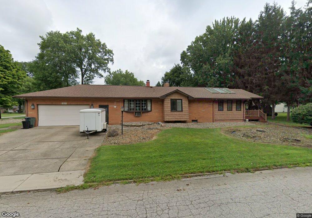
6685 Ronjoy Place Youngstown, OH 44512
Estimated Value: $320,568 - $325,000
3
Beds
3
Baths
2,544
Sq Ft
$127/Sq Ft
Est. Value
About This Home
This home is located at 6685 Ronjoy Place, Youngstown, OH 44512 and is currently estimated at $322,392, approximately $126 per square foot. 6685 Ronjoy Place is a home located in Mahoning County with nearby schools including West Boulevard Elementary School, Boardman Center Middle School, and Boardman High School.
Ownership History
Date
Name
Owned For
Owner Type
Purchase Details
Closed on
Oct 30, 2009
Sold by
Newman Esther S
Bought by
Mcewan Rodney T and Mcewan Martha J
Current Estimated Value
Purchase Details
Closed on
Aug 6, 2002
Sold by
Gene Zilavy
Bought by
Kittle Barnett R
Home Financials for this Owner
Home Financials are based on the most recent Mortgage that was taken out on this home.
Original Mortgage
$135,000
Interest Rate
6.04%
Purchase Details
Closed on
Mar 8, 1961
Bought by
Zilavy Gene and Zilavy Nancy
Create a Home Valuation Report for This Property
The Home Valuation Report is an in-depth analysis detailing your home's value as well as a comparison with similar homes in the area
Home Values in the Area
Average Home Value in this Area
Purchase History
| Date | Buyer | Sale Price | Title Company |
|---|---|---|---|
| Mcewan Rodney T | $140,000 | None Available | |
| Kittle Barnett R | $170,000 | -- | |
| Zilavy Gene | -- | -- |
Source: Public Records
Mortgage History
| Date | Status | Borrower | Loan Amount |
|---|---|---|---|
| Previous Owner | Kittle Barnett R | $135,000 |
Source: Public Records
Tax History
| Year | Tax Paid | Tax Assessment Tax Assessment Total Assessment is a certain percentage of the fair market value that is determined by local assessors to be the total taxable value of land and additions on the property. | Land | Improvement |
|---|---|---|---|---|
| 2025 | $4,385 | $97,610 | $10,140 | $87,470 |
| 2024 | $4,504 | $97,610 | $10,140 | $87,470 |
| 2023 | $4,475 | $97,610 | $10,140 | $87,470 |
| 2022 | $3,255 | $57,490 | $10,120 | $47,370 |
| 2021 | $3,257 | $57,490 | $10,120 | $47,370 |
| 2020 | $3,273 | $57,490 | $10,120 | $47,370 |
| 2019 | $3,340 | $52,260 | $9,200 | $43,060 |
| 2018 | $2,826 | $52,260 | $9,200 | $43,060 |
| 2017 | $2,673 | $52,260 | $9,200 | $43,060 |
| 2016 | $2,558 | $48,220 | $10,220 | $38,000 |
| 2015 | $2,507 | $48,220 | $10,220 | $38,000 |
| 2014 | $2,515 | $48,220 | $10,220 | $38,000 |
| 2013 | $2,483 | $48,220 | $10,220 | $38,000 |
Source: Public Records
Map
Nearby Homes
- 6624 Ronjoy Place
- 6985 Harrington Ave
- 804 Brookfield Ave
- 419 Brookfield Ave
- 768 Crestview Dr
- 477 Wildwood Dr
- 715 Crestview Dr
- 459 Wildwood Dr
- 354 Ewing Rd
- 739 Glen Park Rd
- 242 Oakley Ave
- 7367 Oregon Trail
- 6511 Pembrooke Place
- 7603 Red Fox Dr
- 6723 Lockwood Blvd Unit 4
- 7402 Sierra Madre Trail
- 6747 Lockwood Blvd
- 96 Aylesboro Ave
- 7110 Amherst Ave
- 1173 Red Tail Hawk Ct Unit 5
- 6675 Ronjoy Place
- 6913 Ronjoy Place
- 6684 Ron Park Place
- 6665 Ronjoy Place
- 832 Stuart Ave
- 6674 Ron Park Place
- 6914 Ron Park Place
- 6664 Ron Park Place
- 6921 Ronjoy Place
- 6655 Ronjoy Place
- 838 Stuart Ave
- 6664 Ronjoy Place
- 6926 Ron Park Place
- 6654 Ron Park Place
- 6920 Ronjoy Place
- 6929 Ronjoy Place
- 868 Stuart Ave
- 6657 Ronjoy Place
- 6654 Ronjoy Place
- 6644 Ron Park Place