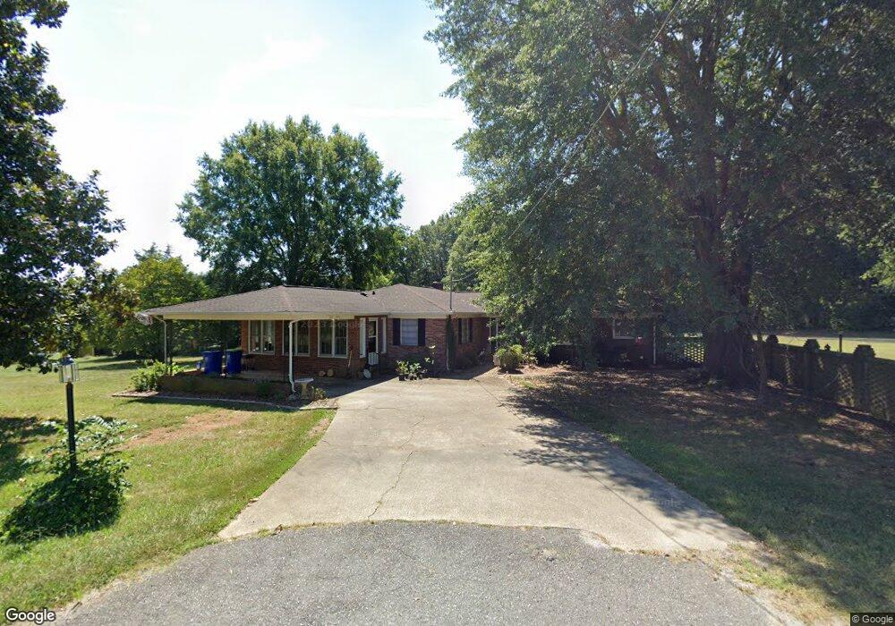
669 Andrews Dr Lincolnton, NC 28092
Estimated Value: $293,000 - $462,000
2
Beds
2
Baths
2,100
Sq Ft
$177/Sq Ft
Est. Value
About This Home
This home is located at 669 Andrews Dr, Lincolnton, NC 28092 and is currently estimated at $371,992, approximately $177 per square foot. 669 Andrews Dr is a home located in Lincoln County with nearby schools including Norris S. Childers Elementary School, Lincolnton Middle School, and Lincolnton High School.
Ownership History
Date
Name
Owned For
Owner Type
Purchase Details
Closed on
Dec 18, 2019
Sold by
Montgomery Gary Lynn
Bought by
Norcutt Hannah Rebekah
Current Estimated Value
Home Financials for this Owner
Home Financials are based on the most recent Mortgage that was taken out on this home.
Original Mortgage
$156,000
Outstanding Balance
$137,536
Interest Rate
3.6%
Mortgage Type
New Conventional
Estimated Equity
$234,456
Purchase Details
Closed on
Oct 4, 2018
Sold by
Andrews Alfred Marion and Andrews Joyce A
Bought by
Norcutt Hannah Rebekah and Montgomery Gary Lynn
Home Financials for this Owner
Home Financials are based on the most recent Mortgage that was taken out on this home.
Original Mortgage
$140,000
Interest Rate
4.5%
Mortgage Type
New Conventional
Create a Home Valuation Report for This Property
The Home Valuation Report is an in-depth analysis detailing your home's value as well as a comparison with similar homes in the area
Home Values in the Area
Average Home Value in this Area
Purchase History
| Date | Buyer | Sale Price | Title Company |
|---|---|---|---|
| Norcutt Hannah Rebekah | -- | None Available | |
| Norcutt Hannah Rebekah | $150,000 | None Available |
Source: Public Records
Mortgage History
| Date | Status | Borrower | Loan Amount |
|---|---|---|---|
| Open | Norcutt Hannah Rebekah | $156,000 | |
| Previous Owner | Norcutt Hannah Rebekah | $140,000 |
Source: Public Records
Tax History Compared to Growth
Tax History
| Year | Tax Paid | Tax Assessment Tax Assessment Total Assessment is a certain percentage of the fair market value that is determined by local assessors to be the total taxable value of land and additions on the property. | Land | Improvement |
|---|---|---|---|---|
| 2025 | $1,957 | $300,801 | $67,569 | $233,232 |
| 2024 | $1,937 | $300,801 | $67,569 | $233,232 |
| 2023 | $1,887 | $300,801 | $67,569 | $233,232 |
| 2022 | $1,418 | $183,849 | $49,046 | $134,803 |
| 2021 | $1,382 | $183,849 | $49,046 | $134,803 |
| 2020 | $1,230 | $183,849 | $49,046 | $134,803 |
| 2019 | $1,230 | $183,849 | $49,046 | $134,803 |
| 2018 | $1,189 | $159,815 | $41,567 | $118,248 |
| 2017 | $1,040 | $159,815 | $41,567 | $118,248 |
| 2016 | $1,040 | $159,815 | $41,567 | $118,248 |
| 2015 | $1,106 | $159,815 | $41,567 | $118,248 |
| 2014 | $1,198 | $176,253 | $43,872 | $132,381 |
Source: Public Records
Map
Nearby Homes
- 743 Lore Rd
- 801 N Grove St
- 1074 Better Brook Ln
- 535 Norman Fair Ave
- 524 Bonview Ave
- 502 Forney Ave
- 000 Better Brook Ln
- 327 Bonview Ave
- #168 Rolling Rd
- 316 N Government St
- 411 W Sycamore St
- 1231 Better Brook Ln
- 536 Lincolnview Rd
- 627 W Main St
- 815 N Laurel St
- 668 Riverside Dr
- 423 N Cedar St
- 958 Hillard Ln
- 0 Hillard Ln
- 317 S High St
- 660 Andrews Dr
- 835 Startown Rd
- 632 Andrews Dr
- 827 Startown Rd
- 935 Startown Rd
- 817 Startown Rd
- 856 Startown Rd
- 787 Startown Rd
- 886 Startown Rd
- 707 Andrews Dr
- 1102 Reepsville Rd
- 1118 Reepsville Rd
- 1080 Reepsville Rd
- 1132 Reepsville Rd
- 769 Startown Rd
- 1064 Reepsville Rd
- 1148 Reepsville Rd
- 1123 Reepsville Rd
- 1162 Reepsville Rd
- 1046 Reepsville Rd