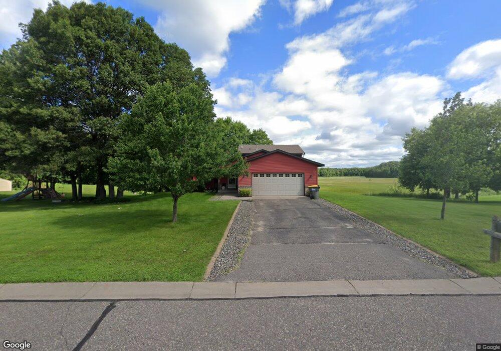
67 173rd Ln NW Andover, MN 55304
Estimated Value: $378,000 - $476,000
3
Beds
2
Baths
2,236
Sq Ft
$198/Sq Ft
Est. Value
About This Home
This home is located at 67 173rd Ln NW, Andover, MN 55304 and is currently estimated at $443,308, approximately $198 per square foot. 67 173rd Ln NW is a home located in Anoka County with nearby schools including Cedar Creek Community School, St. Francis Middle School, and St. Francis High School.
Ownership History
Date
Name
Owned For
Owner Type
Purchase Details
Closed on
Jul 19, 2022
Sold by
Frost Andrew and Frost Brittni
Bought by
Arsenault Haley
Current Estimated Value
Home Financials for this Owner
Home Financials are based on the most recent Mortgage that was taken out on this home.
Original Mortgage
$425,000
Outstanding Balance
$404,339
Interest Rate
5.09%
Mortgage Type
New Conventional
Estimated Equity
$38,969
Purchase Details
Closed on
Aug 26, 2016
Sold by
Owings Samuel and Owings Lisa
Bought by
Frost Andrew S and Frost Brittni
Home Financials for this Owner
Home Financials are based on the most recent Mortgage that was taken out on this home.
Original Mortgage
$240,562
Interest Rate
3.25%
Mortgage Type
FHA
Purchase Details
Closed on
Nov 17, 2011
Sold by
Anderson Brian Lee and Anderson Erin Lisa
Bought by
Owings Lisa and Owings Samuel
Home Financials for this Owner
Home Financials are based on the most recent Mortgage that was taken out on this home.
Original Mortgage
$174,600
Interest Rate
4.12%
Mortgage Type
New Conventional
Purchase Details
Closed on
Oct 23, 2002
Sold by
Lawrence Wallace J and Lawrence Sherry L
Bought by
Anderson Brian Lee and Anderson Erin Lisa
Create a Home Valuation Report for This Property
The Home Valuation Report is an in-depth analysis detailing your home's value as well as a comparison with similar homes in the area
Home Values in the Area
Average Home Value in this Area
Purchase History
| Date | Buyer | Sale Price | Title Company |
|---|---|---|---|
| Arsenault Haley | $425,000 | -- | |
| Frost Andrew S | $245,000 | Liberty Title Inc | |
| Owings Lisa | $194,000 | -- | |
| Anderson Brian Lee | $184,900 | -- |
Source: Public Records
Mortgage History
| Date | Status | Borrower | Loan Amount |
|---|---|---|---|
| Open | Arsenault Haley | $425,000 | |
| Previous Owner | Frost Andrew S | $240,562 | |
| Previous Owner | Owings Lisa | $174,600 |
Source: Public Records
Tax History Compared to Growth
Tax History
| Year | Tax Paid | Tax Assessment Tax Assessment Total Assessment is a certain percentage of the fair market value that is determined by local assessors to be the total taxable value of land and additions on the property. | Land | Improvement |
|---|---|---|---|---|
| 2025 | $3,613 | $391,300 | $163,900 | $227,400 |
| 2024 | $3,613 | $384,600 | $152,700 | $231,900 |
| 2023 | $3,008 | $378,600 | $141,400 | $237,200 |
| 2022 | $2,696 | $373,000 | $136,500 | $236,500 |
| 2021 | $2,763 | $296,000 | $103,600 | $192,400 |
| 2020 | $2,876 | $285,200 | $103,600 | $181,600 |
| 2019 | $2,676 | $277,000 | $100,500 | $176,500 |
| 2018 | $2,516 | $257,500 | $0 | $0 |
| 2017 | $2,420 | $240,400 | $0 | $0 |
| 2016 | $2,405 | $212,800 | $0 | $0 |
| 2015 | -- | $212,800 | $80,200 | $132,600 |
| 2014 | -- | $185,000 | $73,000 | $112,000 |
Source: Public Records
Map
Nearby Homes
- 17215 7th St NE
- 473 173rd Ave NE
- 111 168th Ave NE
- 122 168th Ave NE
- XXX Van Buren St NE
- 17265 Ward Lake Dr NW
- 17295 Ward Lake Dr NW
- 0000 168th Ln NW
- xxx 180th Ln NE
- 17205 Lincoln St NE
- 18410 Jackson St NE
- 18246 Fillmore St NE
- 17749 Johnson St NE
- 2466 180th Ln NE
- 2463 180th Ln NE
- 2451 180th Ln NE
- TBD 169th Ave NE
- 16355 Wintergreen St NW
- 15218 Quince St NW
- 1X Highway 65 NE
- 28 173rd Ln NW
- 84 173rd Ln NW
- 23 173rd Ln NW
- 115 173rd Ln NW
- 5 173rd Ln NE
- 17333 Butternut St NW
- 6 173rd Ln NE
- 17425 Butternut St NW
- 17251 Butternut St NW
- 17334 3rd St NE
- 17334 Butternut St NW
- 139 173rd Ln NE
- 17332 3rd St NE
- 17485 Butternut St NW
- 17349 3rd St NE
- 17446 Butternut St NW
- 17420 Butternut St NW
- 152 173rd Ave NW
- 17480 Butternut St NW
- 189 173rd Ln NE