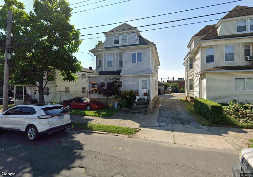
67 Alice St Bridgeport, CT 06606
Brooklawn-Saint Vincent NeighborhoodEstimated Value: $283,000 - $559,000
4
Beds
2
Baths
2,690
Sq Ft
$166/Sq Ft
Est. Value
About This Home
This home is located at 67 Alice St, Bridgeport, CT 06606 and is currently estimated at $446,683, approximately $166 per square foot. 67 Alice St is a home located in Fairfield County with nearby schools including Read School, Central High School, and Catholic Academy of Bridgeport-St. Raphael Academy.
Ownership History
Date
Name
Owned For
Owner Type
Purchase Details
Closed on
Mar 1, 2000
Sold by
Hylton Arthur S
Bought by
Fernandes Jose D
Current Estimated Value
Purchase Details
Closed on
Aug 12, 1996
Sold by
Berkeley Federal B & T
Bought by
Hylton Arthur S
Create a Home Valuation Report for This Property
The Home Valuation Report is an in-depth analysis detailing your home's value as well as a comparison with similar homes in the area
Home Values in the Area
Average Home Value in this Area
Purchase History
| Date | Buyer | Sale Price | Title Company |
|---|---|---|---|
| Fernandes Jose D | $100,000 | -- | |
| Fernandes Jose D | $100,000 | -- | |
| Hylton Arthur S | $43,260 | -- | |
| Hylton Arthur S | $43,260 | -- |
Source: Public Records
Mortgage History
| Date | Status | Borrower | Loan Amount |
|---|---|---|---|
| Open | Hylton Arthur S | $200,000 | |
| Closed | Hylton Arthur S | $118,000 | |
| Closed | Hylton Arthur S | $120,000 |
Source: Public Records
Tax History Compared to Growth
Tax History
| Year | Tax Paid | Tax Assessment Tax Assessment Total Assessment is a certain percentage of the fair market value that is determined by local assessors to be the total taxable value of land and additions on the property. | Land | Improvement |
|---|---|---|---|---|
| 2025 | $8,339 | $191,920 | $70,670 | $121,250 |
| 2024 | $8,339 | $191,920 | $70,670 | $121,250 |
| 2023 | $8,339 | $191,920 | $70,670 | $121,250 |
| 2022 | $8,339 | $191,920 | $70,670 | $121,250 |
| 2021 | $8,339 | $191,920 | $70,670 | $121,250 |
| 2020 | $7,319 | $135,570 | $42,820 | $92,750 |
| 2019 | $7,319 | $135,570 | $42,820 | $92,750 |
| 2018 | $7,371 | $135,570 | $42,820 | $92,750 |
| 2017 | $7,371 | $135,570 | $42,820 | $92,750 |
| 2016 | $7,371 | $135,570 | $42,820 | $92,750 |
| 2015 | $7,014 | $166,200 | $43,180 | $123,020 |
| 2014 | $7,014 | $166,200 | $43,180 | $123,020 |
Source: Public Records
Map
Nearby Homes
- 90 Tom Thumb St
- 78 Fairmount Ave
- 390 Charles St Unit 106
- 76 Porter St
- 31 Taft Ave
- 2395 Main St Unit 2397
- 724 Capitol Ave Unit 726
- 119 Madison Terrace
- 191 Oak St
- 318 Center St
- 330 French St
- 356 Taft Ave
- 100 Lorraine St
- 508 Hawley Ave
- 183 Calhoun Ave
- 201 High Ridge Dr
- 1275 Capitol Ave
- 139 Highland Ave Unit 143
- 152 River St
- 2345 Park Ave
- 57 Alice St
- 75 Alice St
- 83 Alice St
- 89 Alice St Unit 93
- 48-52 Beers St
- 62 Alice St
- 68 Alice St
- 78 Alice St
- 92 Alice St Unit 2
- 92 Alice St Unit 1
- 107 Alice St
- 50 Alice St
- 48 Beers St Unit 52
- 72 Beers St
- 78-84 Alice St Unit 2nd + Attic
- 78-84 Alice St
- 113 Alice St
- 82 Beers St Unit 86
- 106 Alice St
- 106 Alice St Unit 2