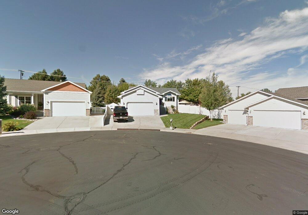
67 Aster Cir Billings, MT 59105
Billings Heights NeighborhoodEstimated Value: $433,000 - $483,000
5
Beds
3
Baths
2,762
Sq Ft
$166/Sq Ft
Est. Value
About This Home
This home is located at 67 Aster Cir, Billings, MT 59105 and is currently estimated at $459,717, approximately $166 per square foot. 67 Aster Cir is a home located in Yellowstone County with nearby schools including Eagle Cliffs Elementary School, Castle Rock Junior High School, and Skyview High School.
Ownership History
Date
Name
Owned For
Owner Type
Purchase Details
Closed on
Jun 12, 2019
Sold by
Thoen Deette J
Bought by
Kennedy Kody and Kennedy Latonya
Current Estimated Value
Home Financials for this Owner
Home Financials are based on the most recent Mortgage that was taken out on this home.
Original Mortgage
$304,385
Outstanding Balance
$267,086
Interest Rate
4%
Mortgage Type
FHA
Estimated Equity
$192,631
Purchase Details
Closed on
Jul 7, 2017
Sold by
Delperdang Dodge N and Delperdang Leslie A
Bought by
Thoen Deette J
Purchase Details
Closed on
Apr 25, 2017
Sold by
Balliet William L and Balliet Patricia A
Bought by
Delperdang Dodge N and Delperdang Leslie A
Purchase Details
Closed on
Jun 14, 2013
Sold by
Rieger Paul E and Rieger Akvilina
Bought by
Balliet William L and Balliet Patricia A
Home Financials for this Owner
Home Financials are based on the most recent Mortgage that was taken out on this home.
Original Mortgage
$266,091
Interest Rate
3.37%
Mortgage Type
FHA
Create a Home Valuation Report for This Property
The Home Valuation Report is an in-depth analysis detailing your home's value as well as a comparison with similar homes in the area
Home Values in the Area
Average Home Value in this Area
Purchase History
| Date | Buyer | Sale Price | Title Company |
|---|---|---|---|
| Kennedy Kody | -- | Chicago Title | |
| Thoen Deette J | -- | Stewart Title | |
| Delperdang Dodge N | -- | Stewart Title | |
| Balliet William L | -- | Chicago Title |
Source: Public Records
Mortgage History
| Date | Status | Borrower | Loan Amount |
|---|---|---|---|
| Open | Kennedy Kody | $304,385 | |
| Previous Owner | Balliet William L | $266,091 |
Source: Public Records
Tax History
| Year | Tax Paid | Tax Assessment Tax Assessment Total Assessment is a certain percentage of the fair market value that is determined by local assessors to be the total taxable value of land and additions on the property. | Land | Improvement |
|---|---|---|---|---|
| 2025 | $4,044 | $466,300 | $64,741 | $401,559 |
| 2024 | $4,044 | $412,700 | $65,187 | $347,513 |
| 2023 | $4,039 | $412,700 | $65,187 | $347,513 |
| 2022 | $3,508 | $312,500 | $0 | $0 |
| 2021 | $3,339 | $312,500 | $0 | $0 |
| 2020 | $3,337 | $299,400 | $0 | $0 |
| 2019 | $3,164 | $296,900 | $0 | $0 |
| 2018 | $2,992 | $274,500 | $0 | $0 |
| 2017 | $2,925 | $276,200 | $0 | $0 |
| 2016 | $2,601 | $248,800 | $0 | $0 |
| 2015 | $2,569 | $248,800 | $0 | $0 |
| 2014 | $2,284 | $116,441 | $0 | $0 |
Source: Public Records
Map
Nearby Homes
- 114 Windsor Cir S
- 153 W Hilltop Rd
- 66 Antelope Trail W Unit 5
- 66 Antelope Trail W Unit 10
- 11 Queen Victoria Place
- 636 Antelope Cir
- 914 Aronson Ave
- 663 Valle Vista Ave
- 218 Reda Ln Unit 4
- 218 Reda Ln Unit 3
- 658 Valle Vista Ave
- 657 Valle Vista Ave
- 325 Sahara Dr
- 228 Nash Ln
- 1152 Toole Ct
- NKN Antelope
- 938 Anacapa Ln
- 926 Anacapa Ln
- 1017 Toole Cir
- 1410 Twin Oaks Dr
- 75 Aster Cir
- 72 Aster Cir
- 915 Nutter Blvd
- 909 Nutter Blvd
- 919 Nutter Blvd
- 66 Jonquil Cir
- 78 Aster Cir
- 81 Aster Cir
- 60 Jonquil Cir
- 907 Nutter Blvd
- 923 Nutter Blvd
- 84 Aster Cir
- 72 Jonquil Cir
- 87 Aster Cir
- 903 Nutter Blvd
- 927 Nutter Blvd
- 924 Shamrock Ln
- 874 Sapphire Ave
- 83 Lily Valley Cir
- 55 Jonquil Cir
