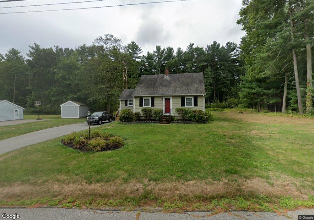
67 Bradford Rd Hanover, MA 02339
Estimated Value: $628,000 - $739,456
3
Beds
2
Baths
1,440
Sq Ft
$475/Sq Ft
Est. Value
About This Home
This home is located at 67 Bradford Rd, Hanover, MA 02339 and is currently estimated at $684,614, approximately $475 per square foot. 67 Bradford Rd is a home located in Plymouth County with nearby schools including Hanover High School, Cadence Academy Preschool - Hanover, and Cardinal Cushing Centers.
Ownership History
Date
Name
Owned For
Owner Type
Purchase Details
Closed on
Aug 30, 2016
Sold by
Mood Regina M
Bought by
Mood Regina M and Cushing James B
Current Estimated Value
Purchase Details
Closed on
Jul 31, 2006
Sold by
Cleveland Carolyn R
Bought by
Mood Regina M
Home Financials for this Owner
Home Financials are based on the most recent Mortgage that was taken out on this home.
Original Mortgage
$289,000
Interest Rate
6.67%
Mortgage Type
Purchase Money Mortgage
Purchase Details
Closed on
Nov 22, 2000
Sold by
Est Howes Winifred K and Howes Leonard E
Bought by
Cleveland Carolyn R
Create a Home Valuation Report for This Property
The Home Valuation Report is an in-depth analysis detailing your home's value as well as a comparison with similar homes in the area
Home Values in the Area
Average Home Value in this Area
Purchase History
| Date | Buyer | Sale Price | Title Company |
|---|---|---|---|
| Mood Regina M | -- | -- | |
| Mood Regina M | $369,000 | -- | |
| Cleveland Carolyn R | $206,320 | -- |
Source: Public Records
Mortgage History
| Date | Status | Borrower | Loan Amount |
|---|---|---|---|
| Previous Owner | Cleveland Carolyn R | $292,000 | |
| Previous Owner | Cleveland Carolyn R | $289,000 | |
| Previous Owner | Cleveland Carolyn R | $300,000 |
Source: Public Records
Tax History Compared to Growth
Tax History
| Year | Tax Paid | Tax Assessment Tax Assessment Total Assessment is a certain percentage of the fair market value that is determined by local assessors to be the total taxable value of land and additions on the property. | Land | Improvement |
|---|---|---|---|---|
| 2025 | $6,449 | $522,200 | $280,500 | $241,700 |
| 2024 | $6,365 | $495,700 | $280,500 | $215,200 |
| 2023 | $6,003 | $445,000 | $255,200 | $189,800 |
| 2022 | $6,436 | $422,000 | $255,200 | $166,800 |
| 2021 | $6,336 | $388,000 | $220,500 | $167,500 |
| 2020 | $6,281 | $385,100 | $220,500 | $164,600 |
| 2019 | $5,963 | $363,400 | $220,500 | $142,900 |
| 2018 | $4,697 | $360,500 | $220,500 | $140,000 |
| 2017 | $5,557 | $336,400 | $215,900 | $120,500 |
| 2016 | $5,388 | $319,600 | $196,300 | $123,300 |
| 2015 | $5,071 | $314,000 | $196,300 | $117,700 |
Source: Public Records
Map
Nearby Homes
- 77 Bradford Rd
- 55 Bradford Rd
- 72 Bradford Rd
- 54 Bradford Rd
- 84 Bradford Rd
- 87 Bradford Rd
- 43 Bradford Rd
- 40 Bradford Rd
- 96 Bradford Rd
- 101 Bradford Rd
- 56 Cornet Stetson Rd
- 48 Cornet Stetson Rd
- 48 Cornet Stetson Rd
- 22 Bradford Rd
- 99 Plymouth Rd
- 29 Bradford Rd
- 114 Bradford Rd
- 91 Plymouth Rd
- 113 Plymouth Rd
- 113 Bradford Rd