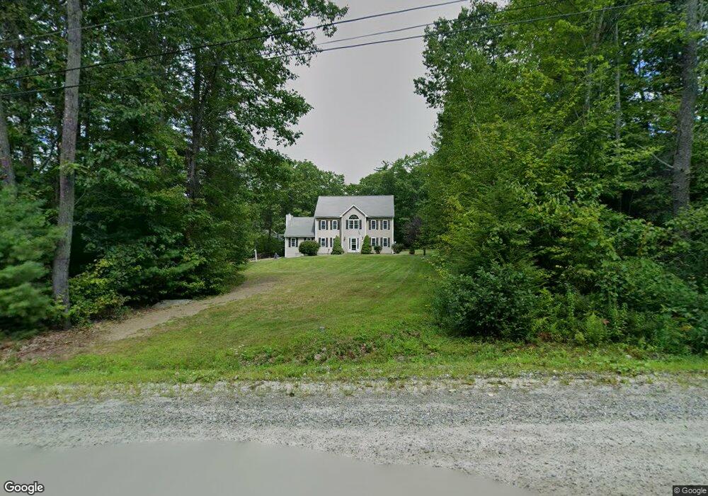
67 Dupaw Gould Rd Brookline, NH 03033
Estimated Value: $724,000 - $749,000
3
Beds
3
Baths
3,144
Sq Ft
$235/Sq Ft
Est. Value
About This Home
This home is located at 67 Dupaw Gould Rd, Brookline, NH 03033 and is currently estimated at $739,055, approximately $235 per square foot. 67 Dupaw Gould Rd is a home with nearby schools including Richard Maghakian Memorial School, Captain Samuel Douglass Academy, and Hollis-Brookline Middle School.
Ownership History
Date
Name
Owned For
Owner Type
Purchase Details
Closed on
Jun 15, 2004
Sold by
Farwell Gerald G
Bought by
Laborde David W and Laborde Heidi A
Current Estimated Value
Home Financials for this Owner
Home Financials are based on the most recent Mortgage that was taken out on this home.
Original Mortgage
$210,000
Interest Rate
5.99%
Mortgage Type
Purchase Money Mortgage
Create a Home Valuation Report for This Property
The Home Valuation Report is an in-depth analysis detailing your home's value as well as a comparison with similar homes in the area
Home Values in the Area
Average Home Value in this Area
Purchase History
| Date | Buyer | Sale Price | Title Company |
|---|---|---|---|
| Laborde David W | $300,000 | -- |
Source: Public Records
Mortgage History
| Date | Status | Borrower | Loan Amount |
|---|---|---|---|
| Open | Laborde David W | $198,000 | |
| Closed | Laborde David W | $210,000 |
Source: Public Records
Tax History Compared to Growth
Tax History
| Year | Tax Paid | Tax Assessment Tax Assessment Total Assessment is a certain percentage of the fair market value that is determined by local assessors to be the total taxable value of land and additions on the property. | Land | Improvement |
|---|---|---|---|---|
| 2024 | $14,509 | $641,700 | $197,800 | $443,900 |
| 2023 | $13,335 | $641,700 | $197,800 | $443,900 |
| 2022 | $11,665 | $392,500 | $119,100 | $273,400 |
| 2021 | $11,221 | $392,600 | $119,100 | $273,500 |
| 2020 | $10,914 | $392,600 | $119,100 | $273,500 |
| 2019 | $11,727 | $392,600 | $119,100 | $273,500 |
| 2018 | $11,605 | $392,600 | $119,100 | $273,500 |
| 2017 | $10,136 | $307,700 | $96,300 | $211,400 |
| 2016 | $10,019 | $307,700 | $96,300 | $211,400 |
| 2015 | $9,554 | $307,700 | $96,300 | $211,400 |
| 2014 | $10,108 | $307,700 | $96,300 | $211,400 |
| 2013 | $9,733 | $307,700 | $96,300 | $211,400 |
Source: Public Records
Map
Nearby Homes
- 3 Ben Farnsworth Rd
- 104 N Mason Rd
- 38 Countryside Dr
- 8 Colburn Rd
- 5 Carons Way
- 7 Winterberry Rd
- 9 Winterberry Rd
- 303 Route 13
- 59 Cleveland Hill Rd
- 81 Badger Hill Dr
- 131 Badger Hill Dr
- 25 Rocky Pond Rd
- 301 Mile Slip Rd
- 22 Hobart Hill Rd
- 9 Marjorie Dr
- 0 Ball Hill Rd
- 4 Bohanon Bridge Rd
- 00 Ruonala Rd
- 18 Sawtelle Rd
- 42 Pepperell Rd
- 65 Dupaw Gould Rd
- 69 Dupaw Gould Rd
- 71 Dupaw Gould Rd
- 64 Dupaw Gould Rd
- 62 Dupaw Gould Rd
- 60 Dupaw Gould Rd
- 59 Dupaw Gould Rd
- 3 Kemp Dr
- 3 Kemp Dr Unit C-14-1
- 1 Kemp Dr
- 5 Kemp Dr
- 2 Kemp Dr
- 55 Dupaw Gould Rd
- 8 Barber Way
- 7 Kemp Dr
- 6 Barber Way
- 53 Dupaw Gould Rd
- 0 Kemp Dr
- 0 Kemp Dr Unit 2757210
- 15 Jefts Dr