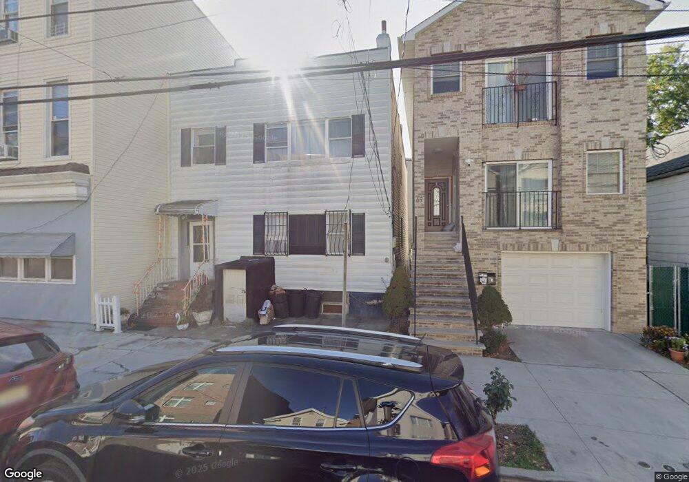
67 Hutton St Jersey City, NJ 07307
The Heights NeighborhoodEstimated Value: $505,000 - $1,091,000
3
Beds
3
Baths
2,000
Sq Ft
$423/Sq Ft
Est. Value
About This Home
This home is located at 67 Hutton St, Jersey City, NJ 07307 and is currently estimated at $846,147, approximately $423 per square foot. 67 Hutton St is a home located in Hudson County with nearby schools including Charles E. Trefurt School, William L. Dickinson High School, and Dr Ronald McNair High School.
Ownership History
Date
Name
Owned For
Owner Type
Purchase Details
Closed on
Aug 23, 2002
Sold by
Afalla Aurelio and Afalla Isabelita
Bought by
Sosa Alicia and Padilla Jairo
Current Estimated Value
Home Financials for this Owner
Home Financials are based on the most recent Mortgage that was taken out on this home.
Original Mortgage
$169,302
Outstanding Balance
$71,640
Interest Rate
6.55%
Mortgage Type
FHA
Estimated Equity
$774,507
Create a Home Valuation Report for This Property
The Home Valuation Report is an in-depth analysis detailing your home's value as well as a comparison with similar homes in the area
Home Values in the Area
Average Home Value in this Area
Purchase History
| Date | Buyer | Sale Price | Title Company |
|---|---|---|---|
| Sosa Alicia | $172,000 | -- |
Source: Public Records
Mortgage History
| Date | Status | Borrower | Loan Amount |
|---|---|---|---|
| Open | Sosa Alicia | $169,302 |
Source: Public Records
Tax History Compared to Growth
Tax History
| Year | Tax Paid | Tax Assessment Tax Assessment Total Assessment is a certain percentage of the fair market value that is determined by local assessors to be the total taxable value of land and additions on the property. | Land | Improvement |
|---|---|---|---|---|
| 2025 | $11,248 | $503,700 | $237,500 | $266,200 |
| 2024 | $11,318 | $503,700 | $237,500 | $266,200 |
| 2023 | $11,318 | $503,700 | $237,500 | $266,200 |
| 2022 | $10,668 | $503,700 | $237,500 | $266,200 |
| 2021 | $8,079 | $503,700 | $237,500 | $266,200 |
| 2020 | $8,110 | $503,700 | $237,500 | $266,200 |
| 2019 | $7,757 | $503,700 | $237,500 | $266,200 |
| 2018 | $1,265 | $503,700 | $237,500 | $266,200 |
| 2017 | $6,630 | $85,000 | $20,000 | $65,000 |
| 2016 | $6,546 | $85,000 | $20,000 | $65,000 |
| 2015 | $6,319 | $114,400 | $20,000 | $94,400 |
| 2014 | $8,505 | $114,400 | $20,000 | $94,400 |
Source: Public Records
Map
Nearby Homes
- 28 Cambridge Ave Unit 2
- 21 Hancock Ave Unit 3
- 32 Hancock Ave Unit 3
- 32 Hancock Ave Unit 2
- 11 Cambridge Ave Unit 2
- 92 Hutton St
- 129 Franklin St Unit A1
- 281 Central Ave Unit 4A
- 62 Hancock Ave
- 123 Webster Ave
- 44 Sherman Ave Unit 5F
- 151 Webster Ave Unit 101
- 117 Sherman Ave
- 130 Griffith St
- 106 Griffith St
- 126 Webster Ave Unit 1G
- 17 Sherman Ave
- 84 Manhattan Ave Unit 2
- 100 Webster Ave Unit 1
- 100 Webster Ave Unit 2
- 69 Hutton St
- 69 Hutton St Unit 1
- 71 Hutton St
- 73 Hutton St
- 31 Hancock Ave
- 75 Hutton St
- 63 Hutton St
- 29 Hancock Ave
- 29 Hancock Ave Unit 1
- 29 Hancock Ave Unit 3
- 29 Hancock Ave Unit 2
- 38 Hancock Ave
- 38 Hancock Ave Unit 3R
- 38 Hancock Ave Unit 2R
- 34 Cambridge Ave Unit 34
- 34 Hancock Ave
- 34 Hancock Ave Unit 3
- 61 Hutton St
- 61 Hutton St Unit 3
- 32 Cambridge Ave