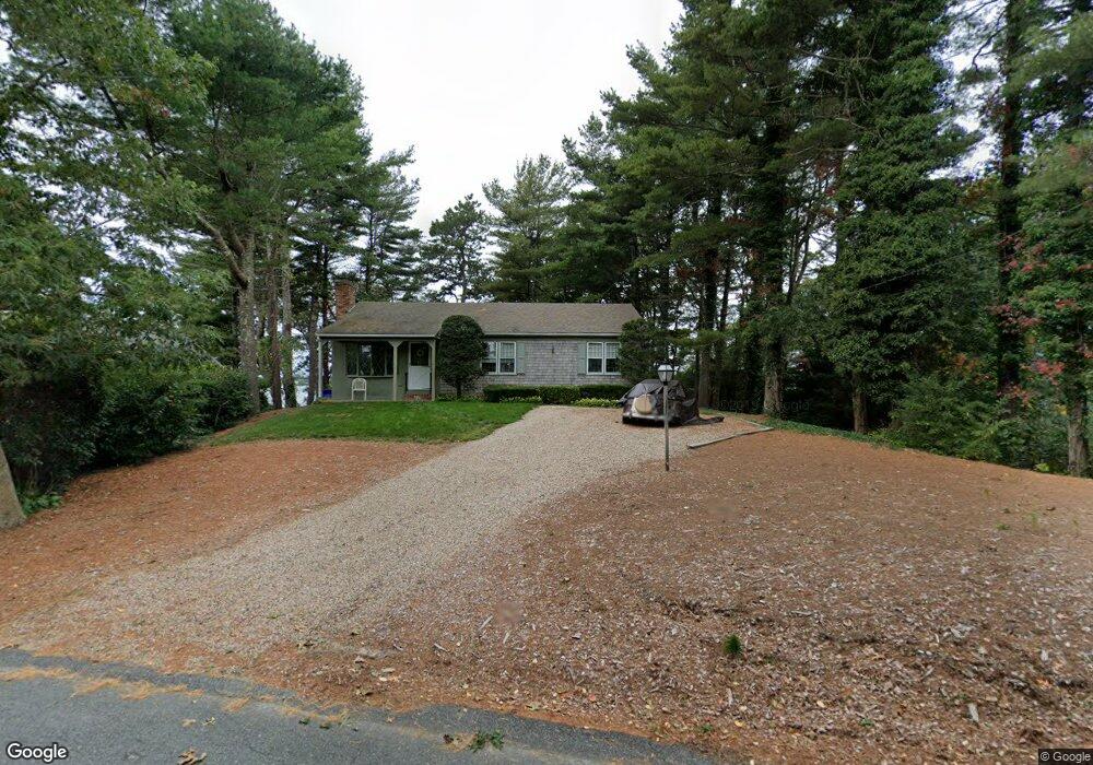
67 Lewis Point Rd Bourne, MA 2532
Estimated Value: $774,000 - $1,332,216
3
Beds
5
Baths
2,152
Sq Ft
$494/Sq Ft
Est. Value
About This Home
This home is located at 67 Lewis Point Rd, Bourne, MA 2532 and is currently estimated at $1,063,804, approximately $494 per square foot. 67 Lewis Point Rd is a home located in Barnstable County with nearby schools including Bourne High School and St Margaret Regional School.
Ownership History
Date
Name
Owned For
Owner Type
Purchase Details
Closed on
Aug 20, 2020
Sold by
John Joseph Sindoni Lt and Peddicord
Bought by
Leary Michael F and Leary Anne C
Current Estimated Value
Purchase Details
Closed on
Jul 7, 2014
Sold by
Sindoni John J
Bought by
John Joseph Sindoni Lt and Sindoni
Create a Home Valuation Report for This Property
The Home Valuation Report is an in-depth analysis detailing your home's value as well as a comparison with similar homes in the area
Home Values in the Area
Average Home Value in this Area
Purchase History
| Date | Buyer | Sale Price | Title Company |
|---|---|---|---|
| Leary Michael F | $649,000 | None Available | |
| John Joseph Sindoni Lt | -- | -- | |
| John Joseph Sindoni Lt | -- | -- |
Source: Public Records
Mortgage History
| Date | Status | Borrower | Loan Amount |
|---|---|---|---|
| Previous Owner | John Joseph Sindoni Lt | $123,000 |
Source: Public Records
Tax History Compared to Growth
Tax History
| Year | Tax Paid | Tax Assessment Tax Assessment Total Assessment is a certain percentage of the fair market value that is determined by local assessors to be the total taxable value of land and additions on the property. | Land | Improvement |
|---|---|---|---|---|
| 2025 | $10,006 | $1,281,200 | $532,700 | $748,500 |
| 2024 | $6,936 | $864,800 | $507,300 | $357,500 |
| 2023 | $5,925 | $672,500 | $431,700 | $240,800 |
| 2022 | $5,784 | $573,200 | $382,100 | $191,100 |
| 2021 | $5,366 | $498,200 | $347,700 | $150,500 |
| 2020 | $5,237 | $487,600 | $344,400 | $143,200 |
| 2019 | $5,041 | $479,600 | $344,400 | $135,200 |
| 2018 | $4,746 | $450,300 | $328,000 | $122,300 |
| 2017 | $4,928 | $478,400 | $357,400 | $121,000 |
| 2016 | $4,668 | $459,400 | $357,400 | $102,000 |
| 2015 | $4,626 | $459,400 | $357,400 | $102,000 |
Source: Public Records
Map
Nearby Homes
- 73 Lewis Point Rd
- 65 Lewis Point Rd
- 0 Lewis Point Rd
- 810 Head of The Bay Rd
- 162 Puritan Rd
- 171 Puritan Rd
- 181 Head of The Bay Rd
- 15 Maple St
- 11 Thompson Rd Unit A
- 11 Thompson Rd Unit 11A
- 3 Wolf Rd
- 22 Wallace Point
- 23 Pine Ridge Rd
- 8 Van Bummel Rd
- 85 Maple St
- 4 Finch Ln
- 17 Harrison Ave
- 47 Harrison Ave
- 56 Rip Van Winkle Way
- 34 Washington Ave
- 67 Lewis Point Rd
- 72 Lewis Point Rd
- 61 Lewis Point Rd
- 77 Lewis Point Rd
- 77 Lewis Point Rd
- 60 Lewis Point Rd
- 55 Lewis Point Rd
- 79 Lewis Point Rd
- 9 Nye Ln
- 10 Nye Ln
- 9 Nye Ln
- 10 Nye Ln
- 82 Lewis Point Rd
- 78 Lewis Point Rd
- 84 Lewis Point Rd
- 12 Nye Ln
- 50 Lewis Point Rd
- 12 Nye Ln
- 85 Lewis Point Rd
- 82 Lewis Point Rd