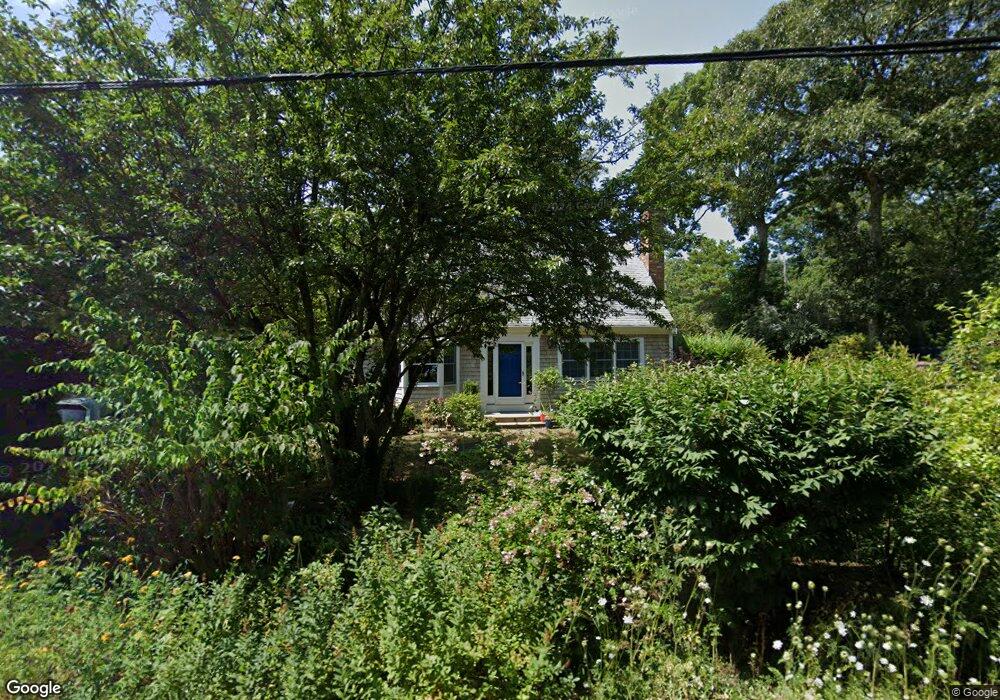
67 Linnell Landing Rd Brewster, MA 02631
Estimated Value: $742,127 - $931,000
3
Beds
2
Baths
1,566
Sq Ft
$548/Sq Ft
Est. Value
About This Home
This home is located at 67 Linnell Landing Rd, Brewster, MA 02631 and is currently estimated at $858,032, approximately $547 per square foot. 67 Linnell Landing Rd is a home located in Barnstable County with nearby schools including Stony Brook Elementary School, Eddy Elementary School, and Nauset Regional Middle School.
Ownership History
Date
Name
Owned For
Owner Type
Purchase Details
Closed on
Jan 7, 2026
Sold by
Husband Janet G
Bought by
Hardy Michael J and Hardy Virginia M
Current Estimated Value
Home Financials for this Owner
Home Financials are based on the most recent Mortgage that was taken out on this home.
Original Mortgage
$450,000
Outstanding Balance
$450,000
Interest Rate
6.23%
Mortgage Type
New Conventional
Estimated Equity
$408,032
Purchase Details
Closed on
Jun 11, 2019
Sold by
Husband Ft and Husband
Bought by
Husband Jonathan F and Husband Janet G
Home Financials for this Owner
Home Financials are based on the most recent Mortgage that was taken out on this home.
Original Mortgage
$99,200
Interest Rate
4%
Mortgage Type
New Conventional
Create a Home Valuation Report for This Property
The Home Valuation Report is an in-depth analysis detailing your home's value as well as a comparison with similar homes in the area
Home Values in the Area
Average Home Value in this Area
Purchase History
| Date | Buyer | Sale Price | Title Company |
|---|---|---|---|
| Hardy Michael J | $900,000 | -- | |
| Husband Jonathan F | -- | -- |
Source: Public Records
Mortgage History
| Date | Status | Borrower | Loan Amount |
|---|---|---|---|
| Open | Hardy Michael J | $450,000 | |
| Previous Owner | Husband Jonathan F | $99,200 |
Source: Public Records
Tax History
| Year | Tax Paid | Tax Assessment Tax Assessment Total Assessment is a certain percentage of the fair market value that is determined by local assessors to be the total taxable value of land and additions on the property. | Land | Improvement |
|---|---|---|---|---|
| 2025 | $4,312 | $626,800 | $274,200 | $352,600 |
| 2024 | $4,029 | $591,700 | $258,700 | $333,000 |
| 2023 | $3,725 | $532,900 | $230,900 | $302,000 |
| 2022 | $3,494 | $445,100 | $192,400 | $252,700 |
| 2021 | $3,352 | $390,700 | $167,200 | $223,500 |
| 2020 | $3,278 | $380,300 | $167,200 | $213,100 |
| 2019 | $3,167 | $369,100 | $160,900 | $208,200 |
| 2018 | $2,985 | $361,400 | $160,900 | $200,500 |
| 2017 | $2,943 | $350,800 | $160,900 | $189,900 |
| 2016 | $2,832 | $336,000 | $157,700 | $178,300 |
| 2015 | $2,734 | $331,000 | $154,600 | $176,400 |
Source: Public Records
Map
Nearby Homes
- 398 Lund Farm Way
- 87 N Pond Dr
- 23 Landing Ln Unit 23
- 14 Howland Cir Unit 14
- 100 Fletcher Ln Unit E
- 60 Fletcher Ln Unit H
- 34 Sky Meadow Dr
- 63 Trevor Ln Unit 63
- 103 Trevor Ln Unit 103
- 0 Old Chatham Rd
- 0 Commons Way Unit 22504099
- 31 Chase Ln
- 127 Eaton Ln Unit 127
- 16 Commons Way
- 52 Eaton Ln Unit (52)
- 204 Eaton Ln Unit 204
- 9 Honeysuckle Ln
- 235 Old Chatham Rd
- 12 Phoebes Close
- 78 Old Colony Way Unit 3
- 17 Flying Mist Ln
- 57 Linnell Landing Rd
- 81 Linnell Landing Rd
- 16 Eagle Wing Ln
- 16 Flying Mist Ln
- 25 Flying Mist Ln
- 26 Eagle Wing Ln
- 16-22 Partridge Cir
- 30 Flying Mist Ln
- 43 Linnell Landing Rd
- 15 Eagle Wing Ln
- 37 Flying Mist Ln
- 101 Linnell Landing Rd
- 12 Partridge Cir
- 36 Eagle Wing Ln
- 27 Eagle Wing Ln
- 42 Partridge Cir
- 36-38 Linnell Landing Rd
- 29 Partridge Cir
- 40 Flying Mist Ln
Your Personal Tour Guide
Ask me questions while you tour the home.