Estimated Value: $174,000 - $265,000
Studio
1
Bath
1,474
Sq Ft
$138/Sq Ft
Est. Value
About This Home
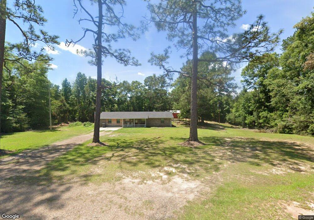
This home is located at 67 Shows Rd, Petal, MS 39465 and is currently estimated at $204,119, approximately $138 per square foot. 67 Shows Rd is a home located in Forrest County with nearby schools including Petal Primary School, Petal Elementary School, and Petal Middle School.
Ownership History
Date
Name
Owned For
Owner Type
Purchase Details
Closed on
Jul 13, 2022
Sold by
Jones Jessica S and Jones Shaughn
Bought by
Shoemake Shannon and Shoemake Kenneth
Current Estimated Value
Home Financials for this Owner
Home Financials are based on the most recent Mortgage that was taken out on this home.
Original Mortgage
$100,000
Outstanding Balance
$94,439
Interest Rate
5.09%
Mortgage Type
New Conventional
Estimated Equity
$109,680
Purchase Details
Closed on
Jun 30, 2020
Sold by
Goss Angela Renee and Memaree Gary David
Bought by
Jones Jessica S and Jones Shaughn
Home Financials for this Owner
Home Financials are based on the most recent Mortgage that was taken out on this home.
Original Mortgage
$167,676
Interest Rate
3.1%
Mortgage Type
New Conventional
Purchase Details
Closed on
Feb 4, 2013
Sold by
Demaree Gary David and Demaree Phillip Lavaster
Bought by
Goss Angela Renee and Demoree Gary David
Create a Home Valuation Report for This Property
The Home Valuation Report is an in-depth analysis detailing your home's value as well as a comparison with similar homes in the area
Purchase History
| Date | Buyer | Sale Price | Title Company |
|---|---|---|---|
| Shoemake Shannon | -- | Richard & Thomas Pllc | |
| Jones Jessica S | -- | -- | |
| Goss Angela Renee | -- | -- |
Source: Public Records
Mortgage History
| Date | Status | Borrower | Loan Amount |
|---|---|---|---|
| Open | Shoemake Shannon | $100,000 | |
| Previous Owner | Jones Jessica S | $167,676 |
Source: Public Records
Tax History
| Year | Tax Paid | Tax Assessment Tax Assessment Total Assessment is a certain percentage of the fair market value that is determined by local assessors to be the total taxable value of land and additions on the property. | Land | Improvement |
|---|---|---|---|---|
| 2025 | $216 | $9,572 | $0 | $0 |
| 2024 | $216 | $9,123 | $0 | $0 |
| 2023 | $214 | $85,800 | $0 | $0 |
| 2022 | $887 | $9,359 | $0 | $0 |
| 2021 | $897 | $9,380 | $0 | $0 |
| 2020 | $214 | $12,656 | $0 | $0 |
| 2019 | $1,627 | $12,680 | $0 | $0 |
| 2018 | $214 | $9,165 | $0 | $0 |
| 2017 | $214 | $9,141 | $0 | $0 |
| 2016 | $139 | $8,568 | $0 | $0 |
| 2015 | $129 | $85,171 | $0 | $0 |
| 2014 | $122 | $8,475 | $0 | $0 |
Source: Public Records
Map
Nearby Homes
- 69 Sunnyvale Dr
- 18 Gordon Dr
- 5.5 Acres Lynn Ray Rd
- 0 5 Acres Lynn Ray Rd
- 57 Lazenby Rd
- 42 & 46 Craft Rd
- 00 Green Acres
- Parcel B J Runnels Rd
- Parcel C J Runnels Rd
- Parcel A J Runnels Rd
- 3.4+/- Ac Morriston Rd
- 114 Lynnstone
- 110 Lynnstone
- 2070 Old Richton Rd
- 20 Brookstone
- 417 Herrington Rd
- 120 Cedar Grove Rd
- 0 Pecanwood Dr Unit 143313
- 75 Otis Lee Rd
- 243 Beverly Hills Loop
Your Personal Tour Guide
Ask me questions while you tour the home.