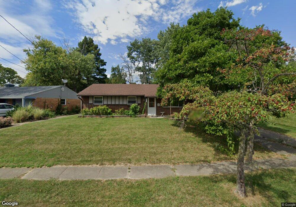
670 Castro Ln Cincinnati, OH 45246
Estimated Value: $192,000 - $214,491
3
Beds
2
Baths
1,026
Sq Ft
$195/Sq Ft
Est. Value
About This Home
This home is located at 670 Castro Ln, Cincinnati, OH 45246 and is currently estimated at $199,623, approximately $194 per square foot. 670 Castro Ln is a home located in Hamilton County with nearby schools including Stewart Elementary School, Princeton Community Middle School, and Princeton High School.
Ownership History
Date
Name
Owned For
Owner Type
Purchase Details
Closed on
Apr 8, 2002
Sold by
Lockard Larry W
Bought by
Lockard Larry W and Lockard Debbie S
Current Estimated Value
Home Financials for this Owner
Home Financials are based on the most recent Mortgage that was taken out on this home.
Original Mortgage
$88,000
Interest Rate
6.93%
Purchase Details
Closed on
Mar 30, 1995
Sold by
Kolp A Douglas and Kolp Connie
Bought by
Lockard Larry W
Home Financials for this Owner
Home Financials are based on the most recent Mortgage that was taken out on this home.
Original Mortgage
$58,800
Interest Rate
8.91%
Create a Home Valuation Report for This Property
The Home Valuation Report is an in-depth analysis detailing your home's value as well as a comparison with similar homes in the area
Home Values in the Area
Average Home Value in this Area
Purchase History
| Date | Buyer | Sale Price | Title Company |
|---|---|---|---|
| Lockard Larry W | -- | -- | |
| Lockard Larry W | -- | -- |
Source: Public Records
Mortgage History
| Date | Status | Borrower | Loan Amount |
|---|---|---|---|
| Closed | Lockard Larry W | $88,000 | |
| Closed | Lockard Larry W | $58,800 |
Source: Public Records
Tax History Compared to Growth
Tax History
| Year | Tax Paid | Tax Assessment Tax Assessment Total Assessment is a certain percentage of the fair market value that is determined by local assessors to be the total taxable value of land and additions on the property. | Land | Improvement |
|---|---|---|---|---|
| 2024 | $2,068 | $47,982 | $11,081 | $36,901 |
| 2023 | $2,072 | $47,982 | $11,081 | $36,901 |
| 2022 | $1,714 | $32,288 | $8,603 | $23,685 |
| 2021 | $1,667 | $32,288 | $8,603 | $23,685 |
| 2020 | $1,688 | $32,288 | $8,603 | $23,685 |
| 2019 | $1,562 | $27,598 | $7,354 | $20,244 |
| 2018 | $1,469 | $27,598 | $7,354 | $20,244 |
| 2017 | $1,379 | $27,598 | $7,354 | $20,244 |
| 2016 | $1,442 | $28,648 | $8,043 | $20,605 |
| 2015 | $1,457 | $28,648 | $8,043 | $20,605 |
| 2014 | $1,461 | $28,648 | $8,043 | $20,605 |
| 2013 | $1,473 | $29,534 | $8,292 | $21,242 |
Source: Public Records
Map
Nearby Homes
- 12021 Mallet Dr
- 982 Pilgrim Place
- 1030 Castro Ln
- 415 Lisbon Ln
- 228 Edinburgh Ln
- 403 Lisbon Ln Unit 131
- 230 Edinburgh Ln Unit 47
- 1016 E Crescentville Rd Unit 1016
- 1024 E Crescentville Rd
- 1032 E Crescentville Rd
- 1541 Fawnvista Ln
- 107 Harter Ave
- 11760 Van Camp Ln
- 11839 Mangrove Ln
- 11837 Mangrove Ln
- 11907 Lawnview Ave
- 18 James Place
- 9586 Woodland Hills Dr
- 5077 Queenswood Ct
- 9589 Cornell Ln Unit 7