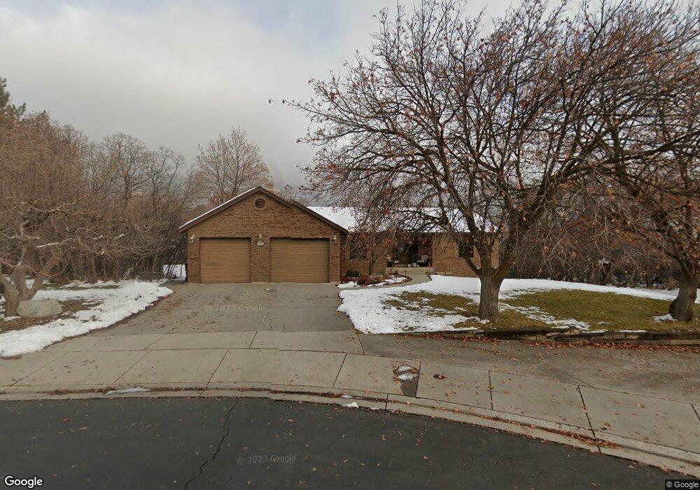
670 N 610 E Alpine, UT 84004
Estimated Value: $1,127,000 - $1,326,000
5
Beds
6
Baths
2,832
Sq Ft
$428/Sq Ft
Est. Value
About This Home
This home is located at 670 N 610 E, Alpine, UT 84004 and is currently estimated at $1,212,707, approximately $428 per square foot. 670 N 610 E is a home located in Utah County with nearby schools including Alpine School, Timberline Middle School, and Lone Peak High School.
Ownership History
Date
Name
Owned For
Owner Type
Purchase Details
Closed on
Dec 18, 2025
Sold by
Pack Marvin Dean and Pack Cindy M
Bought by
Marvin And Cindy Pack Trust and Pack
Current Estimated Value
Purchase Details
Closed on
Sep 18, 2002
Sold by
Matheson Kenneth H and Matheson Marlene G
Bought by
Pack Marvin Dean and Pack Cindy M
Home Financials for this Owner
Home Financials are based on the most recent Mortgage that was taken out on this home.
Original Mortgage
$300,000
Interest Rate
6.24%
Create a Home Valuation Report for This Property
The Home Valuation Report is an in-depth analysis detailing your home's value as well as a comparison with similar homes in the area
Home Values in the Area
Average Home Value in this Area
Purchase History
| Date | Buyer | Sale Price | Title Company |
|---|---|---|---|
| Marvin And Cindy Pack Trust | -- | None Listed On Document | |
| Pack Marvin Dean | -- | Equity Title Agency Inc |
Source: Public Records
Mortgage History
| Date | Status | Borrower | Loan Amount |
|---|---|---|---|
| Previous Owner | Pack Marvin Dean | $300,000 |
Source: Public Records
Tax History
| Year | Tax Paid | Tax Assessment Tax Assessment Total Assessment is a certain percentage of the fair market value that is determined by local assessors to be the total taxable value of land and additions on the property. | Land | Improvement |
|---|---|---|---|---|
| 2025 | $4,311 | $521,235 | -- | -- |
| 2024 | $4,311 | $502,480 | $0 | $0 |
| 2023 | $3,828 | $478,995 | $0 | $0 |
| 2022 | $3,712 | $451,110 | $0 | $0 |
| 2021 | $3,264 | $616,100 | $345,000 | $271,100 |
| 2020 | $3,063 | $565,800 | $300,000 | $265,800 |
| 2019 | $2,867 | $552,900 | $300,000 | $252,900 |
| 2018 | $2,902 | $552,900 | $300,000 | $252,900 |
| 2017 | $2,712 | $274,945 | $0 | $0 |
| 2016 | $2,934 | $277,365 | $0 | $0 |
| 2015 | $2,874 | $257,015 | $0 | $0 |
| 2014 | $2,676 | $236,720 | $0 | $0 |
Source: Public Records
Map
Nearby Homes
- 358 Eastview Dr
- 499 E 300 N
- 475 Grove Dr
- 381 E Watkins Cir Unit 28
- 463 Heritage Hills Dr
- 382 E Heritage Hills Dr
- 986 N Sunbrook Cir
- 781 N Country Manor Ln
- 887 E Village Way
- 1319 N Eastview Ln Unit 214
- 1333 N Eastview Ln
- 19 E Elk Ct
- 1103 E Lone Peak Dr
- 102 E Deer Crest Ln
- 1540 Cherrypoint Ln Unit 7
- 1449 N Annie Cir
- 48 N 100 E
- 151 Glacier Lily Dr
- 1292 N Elk Ridge Ln
- 516 E Savannah Cir
- 670 N 610 E
- 706 N 610 E
- 575 Wilderness Dr
- 646 N 610 E
- 553 Wilderness Dr
- 553 Wilderness Dr Unit 2
- 652 Hampton Ct
- 634 Wilderness Dr
- 705 Stamford Ct
- 736 N 610 E
- 610 E 770 N
- 621 Windsor Ct
- 626 Wilderness Dr Unit 9
- 663 Hampton Ct
- 721 Stamford Ct
- 721 Stamford Ct Unit 11
- 537 Wilderness Dr Unit 3
- 578 E 770 N
- 537 Wilderness Dr
- 662 Hampton Ct
Your Personal Tour Guide
Ask me questions while you tour the home.