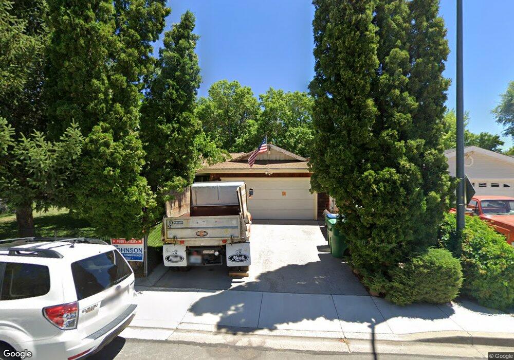
670 Thornton St Sparks, NV 89431
McCarran Boulevard-Probasco NeighborhoodEstimated Value: $404,845 - $442,000
3
Beds
2
Baths
1,347
Sq Ft
$319/Sq Ft
Est. Value
About This Home
This home is located at 670 Thornton St, Sparks, NV 89431 and is currently estimated at $429,461, approximately $318 per square foot. 670 Thornton St is a home located in Washoe County with nearby schools including Lincoln Park Elementary School, George L Dilworth Middle School, and Sparks High School.
Ownership History
Date
Name
Owned For
Owner Type
Purchase Details
Closed on
Apr 7, 2022
Sold by
Kirtley Richard F and Kirtley Kathy D
Bought by
Kirtley Family Revocable Living Trust
Current Estimated Value
Create a Home Valuation Report for This Property
The Home Valuation Report is an in-depth analysis detailing your home's value as well as a comparison with similar homes in the area
Home Values in the Area
Average Home Value in this Area
Purchase History
| Date | Buyer | Sale Price | Title Company |
|---|---|---|---|
| Kirtley Family Revocable Living Trust | -- | None Listed On Document |
Source: Public Records
Tax History Compared to Growth
Tax History
| Year | Tax Paid | Tax Assessment Tax Assessment Total Assessment is a certain percentage of the fair market value that is determined by local assessors to be the total taxable value of land and additions on the property. | Land | Improvement |
|---|---|---|---|---|
| 2025 | $764 | $55,217 | $33,565 | $21,652 |
| 2024 | $742 | $51,415 | $30,065 | $21,350 |
| 2023 | $742 | $51,081 | $31,325 | $19,756 |
| 2022 | $728 | $42,278 | $26,180 | $16,098 |
| 2021 | $710 | $33,648 | $17,955 | $15,693 |
| 2020 | $685 | $32,340 | $16,940 | $15,400 |
| 2019 | $666 | $30,517 | $15,890 | $14,627 |
| 2018 | $647 | $25,737 | $11,725 | $14,012 |
| 2017 | $628 | $24,158 | $10,395 | $13,763 |
| 2016 | $710 | $23,083 | $9,345 | $13,738 |
| 2015 | $710 | $21,197 | $7,700 | $13,497 |
| 2014 | $689 | $19,995 | $6,440 | $13,555 |
| 2013 | -- | $18,149 | $4,270 | $13,879 |
Source: Public Records
Map
Nearby Homes
- 601 Oakwood Dr Unit 4
- 611 Oakwood Dr Unit 1
- 360 E Lincoln Way
- 604 Oakwood Dr Unit 1
- 445 Pine Meadows Dr Unit E25
- 644 Oakwood Dr Unit 2
- 684 Oakwood Dr Unit 3
- 560 Nichols Blvd
- 907 Camino Real Dr
- 801 Woodglen Dr Unit 2
- 848 Parkside Dr Unit 1
- 385 Gleeson Way
- 10 Lincoln Way
- 949 Crestwood Dr Unit 3
- 857 Cherry Tree Dr Unit 3
- 370 O'Brien Way
- 400 4th St
- 300 I St
- 324 Victorian Ave
- 675 Parlanti Ln Unit 52
- 680 Thornton St
- 650 Thornton St
- 630 Thornton St
- 653 Pine Meadows Dr
- 653 Pine Meadows Dr Unit 2
- 653 Pine Meadows Dr Unit 1
- 653 Pine Meadows Dr Unit 3
- 653 Pine Meadows Dr Unit 4
- 390 Sells St
- 643 Pine Meadows Dr
- 643 Pine Meadows Dr Unit 3
- 643 Pine Meadows Dr Unit 1
- 643 Pine Meadows Dr
- 643 Pine Meadows Dr Unit 4
- 643 Pine Meadows Dr Unit 2
- 633 Pine Meadows Dr
- 633 Pine Meadows Dr Unit 4
- 633 Pine Meadows Dr Unit 2
- 633 Pine Meadows Dr Unit 1
- 633 Pine Meadows Dr Unit 3