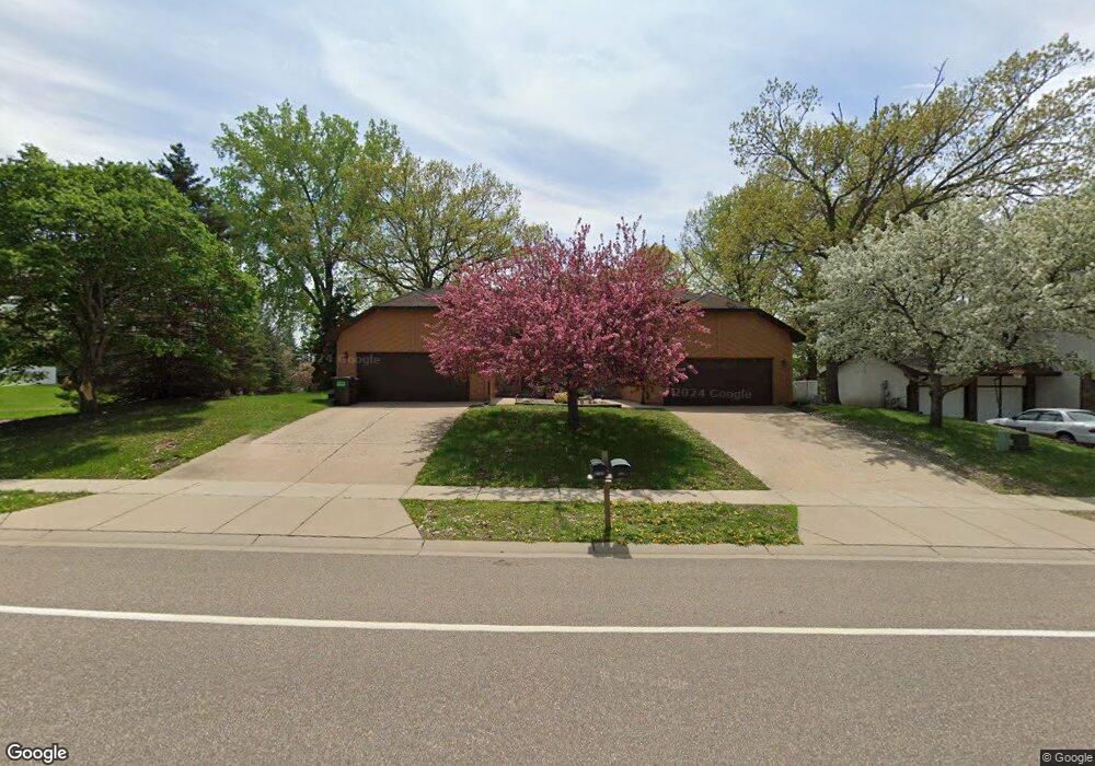
6704 132nd St W Saint Paul, MN 55124
Scott Highlands NeighborhoodEstimated Value: $330,000 - $345,482
3
Beds
2
Baths
1,014
Sq Ft
$334/Sq Ft
Est. Value
About This Home
This home is located at 6704 132nd St W, Saint Paul, MN 55124 and is currently estimated at $339,121, approximately $334 per square foot. 6704 132nd St W is a home located in Dakota County with nearby schools including Greenleaf Elementary School, Falcon Ridge Middle School, and Eastview Senior High School.
Ownership History
Date
Name
Owned For
Owner Type
Purchase Details
Closed on
May 18, 2018
Sold by
Ulschmid John and Hall Majken K
Bought by
Goude Anne M
Current Estimated Value
Home Financials for this Owner
Home Financials are based on the most recent Mortgage that was taken out on this home.
Original Mortgage
$232,800
Outstanding Balance
$200,908
Interest Rate
4.5%
Mortgage Type
New Conventional
Estimated Equity
$138,213
Purchase Details
Closed on
Jul 17, 2015
Sold by
Ulschmid John and Hall Majken K
Bought by
Ulschmid John and Hall Majken K
Home Financials for this Owner
Home Financials are based on the most recent Mortgage that was taken out on this home.
Original Mortgage
$125,500
Interest Rate
3.5%
Mortgage Type
Adjustable Rate Mortgage/ARM
Create a Home Valuation Report for This Property
The Home Valuation Report is an in-depth analysis detailing your home's value as well as a comparison with similar homes in the area
Home Values in the Area
Average Home Value in this Area
Purchase History
| Date | Buyer | Sale Price | Title Company |
|---|---|---|---|
| Goude Anne M | $243,000 | Edina Realty Title Inc | |
| Ulschmid John | -- | Stewart Title Company |
Source: Public Records
Mortgage History
| Date | Status | Borrower | Loan Amount |
|---|---|---|---|
| Open | Goude Anne M | $232,800 | |
| Previous Owner | Ulschmid John | $125,500 |
Source: Public Records
Tax History Compared to Growth
Tax History
| Year | Tax Paid | Tax Assessment Tax Assessment Total Assessment is a certain percentage of the fair market value that is determined by local assessors to be the total taxable value of land and additions on the property. | Land | Improvement |
|---|---|---|---|---|
| 2024 | $3,378 | $291,700 | $59,700 | $232,000 |
| 2023 | $3,378 | $304,800 | $59,800 | $245,000 |
| 2022 | $2,872 | $307,300 | $59,600 | $247,700 |
| 2021 | $2,748 | $256,800 | $51,900 | $204,900 |
| 2020 | $2,702 | $241,800 | $49,400 | $192,400 |
| 2019 | $2,384 | $231,600 | $47,000 | $184,600 |
| 2018 | $2,162 | $216,100 | $44,800 | $171,300 |
| 2017 | $2,057 | $190,900 | $42,700 | $148,200 |
| 2016 | $2,002 | $174,800 | $40,600 | $134,200 |
| 2015 | $1,814 | $147,188 | $34,622 | $112,566 |
| 2014 | -- | $133,890 | $32,748 | $101,142 |
| 2013 | -- | $118,957 | $29,469 | $89,488 |
Source: Public Records
Map
Nearby Homes
- 6790 132nd St W
- 6567 133rd St W
- 13358 Foliage Ave
- 13055 Florida Ct
- 13135 Gamma Way
- 12865 Foliage Ave
- 13213 Ferris Ave
- 6118 132nd St W
- 12888 Falcon Dr
- 13199 Gemstone Ct
- 13954 Flagstaff Ct
- 7291 Upper 136th St W
- 13947 Fleetwood Ave
- 12710 Granger Ct Unit 323
- 12596 Gavotte Ave Unit 98
- 12816 Falcon Dr
- 12585 Gavotte Ave Unit 96
- 14057 Flintwood Ct
- 13720 Georgia Dr
- 13868 Glendale Ct
- 6700 132nd St W
- 6712 132nd St W
- 6730 132nd St W
- 6705 133rd St W
- 6735 133rd St W
- 13270 Foliage Ave
- 6732 132nd St W
- 6765 133rd St W
- 6735 6735 133rd-Street-w
- 6685 133rd St W
- 6685 6685 133rd-Street-w
- 6750 132nd St W
- 6660 132nd St W
- 6803 133rd St W
- 13196 Foliage Ave
- 6671 133rd St W
- 6803 6803 133rd-Street-w
- 6770 6770 132nd-Street-w
- 6770 132nd St W
- 6827 133rd St W