Estimated Value: $877,000 - $1,324,000
4
Beds
3
Baths
2,672
Sq Ft
$377/Sq Ft
Est. Value
About This Home
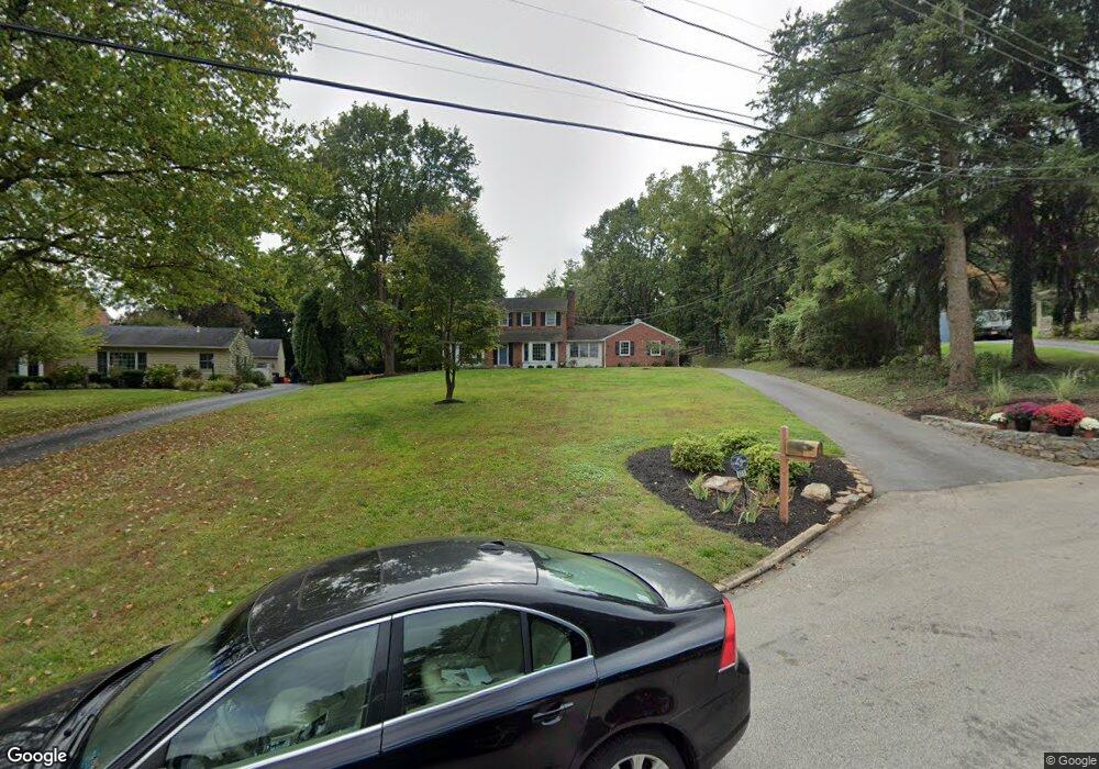
This home is located at 671 Fernfield Cir, Wayne, PA 19087 and is currently estimated at $1,007,410, approximately $377 per square foot. 671 Fernfield Cir is a home located in Chester County with nearby schools including New Eagle Elementary School, Valley Forge Middle School, and Conestoga Senior High School.
Ownership History
Date
Name
Owned For
Owner Type
Purchase Details
Closed on
Jun 9, 1997
Sold by
King Mary Denise D
Bought by
Wolgin Roy Daniel and Wolgin Sally Strong
Current Estimated Value
Home Financials for this Owner
Home Financials are based on the most recent Mortgage that was taken out on this home.
Original Mortgage
$214,600
Outstanding Balance
$30,683
Interest Rate
7.97%
Estimated Equity
$976,727
Create a Home Valuation Report for This Property
The Home Valuation Report is an in-depth analysis detailing your home's value as well as a comparison with similar homes in the area
Home Values in the Area
Average Home Value in this Area
Purchase History
| Date | Buyer | Sale Price | Title Company |
|---|---|---|---|
| Wolgin Roy Daniel | $296,000 | -- |
Source: Public Records
Mortgage History
| Date | Status | Borrower | Loan Amount |
|---|---|---|---|
| Open | Wolgin Roy Daniel | $214,600 |
Source: Public Records
Tax History Compared to Growth
Tax History
| Year | Tax Paid | Tax Assessment Tax Assessment Total Assessment is a certain percentage of the fair market value that is determined by local assessors to be the total taxable value of land and additions on the property. | Land | Improvement |
|---|---|---|---|---|
| 2025 | $10,246 | $290,890 | $79,170 | $211,720 |
| 2024 | $10,246 | $290,890 | $79,170 | $211,720 |
| 2023 | $9,625 | $290,890 | $79,170 | $211,720 |
| 2022 | $9,376 | $290,890 | $79,170 | $211,720 |
| 2021 | $9,198 | $290,890 | $79,170 | $211,720 |
| 2020 | $8,944 | $290,890 | $79,170 | $211,720 |
| 2019 | $8,662 | $290,890 | $79,170 | $211,720 |
| 2018 | $8,490 | $290,890 | $79,170 | $211,720 |
| 2017 | $8,288 | $290,890 | $79,170 | $211,720 |
| 2016 | -- | $290,890 | $79,170 | $211,720 |
| 2015 | -- | $290,890 | $79,170 | $211,720 |
| 2014 | -- | $290,890 | $79,170 | $211,720 |
Source: Public Records
Map
Nearby Homes
- 681 Fernfield Cir
- 634 Knox Rd
- 760 Old Eagle School Rd
- 551 Barton Ln
- 426 School Ln
- 427 School Ln
- 542 Upper Weadley Rd
- 77 Deepdale Rd
- 103 Deepdale Rd
- 280 Deepdale Rd
- 349 Colket Ln
- 1149 Brians Way
- 541 W Beechtree Ln
- 273 Strafford Ave
- 434 Pugh Rd
- 2 Forest Rd
- 65 Upper Gulph Rd
- 570 Fletcher Rd
- 332 & 334 E Conestoga Rd
- 28 Homestead Rd
- 673 Fernfield Cir
- 667 Fernfield Cir
- 663 Fernfield Cir
- 623 Kennedy Ln
- 611 Kennedy Ln
- 639 Kennedy Ln
- 668 Fernfield Cir
- 429 Old Eagle School Rd
- 559 Red Fox Ln
- 658 Fernfield Cir
- 412 Maynard Dr
- 653 Fernfield Cir
- 404 Maynard Dr
- 674 Fernfield Cir
- 426 Maynard Dr
- 624 Kennedy Ln
- 551 Red Fox Ln
- 634 Kennedy Ln
- 644 Kennedy Rd
- 567 Red Fox Ln