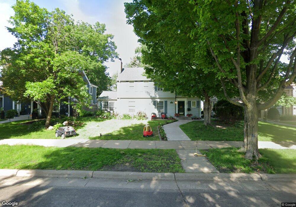
671 Sumner St Saint Paul, MN 55116
Highland Park NeighborhoodEstimated Value: $797,458 - $854,000
4
Beds
3
Baths
2,452
Sq Ft
$335/Sq Ft
Est. Value
About This Home
This home is located at 671 Sumner St, Saint Paul, MN 55116 and is currently estimated at $822,615, approximately $335 per square foot. 671 Sumner St is a home located in Ramsey County with nearby schools including Horace Mann School, Highland Park Middle School, and Highland Park Senior High.
Ownership History
Date
Name
Owned For
Owner Type
Purchase Details
Closed on
Dec 6, 2016
Sold by
Mayer Monte E
Bought by
Montzka Justin D and Montzka Martha
Current Estimated Value
Home Financials for this Owner
Home Financials are based on the most recent Mortgage that was taken out on this home.
Original Mortgage
$265,000
Outstanding Balance
$214,312
Interest Rate
3.57%
Mortgage Type
New Conventional
Estimated Equity
$608,303
Purchase Details
Closed on
Nov 22, 2016
Sold by
Mayer Monte E and Mayer Ann Catherine
Bought by
Mayer Monte E
Home Financials for this Owner
Home Financials are based on the most recent Mortgage that was taken out on this home.
Original Mortgage
$265,000
Outstanding Balance
$214,312
Interest Rate
3.57%
Mortgage Type
New Conventional
Estimated Equity
$608,303
Purchase Details
Closed on
May 31, 1996
Sold by
Peterson Douglas R and Peterson Terese F
Bought by
Mayer Monte and Mayer Ann C
Create a Home Valuation Report for This Property
The Home Valuation Report is an in-depth analysis detailing your home's value as well as a comparison with similar homes in the area
Home Values in the Area
Average Home Value in this Area
Purchase History
| Date | Buyer | Sale Price | Title Company |
|---|---|---|---|
| Montzka Justin D | $571,818 | Burnet Title | |
| Mayer Monte E | -- | Burnet Title | |
| Mayer Monte | $230,000 | -- |
Source: Public Records
Mortgage History
| Date | Status | Borrower | Loan Amount |
|---|---|---|---|
| Open | Montzka Justin D | $265,000 |
Source: Public Records
Tax History
| Year | Tax Paid | Tax Assessment Tax Assessment Total Assessment is a certain percentage of the fair market value that is determined by local assessors to be the total taxable value of land and additions on the property. | Land | Improvement |
|---|---|---|---|---|
| 2025 | $11,340 | $769,000 | $211,300 | $557,700 |
| 2023 | $11,340 | $691,600 | $211,300 | $480,300 |
| 2022 | $10,692 | $659,500 | $211,300 | $448,200 |
| 2021 | $9,808 | $634,200 | $211,300 | $422,900 |
| 2020 | $10,726 | $603,900 | $211,300 | $392,600 |
| 2019 | $10,836 | $615,400 | $274,700 | $340,700 |
| 2018 | $10,196 | $614,600 | $274,700 | $339,900 |
| 2017 | $10,278 | $597,000 | $274,700 | $322,300 |
| 2016 | $9,592 | $0 | $0 | $0 |
| 2015 | $9,908 | $560,700 | $235,500 | $325,200 |
| 2014 | $8,752 | $0 | $0 | $0 |
Source: Public Records
Map
Nearby Homes
- 1885 Eleanor Ave
- 2077 Scheffer Ave
- 1827 Eleanor Ave
- 2111 Niles Ave
- 2028 James Ave
- 1780 Ford Pkwy
- 1941 W Rome Ave
- 1715 Scheffer Ave
- 1709 Scheffer Ave
- 1846 Saunders Ave
- 507 Montrose Ln
- 1691 Hartford Ave
- 1751 Beechwood Ave
- 1879 Montreal Ave
- 1679 Bayard Ave
- 745 Mount Curve Blvd
- 1875 Juliet Ave
- 1735 Randolph Ave
- 1947 Yorkshire Ct
- 1756 Saunders Ave
Your Personal Tour Guide
Ask me questions while you tour the home.