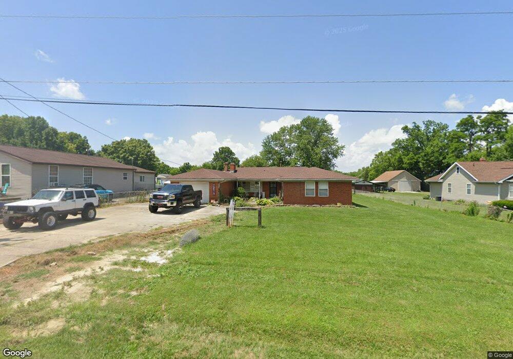
6713 Linwood Rd Franklin, OH 45005
Estimated Value: $247,000 - $297,281
4
Beds
2
Baths
2,292
Sq Ft
$118/Sq Ft
Est. Value
About This Home
This home is located at 6713 Linwood Rd, Franklin, OH 45005 and is currently estimated at $270,070, approximately $117 per square foot. 6713 Linwood Rd is a home located in Warren County with nearby schools including Franklin High School.
Ownership History
Date
Name
Owned For
Owner Type
Purchase Details
Closed on
Oct 25, 2024
Sold by
Adams Linda Fay and Adams Linda Faye
Bought by
Harville David I
Current Estimated Value
Home Financials for this Owner
Home Financials are based on the most recent Mortgage that was taken out on this home.
Original Mortgage
$228,000
Outstanding Balance
$225,814
Interest Rate
6.32%
Mortgage Type
New Conventional
Estimated Equity
$44,256
Purchase Details
Closed on
Oct 31, 2012
Sold by
Collins Alice Joy
Bought by
Adams Linda
Purchase Details
Closed on
Mar 28, 2012
Sold by
Adams Linda
Bought by
Collins Alice Joy
Purchase Details
Closed on
Sep 4, 2009
Sold by
Adams L J
Bought by
Adams Linda
Create a Home Valuation Report for This Property
The Home Valuation Report is an in-depth analysis detailing your home's value as well as a comparison with similar homes in the area
Home Values in the Area
Average Home Value in this Area
Purchase History
| Date | Buyer | Sale Price | Title Company |
|---|---|---|---|
| Harville David I | $240,000 | None Listed On Document | |
| Adams Linda | -- | None Available | |
| Collins Alice Joy | -- | None Available | |
| Adams Linda | -- | Attorney |
Source: Public Records
Mortgage History
| Date | Status | Borrower | Loan Amount |
|---|---|---|---|
| Open | Harville David I | $228,000 |
Source: Public Records
Tax History Compared to Growth
Tax History
| Year | Tax Paid | Tax Assessment Tax Assessment Total Assessment is a certain percentage of the fair market value that is determined by local assessors to be the total taxable value of land and additions on the property. | Land | Improvement |
|---|---|---|---|---|
| 2024 | $3,108 | $80,350 | $16,110 | $64,240 |
| 2023 | $2,694 | $63,798 | $11,378 | $52,419 |
| 2022 | $2,635 | $63,798 | $11,379 | $52,420 |
| 2021 | $2,488 | $63,798 | $11,379 | $52,420 |
| 2020 | $2,451 | $56,459 | $10,070 | $46,389 |
| 2019 | $2,213 | $56,459 | $10,070 | $46,389 |
| 2018 | $2,206 | $56,459 | $10,070 | $46,389 |
| 2017 | $2,151 | $50,901 | $9,226 | $41,675 |
| 2016 | $2,197 | $50,901 | $9,226 | $41,675 |
| 2015 | $2,198 | $50,901 | $9,226 | $41,675 |
| 2014 | -- | $48,020 | $8,700 | $39,320 |
| 2013 | $1,783 | $55,550 | $10,070 | $45,480 |
Source: Public Records
Map
Nearby Homes
- 6686 Catskill Dr
- 6772 Rivulet Dr
- 6652 Rivulet Dr
- 4822 Miller Rd
- 5011 Waterford Ln
- 5019 Waterford Ln
- 5019 Waterford Dr
- 4964 Timberline Dr Unit 81
- 6460 Woodcreek Dr
- Creekside Paired Villa Plan at Waterford Place
- 5814 Woodcreek Dr
- 4904 Timberline Dr Unit 84
- 5760 Autumn Dr
- 4823 Beechwood Ln Unit 28
- 5750 Woodcreek Dr
- 5714 Millbrook Dr
- 5757 S Dixie Hwy
- 6701 Linwood Rd
- 6691 Linwood Rd
- 66ac Linwood Rd
- 3.837ac Linwood Rd
- 6735 Linwood Rd
- 6714 Linwood Rd
- 6741 Joseph Rd
- 6673 Linwood Rd
- 6722 Linwood Rd
- 6700 Linwood Rd
- 6736 Linwood Rd
- 0 Linwood Rd
- 6744 Linwood Rd
- 6674 Linwood Rd
- 6760 Linwood Rd
- 6655 Linwood Rd
- 6772 Linwood Rd
- 6656 Linwood Rd
- 6639 Linwood Rd
- 6797 Linwood Rd